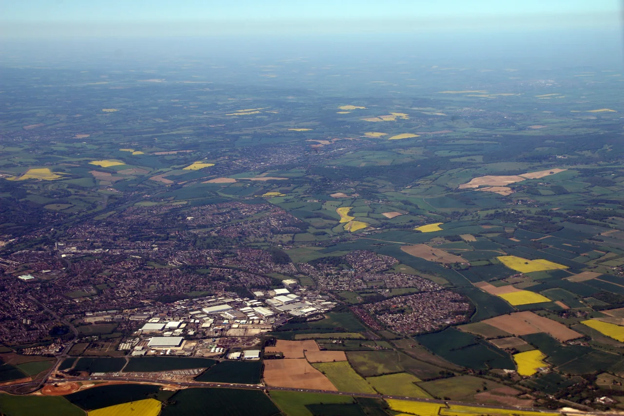

Hemel Hempstead
Just before dawn on 11 December 2005, a fuel-air vapor cloud at the Buncefield oil depot found an ignition source and the morning came early to Hemel Hempstead. The blast registered 2.4 on the Richter scale. People felt the shockwave in Belgium. Residents 125 miles away heard the explosion roll across the countryside like distant artillery. Forty-three people were injured. By some combination of timing, geography, and luck, none died. That morning is woven now into the fabric of a town whose history runs back through Norman parish churches and Saxon land grants to a Romano-Celtic temple unearthed under the modern industrial estate.
The Town the Domesday Book Knew
Hemel Hempstead appears in the Domesday Book of 1086 as Hamelhamstede, a vill of perhaps a hundred souls in a chalk valley where the rivers Gade and Bulbourne meet. The name itself is layered like the chalk beneath the soil. The -stead means simply place, a clearing, a stopping point. The Hemel is harder to fix; some scholars trace it to the eighth-century district name Haemele, others to the Dutch and German words for sky. Either way, the settlement was already old when William's clerks rode out to count it. By 1140, the Norman builders of St Mary's parish church had raised one of the finest Norman churches in the county. A century and a half later, they added a 200-foot spire that still pricks the sky above the Old Town, one of the tallest in Europe.
Paper Mills and Royal Charters
Henry VIII granted Hemel a royal charter in 1539, the same year he broke up the monastery at Ashridge that had held the manor for nearly three centuries. Henry and Anne Boleyn are said to have lodged here. The Industrial Revolution found the town well-positioned, sitting on the main road between London and the Midlands. In 1798 the Grand Junction Canal reached Two Waters, and in 1803 the Fourdrinier brothers, working at Frogmore, perfected the first practical automatic papermaking machine in the world. From their workshops grew John Dickinson & Co., whose mills along the Gade made paper for empire and, during the Second World War, munitions. The Luftwaffe noticed. Ninety high-explosive bombs fell on the town between 1940 and 1945. The worst night was 10 May 1942, when a stick of bombs flattened houses at Nash Mills and killed eight people.
A City in a Park
After the war, the planners came. Hemel Hempstead was designated a New Town in February 1947, one of the first to absorb families displaced by the London Blitz. The architect Geoffrey Jellicoe drew up plans for what he called "not a city in a garden, but a city in a park." Locals were not entirely thrilled. The original plans were softened, the bulldozers moved in anyway, and by 1950 the first families had keys to homes in Adeyfield. Queen Elizabeth II laid a foundation stone here in 1952, in one of her first public engagements as monarch. Streets in the new neighbourhood were named for Hillary and Tenzing, who had just stood on the summit of Everest. A pub called the Top of the World still marks the moment. Jellicoe's Water Gardens, ponded back from the river Gade, became the heart of the new centre.
The Magic Roundabout
Drive into central Hemel and you will eventually meet what locals call the Magic Roundabout, officially the Plough Roundabout. Six roads converge on a single circle. Around the central island, six smaller mini-roundabouts let traffic flow in both directions, a circulating system that was the first of its kind in Britain when it opened in its full form in 1973. Visiting drivers approach it with the bewildered reverence reserved for tax forms and cricket scoring. Locals navigate it without thinking. The town is also home to Britain's first purpose-built free-standing multi-storey car park and, west of town, the Bovingdon stack, where airliners holding for Heathrow stack themselves into the sky on clear evenings. Look up. You can see them turning.
11 December 2005
The Buncefield oil storage terminal sat on the edge of the Maylands industrial estate, a forest of tanks holding millions of litres of petrol, diesel, and aviation fuel piped from the refineries on the Thames. Just after six in the morning on Sunday 11 December 2005, a tank overfilled and vapor spread across the site. When it ignited, the resulting explosion was, by most measures, the largest peacetime explosion in European history. The fireball climbed for days. Smoke from the burning tanks drifted across the south of England and showed up on satellite weather images as a black plume drawn over the Home Counties. Forty-three people were hurt. That nobody died is still treated locally as something like a miracle, the result partly of the early-morning timing, partly of the geography of Maylands, which kept the worst of the blast away from residential streets. Kodak's headquarters, the Northgate building, and dozens of other businesses were destroyed or damaged beyond repair. The Phoenix Gateway sculpture, a set of blue steel arches on the M1 junction roundabout, marks the rebuilding that followed.
Old Town, Living Town
Walk up the High Street in the Old Town and the New Town drops away. Tudor-framed buildings lean over the pavement. The Old Bell has timber dating to 1615 and stands where even older inns served travellers on the road north. Piccotts End, just outside town, holds a cottage where in 1953 builders found medieval wall paintings hidden behind plaster, dating from 1470 to 1500. The same cottage had served as Britain's first free cottage hospital, opened by the surgeon Sir Astley Cooper in 1827. Hemel has produced its share of names, from the highwayman Robert Snooks, who in 1802 became the last man in England executed and buried at the scene of his crime, to the actor Sir Roger Moore, who lived in Leverstock Green during his Saint years, to Formula One driver Anthony Davidson, golfer Luke Donald, and double Olympic gold medallist gymnast Max Whitlock.
From the Air
Hemel Hempstead sits at 51.7526°N, 0.4692°W in southwestern Hertfordshire, roughly 24 miles northwest of central London. The town fills a shallow chalk valley at the confluence of the Gade and Bulbourne; the 200-foot spire of St Mary's pricks up from the Old Town, while the Buncefield site lies on the northeastern edge. Recommended viewing altitude is 3,000 to 5,000 feet for clear sight of the town set against the Chiltern Hills to the north and west. The Bovingdon (BNN) VOR sits just west of town, anchoring the Heathrow holding stack that brings traffic circling overhead at peak times. Nearest airports: London Luton (EGGW) about 12 miles north, Heathrow (EGLL) about 22 miles south, Stansted (EGSS) about 33 miles east. Old Warden (EGTH) lies 23 miles to the north for GA pilots.
Nearby Stories
- Millennium Dome 0.2 km away
- Ampthill Park 1.9 km away
- Heathrow Airport 5.4 km away
- Fowlmere Airfield 6.6 km away
- Waltham Abbey 9.2 km away
- Ufton Nervet rail crash 11 km away
- Sulgrave Manor 12 km away
- Magdalen College, Oxford 13 km away