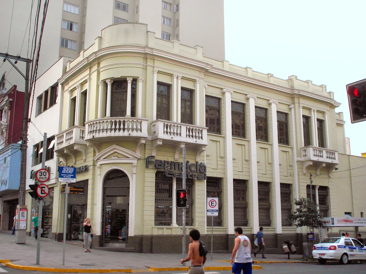

Historic Center of Caxias do Sul
There was a time, not so long ago, when speaking Italian in this city could land you in jail. During the Vargas era of the late 1930s, the federal government set out to erase what it called "foreignisms," and the descendants of Caxias do Sul's immigrant founders learned to keep quiet. They stopped celebrating the grape harvest. They tore down their grandparents' houses without a second thought. The Historic Center - the dense grid of streets around Dante Alighieri Square where the whole city began - became, in the words of one researcher, invisible to the very people who lived among it. Only in recent decades has Caxias begun to see it again.
Campo dos Bugres
Before the surveyors arrived, this high clearing was a resting place. Muleteers driving cattle down from the Campos de Cima da Serra would stop here, where springs broke the surface and an open field offered grazing, on the long haul toward the river port at Sao Sebastiao do Cai. Explorers called the spot Campo dos Bugres, and ancient indigenous routes crossed it long before any of them came. The Imperial Government had a colder vision for the land: settle the empty highlands, build a labor force that was not enslaved, and - in the explicit language of the era - whiten the Brazilian population with chosen European settlers. The colony was founded in 1875. A year later, its headquarters shifted to this clearing, organized around the broad square where the first Mother Church would rise.
The Chessboard and the Rua Grande
On January 10, 1879, a land commission approved Luiz Manoel de Azevedo's plan for the town: a Roman grid, straight streets crossing at right angles like a chessboard. It was an act of imposition. Houses and shops already stood here, built where their owners pleased, and many were demolished to make the new lines straight. From the grid emerged a spine the colonists simply called the Rua Grande, the Big Street, today Julio de Castilhos Avenue. By 1884 the straightening was done. Wealth followed fast. A colonial elite of merchants and industrialists, proud and ambitious, paved the streets, banned timber construction in favor of masonry, and raised palatial homes, banks, and clubs. The same prosperity quietly pushed the poor out of the center they had helped build.
What the Wrecking Ball Took
Progress arrived like a flood, and it drowned much of the old city. As Caxias verticalized through the mid-20th century, swelling with arrivals from the countryside drawn by its wealth, the colonial, Art Nouveau, eclectic, and Art Deco architecture of the center vanished at the same speed the towers went up. The Cine Teatro Opera came down. So did the National Bank of Commerce and old family houses beyond counting. Today not a single building survives in the Historic Center in the traditional stone technique, and only a handful of the original timber family homes remain anywhere in the city. To see what early Caxias actually looked like, you have to drive north to Antonio Prado, where decline preserved what prosperity here destroyed.
Learning to Look Again
Recovery came slowly, and against the grain of a city that had taught itself to forget. The Municipal Museum reopened in 1975 and began gathering the scattered fragments of a discarded past; the Historical Archive followed a year later. In 2007 the General Plan finally drew a protected Special Sector around the old core and named it, plainly, the Historic Center. Yet survivors still stand. The neo-Gothic cathedral of St. Theresa, inaugurated in 1899 and inspired by Italian Gothic, remains austere outside and richly worked within - the only monument of its kind inside the sector's limits. Around the square gather the Saldanha Bookstore, the Clube Juvenil, the old French and Italian Bank for South America, and the Municipal Museum itself, each a survivor of a century that nearly let them all go.
From the Air
The Historic Center sits at roughly 29.17 degrees south, 51.18 degrees west, at about 817 meters elevation on the Serra Gaucha plateau. From the air, look for the dense orthogonal street grid and the cathedral spire near Dante Alighieri Square, surrounded by the sprawl of a modern industrial city. The nearest airport is Hugo Cantergiani Regional Airport at Caxias do Sul (ICAO: SBCX, IATA: CXJ), roughly 89 km from Salgado Filho International at Porto Alegre (ICAO: SBPA, IATA: POA). The highland setting brings frequent fog and low cloud; clear mornings give the best visibility over the city core.
Nearby Stories
- Nova Petrópolis 4.5 km away
- Cambará do Sul 47 km away
- Santa Cruz do Sul 83 km away
- Passo Fundo 95 km away
- Serra do Rio do Rastro 115 km away
- Criciúma 175 km away
- Paleontological Sites of Santa Maria 216 km away
- Battle of the River Plate 539 km away