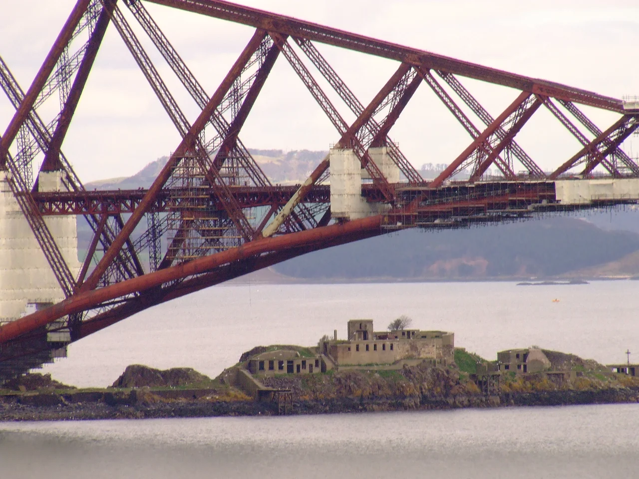

Inchgarvie
Look at the Forth Bridge from the air and you will see something strange between its three red cantilevers: a knuckle of black rock that the engineers built their middle pier on top of. That knuckle is Inchgarvie, and it is much older than the bridge sitting on its shoulders. James IV ordered a tower built here in 1513. By 1580 the Privy Council was banishing plague victims to it. In 1779 cannons were dragged onto it to repel John Paul Jones. The Victorians used it to hold up the world's first major steel cantilever bridge. Every century has found a use for this little rough island, and the rock has obliged.
The Rough Island
Inchgarvie sits between North and South Queensferry, exactly where boats had to thread the Firth of Forth before bridges existed. That accident of geography made it strategic, and the Gaelic name reflects what travellers thought when they saw it: innis garbh, the rough island, or innis gharbhaidh, the island of the rough place. There is an older theory that the name comes from the Scots word garvie, meaning sprat, and that a commercial sprat fishery worked these waters until it was banned in 1983. Whichever etymology is true, the island earned its name. Picrite, an igneous rock, makes up most of it. Hidden below the waves, the rock continues as a crag-and-tail formation gouged by glaciers, a smaller cousin of the one Edinburgh Castle stands on. Inchgarvie is just the visible peak.
Castle, Prison, Pesthouse
King James IV licensed John Dundas to build a fort here on 20 March 1491. Dundas never did. By 1513 James IV had lost patience and ordered the construction himself. From late 1514 the master mason John of Cumbernauld directed eight masons and ten labourers on the rock, supplied with boats by Margaret, Lady of Dundas. Serpentine guns came over from the mainland in 1515, along with a chapel and a blawing horne for raising alarms. The Duke of Albany installed a French garrison in 1521. The fort was captured by an English galley in 1544 and demolished a week later. Between 1519 and 1671 the castle served as a prison. In 1580 the Privy Council made Inchgarvie one of two islands of exile for the plague-stricken. The condemned and the contagious shared this rock for almost two centuries.
Holding Up the Bridge
In 1878, work began on Thomas Bouch's proposed Forth Bridge. The foundations were laid on Inchgarvie. Then the Tay Bridge collapsed on a stormy December night in 1879, killing every soul on the crossing train, and Bouch's reputation collapsed with it. The Forth Bridge plans were abandoned. When the new design by Fowler and Baker rose in the 1880s, Inchgarvie was put back to work. The island was extended westward with a pier, and one of the bridge's three giant cantilevers was anchored to it. The old castle walls were re-roofed as worker accommodation. Stone from the ruined fort went into the caissons themselves. When the bridge opened in 1890, a fortress that had withstood French garrisons and plague exiles became something stranger: a building block of the Industrial Revolution, holding up trains.
Last Stand
Inchgarvie had one more military life. In 1901 two 12-pounder guns went up, intended to cover the controlled minefield laid across the Firth and, later, to fend off torpedo boats trying to reach the naval anchorage at Rosyth Dockyard. The armament was removed in 1906, reinstated in 1908, expanded to four guns during the First World War, and finally retired in the early 1930s. By the Second World War the island was down to machine guns. Today there is no garrison and no fishery. Birds nest on the brickwork of Bouch's abandoned 1878 foundation. The trains still pass overhead every few minutes. From a cockpit window over the Forth you can see the whole timeline at once: medieval ruins, Victorian engineering, Edwardian gun emplacements, all stacked on one small rough island.
From the Air
56.00 N, 3.39 W, beneath the centre cantilever of the Forth Bridge between North and South Queensferry. The bridge itself is the navigation feature: three diamond-shaped red cantilevers, 2.5 km long, unmistakable from any altitude in daylight. Edinburgh Airport (EGPH) lies about 13 km to the south-east; the Forth approach is part of the usual visual circuit. Best viewing from 2,000-4,000 ft on a clear day. The island sits in a busy maritime zone; Rosyth Dockyard is just upstream.
Nearby Stories
- Ardoch Roman Fort 2.2 km away
- Craignethan Castle 3.1 km away
- Haddington 3.8 km away
- Balvaird Castle 4.3 km away
- Battle of Kilsyth 9.4 km away
- Siege of St Andrews Castle 9.9 km away
- Neidpath Castle 11 km away
- Melrose Abbey 15 km away