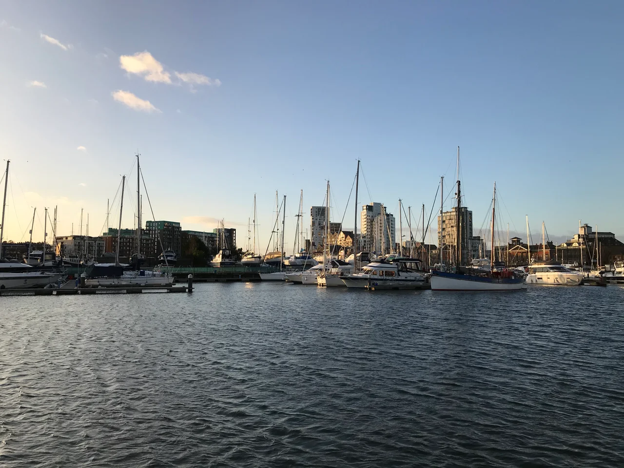

Ipswich Waterfront
Before there was an Ipswich, there was Gipeswic - a riverside settlement where, in the seventh century, ships from the Rhine unloaded lava quern-stones and porcupine sceattas onto a working quay. Archaeologists digging the recent waterfront redevelopment found projecting boardwalks identical to those at the great Frisian port of Dorestad, Gipeswic's principal trading partner across the North Sea. The street plan that grew up around that quay, laid out around the eighth century during the reigns of Kings Ealdwulf and Aelfwald, is still the street plan of central Ipswich. It is one of the oldest post-Roman urban layouts still in use anywhere in Europe. Most ports rebuild themselves into oblivion; this one has been adding new layers without erasing the old since before Alfred the Great was born.
Trading Capital of East Anglia
In the seventh and eighth centuries, the great English ports were four: York and London in the established positions, and two new arrivals - Hamwic at Southampton in the south, and Gipeswic in the east. The kings of East Anglia kept their royal centre nearby at Rendlesham and Sutton Hoo, and Gipeswic served as their trading capital, the place where wealth from the continent came ashore. Excavations have turned up imported Rhenish pottery of Merovingian types, barrel-timbers dendro-dated to eighth-century Germany, and continental coinage including the so-called porcupine sceattas named for the spiky figure on their faces. The local 'Ipswich ware' pottery industry, set up in the town's north-east quarter in the late seventh century, used kiln technologies based on Frisian prototypes - possibly imitated from imports, possibly the work of migrant Frisian potters who had settled on the quay. The cross-Channel link was that close.
Vikings, Wool and the Long Middle Centuries
In 991, a fleet of 93 Viking ships came up the River Orwell and sacked the town. The same campaign produced the Battle of Maldon down the coast, a defeat memorialised in one of the great Old English poems. Ipswich rebuilt. By the reign of Edward III in the fourteenth century, the port was among the richest and most important in England, exporting wool from the Suffolk uplands to the weavers of Flanders and the Netherlands. The quay drifted gradually southward over the centuries as ships grew larger and the river silted - each new generation of merchants threw out fresh revetments further into the channel, building on river-mud. The lines of College Street and Salthouse Street, set back from the modern marina, mark where the medieval waterfront actually ran. The successive embankments are stacked beneath the modern road, each one a frozen moment in the port's commercial life.
The Wet Dock of 1842
By the early nineteenth century, tidal silting and a winding channel were strangling the trade. In 1837 an Act of Parliament authorised the Ipswich Dock Commissioners to dig a new enclosed wet dock, diverting the Orwell along a 'New Cut' to the west. The chief engineer, Edward Caley, was twenty years old. The project ran on borrowed money - £25,000 in original investment, a further £100,000 in authorised borrowing, plus a sixpence-per-tonne levy on imported coal to plug the gap. It opened in 1842 as, by contemporary reckoning, the biggest and most important enclosed dock in the kingdom. For more than a century after that, working ships filled the basin: colliers, timber boats, the steam coasters of the Edwardian era. Then in 1997 the port was sold to Associated British Ports, container traffic moved downriver to Felixstowe, and the old wet dock began its second life - as a marina ringed by apartments, restaurants and the University of Suffolk, which opened on the waterfront in 2008.
The Mill and the Barrier
The Mill, a twenty-three-storey mixed-use tower at the marina's western corner, topped out in late 2008 with the local MP Chris Mole performing the ceremony. It currently holds the record as Suffolk's tallest building. In 2009, DanceEast opened its £8.9m Jerwood DanceHouse inside the same structure - a working contemporary dance company occupying what would, a generation earlier, have been a grain silo. The waterfront's other modern addition arrived in February 2019: a £67m flood barrier across the New Cut, similar in concept to the Thames Barrier downstream of London. It was designed in response to the December 2013 tidal surge that flooded the quays, and to the rising-water projections for the decades ahead. The Anglo-Saxons who built the boardwalks understood that this was an edge of the land - somewhere worth defending. Their successors are still defending it.
From the Air
The Ipswich waterfront sits at the head of the River Orwell at 52.05 degrees north, 1.16 degrees east, with the wet dock visible as a rectangular pool just south of the town centre. The Orwell Bridge - 1.3 kilometres of high concrete carrying the A14 - lies a short distance downstream and is the obvious navigation reference. Recommended viewing altitude is 1,500-3,000 feet, low enough to see the marina basin and The Mill's slab tower. Nearest airfields are RAF Wattisham (EGUW) to the west and Norwich (EGSH) to the north. The Felixstowe container port lies 10 nautical miles down-estuary - watch for instrument traffic.
Nearby Stories
- Walton-on-the-Naze 2.7 km away
- Clare, Suffolk 9.5 km away
- RAF Lakenheath 10 km away
- RAF Hardwick 11 km away
- Beeleigh Abbey 13 km away
- Four Days' Battle 45 km away
- Southern Bight 75 km away
- Battle of Lowestoft 79 km away