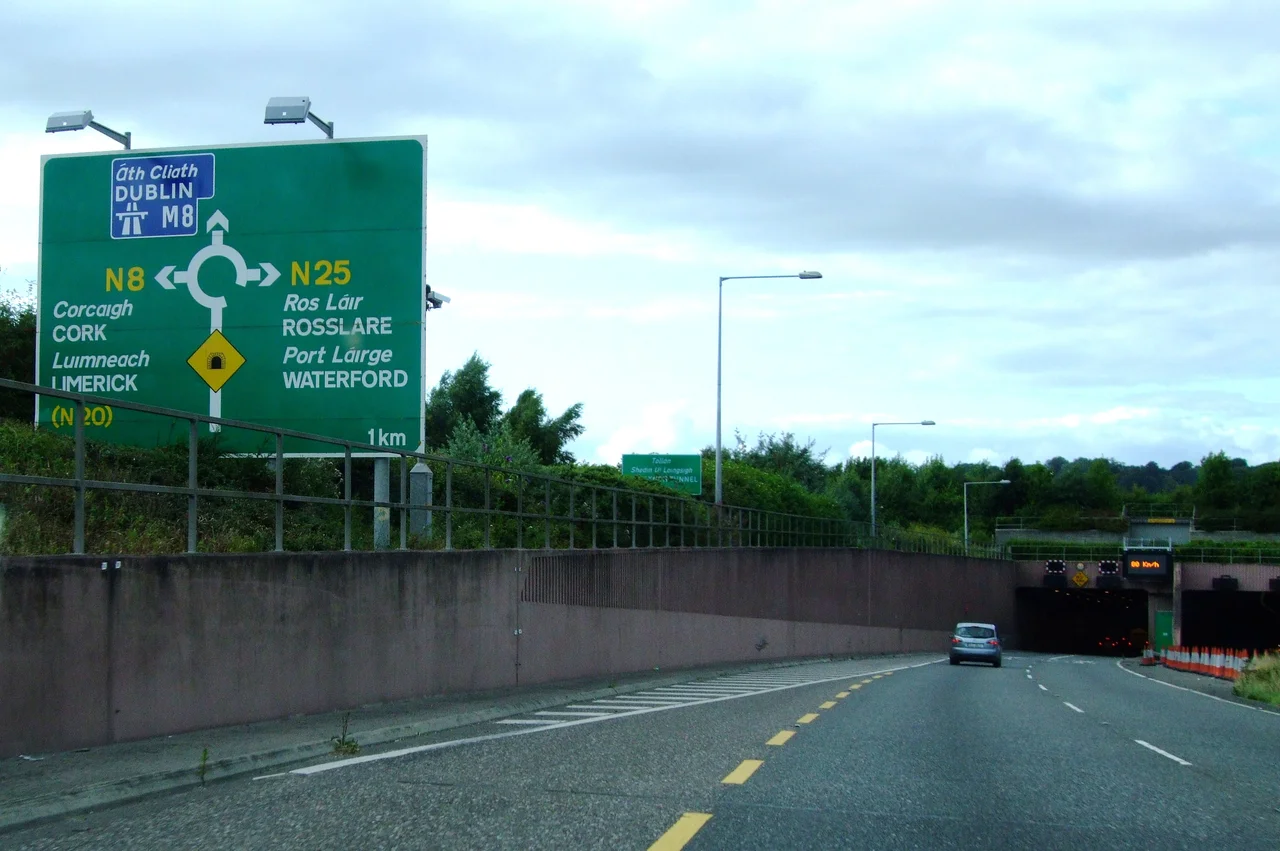

Jack Lynch Tunnel
Cork's medieval street plan was not designed for sixty thousand cars a day. The old city sits on an island in the River Lee, its lanes laid down when traders moved goods by quay and donkey, and by the 1970s the math had become impossible: every road south needed to use bridges in the city centre, and every bridge was choking. The engineers who proposed a solution chose something Ireland had never tried. They would build five reinforced concrete boxes on dry land, float them out into the Lee like enormous ships, and sink them into a trench dredged across the riverbed. When the boxes were joined end to end, drivers would pass beneath the river instead of fighting through the city.
The Long Argument
The idea took roughly twenty years to become a road. It began in the late 1970s with a group of civil engineers - Sean McCarthy, Liam Fitzgerald, Liam Mullins, John O'Regan, B.J. O'Sullivan and a small team at the Department of the Environment - who pushed through Cork's Land Use and Transportation Study, or LUTS. The plan called for a ring road around the city, a downstream crossing of the Lee, and centrally managed traffic on existing streets. The crossing alone would cost more than any road project ever attempted in Ireland. The objections were loud. In 1980 Cork Corporation commissioned a feasibility study from DeLeuw Chadwick O'hEocha, who concluded that a tunnel, though slightly more expensive to build than a high bridge, would carry far more traffic, because trucks would not have to crawl up a long ramp. Politicians eventually agreed. The tolls that would have helped pay for it were dropped after opposition from drivers who feared being pushed back into the city centre.
The Immersed-Tube Method
Building a tunnel under the bed of a tidal estuary sounds impossible. Building it on dry land and dropping it into place is, by comparison, a matter of careful arithmetic. The technique is called immersed-tube. Engineers dredged a trench across the bed of the Lee, then constructed five hollow concrete boxes in a casting basin nearby. Each box was 122 metres long, 24.5 metres wide, and 8.5 metres tall - roughly the size of a city block laid on its side. The ends were sealed with bulkheads to make the boxes float. When everything was ready, the casting basin was flooded and connected to the river, and the boxes were towed out one at a time and lowered into the trench. The northern approach was built as a 120-metre 'boat' section - the first of its kind, an open-topped concrete vessel that was floated into position and grounded. Once the elements were aligned and joined, the bulkheads came out and the river closed over the top.
Dredgers With Names
The trench itself was an exercise in specialised equipment. The backhoe dredger Zenne handled most of the main excavation. Two barges carried the spoil nineteen kilometres downriver to a disposal site four miles offshore. A cutter dredger called Vlaanderen XIX scraped out the underlying fluvioglacial material - the gravels and silts left by long-vanished ice sheets - and her sister Vlaanderen XV breached the casting basin's earthen wall to let the river in. When a stubborn layer of rock turned up on part of the trench line, the jack-up platform Zeebouwer and the backhoe Big Boss, equipped with a precision tool nicknamed the Backhoover, scraped the surface clean centimetre by centimetre, removing thin layers of fresh sediment in the hours before each tunnel section was lowered into place. The five concrete elements, each cast in 72-hour cycles with travelling formwork, came together as a single 610-metre concrete worm under the River Lee.
Open at Last
The tunnel opened to traffic on 21 May 1999, twenty years after the first feasibility studies. The total cost of the scheme, including approach roads, was IR£105 million - about 133 million in euros. Two two-lane bores, each lane 3.75 metres wide, carry traffic in opposite directions. A central service tube doubles as an emergency escape. Photometers outside the portals measure ambient daylight and adjust the tunnel lights so that drivers' eyes have time to adapt. Cameras and a SCADA control system watch every metre. Cyclists and pedestrians are forbidden inside - a frustration for cyclists, since the dual carriageway leading to the tunnel mouth is otherwise open to them. By 2016, about 63,000 vehicles a day were using the tunnel, up from 40,000 in 2005. Egis Road and Tunnel Operation took over running it in 2015 on behalf of Transport Infrastructure Ireland. It remains free to use, which residents quietly note when they compare it to the tolled Limerick Tunnel, completed a decade later by similar methods.
Jack Lynch's Name
The tunnel was named after Jack Lynch, the former Taoiseach who died in 1999, the same year the tunnel opened. Lynch was Cork-born and Cork-loved - a Glen Rovers hurler before he became Fianna Fáil leader and held office as head of government twice, from 1966 to 1973 and again from 1977 to 1979. He was the first Taoiseach from Cork, and one of the most popular figures in twentieth-century Irish politics, remembered for a gentleness in public life that ran against the rougher grain of the period. Putting his name on a tunnel under the Lee was not subtle. The Lee shaped Cork, and Cork shaped Lynch, and now everyone who drives under one is reminded of the other.
From the Air
Located at 51.90 degrees N, 8.39 degrees W, at the southeastern edge of Cork city. The tunnel runs roughly east-west under the River Lee, connecting Mahon on the south bank with Dunkettle on the north. Cork Airport (EICK) lies eight kilometers southwest. Best viewing altitude 2,000 to 4,000 feet to follow the N40 ring road as it disappears into the south portal and emerges by the Dunkettle Interchange. Cork Harbour widens to the southeast, the city centre and its bridges visible upriver to the west.
Nearby Stories
- St. Declan's Monastery 0.8 km away
- Aghavrin House 2.4 km away
- Mitchelstown Castle 7.4 km away
- Clonakilty 9.5 km away
- Inislounaght Abbey 16 km away
- Walter Siepmann 23 km away
- Newcastle West 33 km away
- SM U-27 110 km away