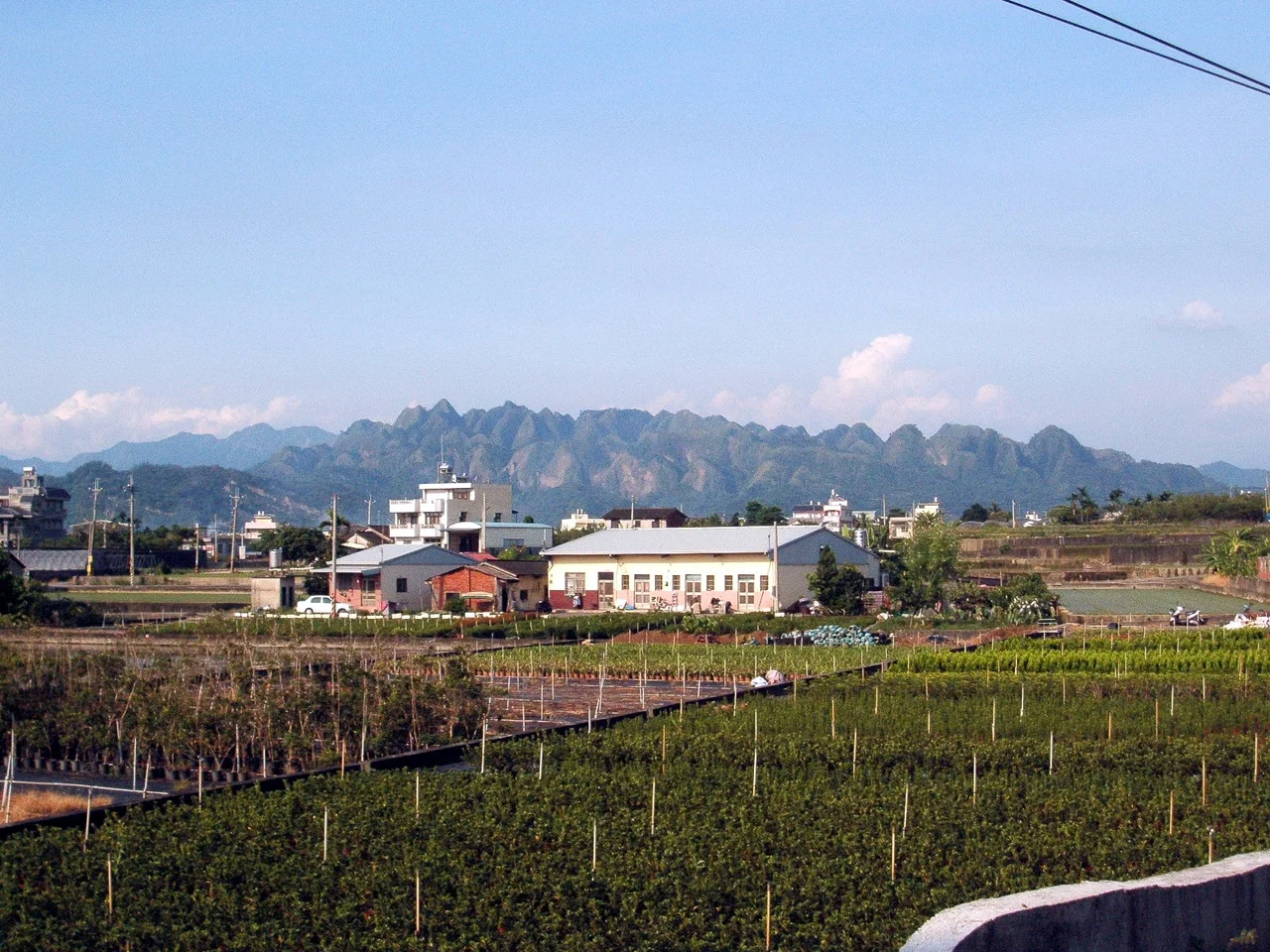

Jiujiufeng
The number ninety-nine in Chinese carries a meaning beyond arithmetic. It implies abundance approaching infinity — so many that counting becomes beside the point. When early settlers looked at the cluster of sharp, closely packed summits rising from the north bank of the Dadu River southeast of Taichung, they chose that number deliberately. Not because someone counted the peaks and arrived at ninety-nine, but because the landscape seemed to exceed counting altogether. Jiujiufeng — the Ninety-Nine Peaks — stretches across the border of Taichung City and Nantou County, a nature reserve of unusual geology and stubborn beauty.
Gravel and Rain
The peaks look as though they were carved by something impatient. In a sense, they were. Jiujiufeng sits within the Toukeshan Formation, a Pleistocene-era geological unit composed primarily of gravelly rock — the compressed deposits of ancient rivers and alluvial fans that once covered this part of central Taiwan. The critical factor is permeability. Because the gravelly soil drains quickly and holds little cohesion against running water, rainfall attacks the slopes efficiently and continuously. Every storm removes a little more. Over Pleistocene timescales, this process cut the formation into the tight cluster of sharp-sided peaks visible today — each one a remnant of what the formation once was, separated from its neighbors by gullies cut by the same rainfall that is still at work. The result is a topography that looks almost deliberate: dozens of pointed summits arranged in dense proximity, their ridgelines serrated against the sky.
What Survived the Shaking
The 921 earthquake of September 1999, which struck just a few kilometers to the southwest along the Chelungpu Fault, left visible marks on Jiujiufeng. Landslides stripped vegetation from many of the slopes, leaving bare grey rock and gravel exposed across broad sections of the reserve. In the immediate aftermath, the peaks looked denuded and raw. Recovery has been gradual — not sudden revegetation but a slow reassertion of plant life on terrain that does not make things easy for roots. Despite the thin, permeable soils and the steep faces, Jiujiufeng sustains a notable variety of plant life, including the rare Reevesia formosana — a small flowering tree endemic to Taiwan and one of the conservation priorities that justified the reserve's protected status. The earthquake stripped the slopes; the plants came back.
The Trail Through the Peaks
A single hiking trail, 1.93 kilometers long, makes a loop through Jiujiufeng. Accessible from Caotun, on the Nantou side of the reserve, it threads between the peaks rather than over them — the terrain is too steep and fragile for summit routes. The trail offers close-up encounters with the formation's characteristic geology: the gravelly slopes, the gullied faces, the narrow ridges separating individual peaks. At sunset, the silhouette of Jiujiufeng becomes particularly striking — a jagged skyline against the orange and pink light over the Taichung basin to the northwest. The reserve spans multiple administrative areas, touching the cities of Caotun and Guoxing in Nantou County and Wufeng and Taiping in Taichung City. The shared jurisdiction reflects the range's position exactly on the county boundary, which in this part of central Taiwan also marks the transition from basin to foothills.
A Landscape on the Edge
Jiujiufeng occupies the geological and geographic boundary between two worlds. To the west, the Taichung basin spreads flat and densely inhabited — farms, cities, highways. To the east, the Central Mountain Range begins its serious ascent toward Taiwan's highest peaks. Jiujiufeng is neither: it belongs to the zone of heavily folded and eroded foothills that marks the collision between the Philippine Sea Plate and the Eurasian Plate, still in slow, geological motion. The Dadu River flows along the southern edge of the reserve, one of the headwaters feeding the river system that drains central Taiwan westward to the Taiwan Strait. Standing on the loop trail and looking west at sunset, you are looking from active geology toward the settled human world — a useful reminder that the ground underfoot in central Taiwan is never entirely still.
From the Air
Jiujiufeng lies at approximately 24.02°N, 120.79°E, on the Taichung–Nantou county border southeast of Taichung City. From altitude, the reserve is distinctive: a dense cluster of closely packed pointed peaks, visibly different in texture and profile from the surrounding foothills. The Dadu River can be traced along the southern boundary of the reserve. Taichung International Airport (RCMQ) is approximately 18 km to the northwest; an approach from that direction at 4,000–6,000 feet provides a clear view of the Jiujiufeng silhouette against the rising terrain of the Central Mountain Range. In clear weather, the contrast between the gravelly, partially vegetated slopes of Jiujiufeng and the greener terrain surrounding it makes the nature reserve identifiable from medium altitude.
Nearby Stories
- Shigang Dam 2.7 km away
- Taixi, Yunlin 4.9 km away
- Xitou Nature Education Area 7.2 km away
- Lintianshan Forestry Culture Park 11 km away
- Taroko National Park 20 km away
- Smangus 36 km away
- China Airlines Flight 611 56 km away
- Taiwan Strait 69 km away