.jpg)
Kat Hing Wai
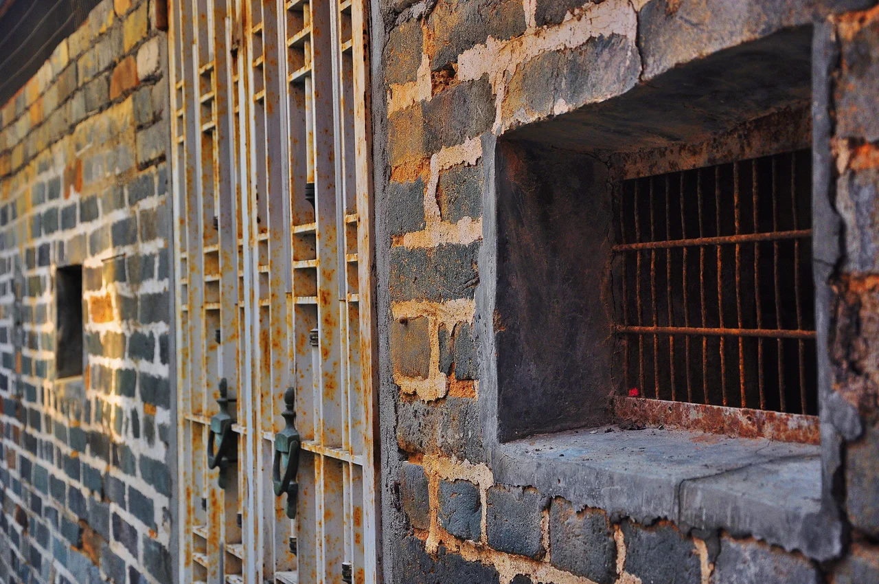
The gates at the entrance of Kat Hing Wai are not a matched pair. The left gate originally belonged to a different village — Tai Hong Wai — and was donated as a gift when the right gate finally came home from London in 1925. That mismatched pair, standing in the single narrow entrance through a seven-meter brick wall, tells the whole story of this place: ancient, defiant, reassembled through persistence. About 400 descendants of the Tang clan still live inside these walls today, on land their ancestors have held since the Ming dynasty. Visitors are welcome, though they are guests in someone else's home.
Built to Last Through Centuries
Kat Hing Wai was founded during the reign of the Ming Chenghua Emperor, who ruled from 1464 to 1487. The walled village takes its distinctive shape from a later era: the enclosing walls were built by Tang Chue-yin and Tang Chik-kin in the early years of the Kangxi reign, between 1661 and 1722. The result is a quasi-rectangular compound roughly eighty meters on a side, encircled by walls of blue brick. Four watchtowers stand at the corners. A moat once ran along the outside, and its remains are still visible. The whole structure was designed as a family stronghold — protection against pirates, bandits, rival clans, and, as the records note with specific detail, wild tigers. At eighteen inches thick, the walls are not symbolic. They were meant to hold.
Six Days, One Gate
When the British Empire moved to formalize control over the New Territories in April 1899, the Punti clans who had held the land for centuries refused to accept it quietly. The Tang clan of Kat Hing Wai joined the resistance, establishing a defensive position inside the village walls. The fighting lasted from April 14 to 19 — six days, remembered in Hong Kong as the Six-Day War. The British prevailed. In a gesture designed to make the point unmistakable, they dismantled Kat Hing Wai's iron gates and shipped them to London for display. It was a deliberate humiliation. The gates remained in Britain for more than two decades. In 1924, the Tang clan began formally requesting their return, and in 1925, Governor Sir Edward Stubbs oversaw the repatriation. A tablet near the entrance commemorates the episode. The gates came back, but as that mismatched pair reveals, history cannot be fully restored — only acknowledged.
What Survives Inside the Walls
Step through the single entrance and the geometry contracts. Narrow row-houses press close on either side, separated by alleys barely wide enough for two people to pass. Temples occupy corners where the alleys intersect. The layout has not changed fundamentally since the Qing dynasty, though most of the houses inside have been rebuilt in recent years — concrete replacing the original materials, modern fixtures behind historic walls. The village is still entirely surrounded by its perimeter. The ancient street plan survives. The character of the place — dense, self-contained, organized for collective life — is recognizable from the photographs taken in the 1920s. In 2010, the entrance gate, the shrine, the four watchtowers, and the enclosing walls were collectively listed as Grade I historic buildings, the highest heritage category in Hong Kong.
A Private Place, Publicly Significant
Kat Hing Wai is private property, owned by its Tang clan residents. That tension between heritage value and private ownership has shaped its conservation history. In 2002, Hong Kong's Acting Secretary for Home Affairs acknowledged that the Antiquities and Monuments Office was in negotiations with the village owners, seeking agreement to formally recognize the site as a declared monument. Those negotiations moved slowly. The Grade I listing in 2010 represented progress without full resolution — official recognition of historic importance, without the legal protections that full monument status would bring. The Tang clan has not dissolved the tension; they have lived with it, welcoming visitors through that single narrow gate while maintaining the right to determine what happens within their walls.
From the Air
Kat Hing Wai is located at approximately 22.44°N, 114.064°E in the Kam Tin area of the New Territories, Hong Kong. From altitude, it appears as a tight rectangular cluster set against the open agricultural plain of Yuen Long — the compact walled perimeter is distinct from the looser village structures surrounding it. Tai Mo Shan (957 m), Hong Kong's highest peak, rises clearly to the south and serves as a dominant visual reference. The nearest airport is Hong Kong International Airport (VHHH) on Lantau Island, about 25 km to the southwest. Recommended viewing altitude is 2,000–3,500 feet for clear resolution of the village geometry against the surrounding paddies and open land. The MTR Kam Sheung Road station is visible nearby.
Nearby Stories
- Chapel of St. Francis Xavier 3.5 km away
- Cuiheng 4.1 km away
- 2015 Shenzhen Landslide 16 km away
- Shunde 31 km away
- Wanshan Archipelago 37 km away
- Nanxiong Formation 96 km away
- Heyuan 149 km away
- Checheng Fu'an Temple 629 km away