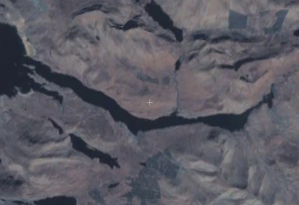

Killary Harbour
Killary Harbour drives 16 kilometres inland from the Atlantic, narrow and dark, with the slopes of Mweelrea rising 814 metres almost straight out of the water on the northern side. Connacht's highest mountain meets sea level in a few hundred horizontal metres. Locals and tourism literature call Killary Ireland's only true fjord, though geographers argue the point. What is not in dispute is the shape of the place: a flooded glacial valley with a sea bed deeper at its centre than at its mouth, just as fjords are supposed to be, carved out by a massive glacier that once dragged its way to the Atlantic.
Fjord or Fjard
Killary has been called a fjord for centuries. Modern geomorphologists have occasionally pushed back, suggesting it is technically a fjard, the shallower cousin of a true fjord, and grouping it with Lough Swilly and Carlingford Lough as Ireland's three glacial fjards. The argument hinges partly on the absence of extensive steep cliff walls. But a dedicated peer-reviewed paper titled An Oceanographical Survey of Killary Harbour took into account the underwater contours of the valley and the shape of its bed, and concluded that Killary is indeed a fjord. The waters reach more than 42 metres in depth at the centre, while the sea bed rises again outside the mouth, the classic fjord profile. The argument matters mostly to specialists. To anyone standing on the shore at Leenane and looking west toward the Atlantic, the shape of the place tells its own story.
Mweelrea and the Twelve Bens
The asymmetry of Killary is the first thing the eye registers. The northern shore rises sharply, dominated by Mweelrea, the highest mountain in Connacht. Its slopes descend almost vertically into the inlet. Uggool Beach sits at its western edge, a curve of pale sand at the foot of dark rock. The southern shore, by contrast, is merely hilly, giving way to the Maumturk Mountains and the Twelve Bens further inland. The island of Inishbarna guards the mouth of the harbour, breaking the line where the inlet meets the open sea. Otters work the shoreline. Grey and harbour seals haul out on the rocks. Dolphins enter the inlet often enough to be expected, and on one occasion a bearded seal, far from its Arctic home, was sighted in the waters.
The Famine Road
Near the hamlet of Rosroe at the mouth of the harbour begins what locals call the Green Road. It is a rough track running roughly nine kilometres east along the southern slope back toward Leenane. The road was built during the Great Famine of the 1840s as a relief work, one of countless schemes that paid starving labourers a pittance to construct infrastructure that often led nowhere and served no obvious purpose. The Green Road passes the last remnants of Foher, a hamlet that simply vanished during the famine years. Above Uggool Beach near the mouth, another lost village called Uggool once stood. Both are gone now, their stones absorbed back into the bog or scattered by weather. Walking the road today, you are walking on work made by hungry hands paid in soup.
The Philosopher in the Cottage
Near Rosroe stands an old building that now serves as a hostel. In the years just after the Second World War, it was a modest house used by the Austrian-British philosopher Ludwig Wittgenstein as a place to write in quiet. He needed isolation, and Killary offered it in abundance. In 1993, President Mary Robinson unveiled a plaque acknowledging the connection. The choice of Killary for serious thinking makes sense. The inlet's silence is broken only by water, wind, and the occasional cry of a seabird. The mountains close in around the cottage. For a thinker working on the foundations of language and certainty, the place must have offered exactly the absence of distraction the work required.
Salmon, Mussels, and Tourist Catamarans
Killary's modern economy braids three strands. A salmon farm operates at Rosroe. Mussel rafts cover wide stretches of the inner inlet, harvested commercially. And from April to mid-October, the catamaran fleet of Killary Fjord Boat Tours runs cruises up and down the length of the harbour, the boats turning out from Leenane and pushing west into water deep enough to hide them from the rest of Ireland. Salmon and sea trout still run the inlet, providing food for the seals that watch the cruise boats with practiced indifference. The Erriff River enters at the head of the inlet, dropping over the Aasleagh Falls just before it joins the sea, completing a journey from the bogs above to the deep cold water below.
From the Air
Coordinates: 53.617 N, 9.80 W. Killary Harbour is a long narrow east-west inlet straddling the County Mayo / County Galway border, 16 km from the Atlantic to its head near Leenane. From the air the inlet reads as a dark blue slash flanked by Mweelrea (814 m) on the north and the lower Connemara hills on the south. Nearest airports: Ireland West Knock (EIKN) about 90 km northeast, Galway (EICM, GA only) about 65 km southeast. Recommended viewing altitude 3,500 to 5,500 ft to clear Mweelrea with margin; the steep northern wall generates rotor and lee turbulence in westerly flow, and the inlet funnels Atlantic squalls inland fast.
Nearby Stories
- Annaghdown 6.9 km away
- Claremorris 9.4 km away
- Inishbofin Island 9.9 km away
- Attymass 10 km away
- Ballycroy 11 km away
- Toombeola 13 km away
- Blackrock Island, County Mayo 14 km away
- RMS Carinthia (1925) 40 km away