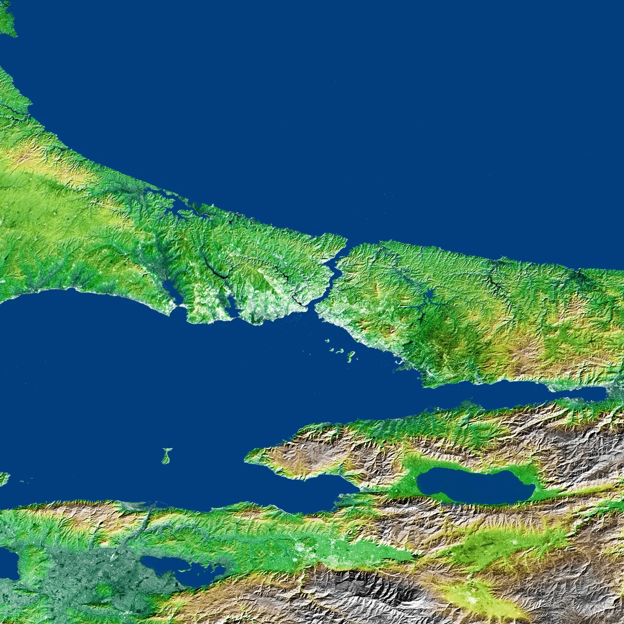

Kocaeli Peninsula
Hannibal of Carthage, the general who nearly brought Rome to its knees, spent his last years here. He had crossed the Alps with elephants, outmaneuvered Roman legions on three fronts, and lived into old age as an exile — only to die somewhere on this narrow wedge of land between two seas, around 183 BC, allegedly taking poison rather than surrender. The peninsula that sheltered him in his final hours now anchors one of the most industrialized corners of modern Turkey, and most people crossing it by highway have no idea what lies beneath the asphalt.
Between Two Seas
The Kocaeli Peninsula juts west from the Anatolian interior into a natural bottleneck formed by the Black Sea to the north and the Sea of Marmara to the south. About 90 kilometers long and 40 kilometers wide at its broadest, the landmass tapers toward the Bosphorus, where Istanbul straddles the strait. The geography is not subtle: this is the last solid ground before Europe. Armies, pilgrims, merchants, and refugees crossing from Asia into the European continent have traversed this peninsula since before written memory. The Greeks, the Romans, the Crusaders — all passed through. The Bosphorus narrows the choice to almost nothing, and the Kocaeli Peninsula funnels everything toward that crossing. Together with the Dardanelles to the south, it forms one of the two great hinges of the ancient world.
The Kingdom of Bithynia
For several centuries beginning in the fourth century BC, the Bithynians — a Thracian people who had migrated into northwestern Anatolia — ruled the peninsula and the surrounding region with surprising longevity and skill. While the Phrygians and Galatians pushed deeper into the Anatolian interior, the Bithynians held their ground between the mountains and the sea, absorbing Greek cultural influence while maintaining independence. Their kingdom survived Alexander the Great, the wars of his successors, and the expansion of Rome — no small feat in a neighborhood that consumed kingdoms wholesale. It was to Bithynia that Hannibal fled after his Macedonian exile ended, finding patronage at the court of the Bithynian king Prusias I. The region was known in Byzantine times as Mesothynia, meaning 'Middle Thynia,' a name that preserved its ancient identity even as empires above it changed hands.
Where Hannibal Died
The exact location of Hannibal's death remains disputed, but the peninsula holds the two leading candidates: Dilovası and Gebze, both sitting roughly at the middle of the Kocaeli Peninsula along the Marmara coast. Ancient sources agree on the method — poison — and on the year, around 183 BC, when Roman envoys came to demand his extradition. Hannibal is said to have kept poison in a ring for exactly this contingency. Whether the grave is at Dilovası or Gebze, it is unmarked in any permanent sense, absorbed into the landscape of petrochemical plants and container terminals that define this stretch of coast today. The peninsula that gave a great general his final asylum now runs on diesel and logistics.
The Industrial Shore
The southern coastline of the Kocaeli Peninsula — the Marmara side — is dense with cities, factories, and shipyards strung between Istanbul and İzmit. This corridor carries some of the heaviest industrial output in Turkey, including refining, chemicals, automotive manufacturing, and port operations. Population density here is among the highest in the country. The northern coastline tells a different story. The Black Sea shore, facing the cold northerly winds that come off the open water, is far less developed — a mix of resort towns, fishing hamlets, and wooded hills that slope down to sandy beaches. Şile and Ağva anchor this quieter coast, drawing Istanbulites who want distance from the city without leaving the province. The peninsula is, in this sense, two different places sharing the same peninsula.
Still a Crossing
The Kocaeli Peninsula's function has not changed in three thousand years. People still cross it to move between continents. The Trans-European Motorway and the O-7 highway now carry the traffic that Roman roads once channeled. The Osmangazi Bridge, completed in 2016, spans the Gulf of İzmit at the peninsula's eastern end, cutting travel time between Istanbul and points south. Trains thread the Marmara coast. Ferries cross the gulf. The peninsula is perpetually in transit — a place that millions pass through every year, and that relatively few stop to understand. Hannibal understood it, at least in the end: it was far enough from Rome to feel safe, close enough to the sea to escape, and old enough in its bones to offer shelter to a man who had run out of options.
From the Air
The Kocaeli Peninsula lies at approximately 41.00°N, 29.60°E, extending east from Istanbul. At 5,000–8,000 feet, the full shape of the peninsula becomes visible — the Black Sea coast to the north, the Gulf of İzmit and Sea of Marmara to the south, with the industrial ribbon of the Marmara shore contrasting sharply with the wooded, quieter Black Sea coast. The Bosphorus strait and Istanbul's sprawl are clearly visible to the west. Nearest major airport: LTFJ (Sabiha Gökçen International), on the Marmara coast of the peninsula's western end, approximately 20 km southwest. Approach from the north offers a dramatic view of the peninsula narrowing toward the strait. Morning haze is common over the Marmara; the Black Sea coast typically clears by midday.
Nearby Stories
- Istanbul/Eastern Suburbs 7.4 km away
- Sangarius Bridge 13 km away
- Kefken Island 19 km away
- Istanbul Canal 40 km away
- MV Struma 42 km away
- Tottenham (1802 Indiaman) 59 km away
- Bursa 66 km away
- Green Mosque of Bursa 85 km away