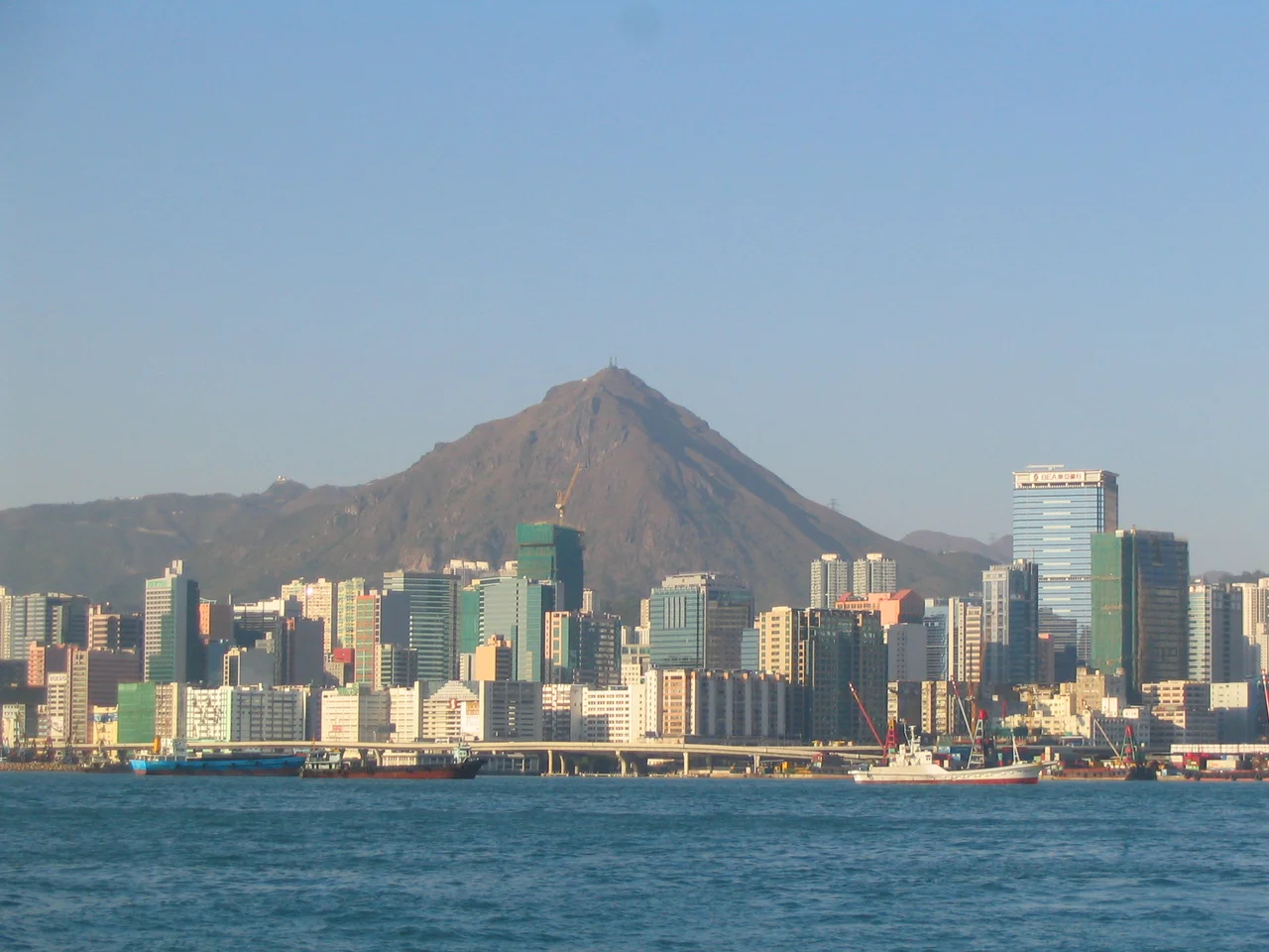

Kowloon Peak
The name is optimistic. Fei Ngo Shan — the Soaring Goose Mountain — suggests something graceful and airborne, a peak that lifts you. The reality is more demanding. At 602 meters, Kowloon Peak is the tallest mountain in Kowloon, and the face it turns toward the city is steep. The southern slope drops sharply toward the urban density of New Kowloon; the eastern and western flanks curve more gently down into the country parks. Two of Hong Kong's great long-distance hiking routes cross here — the Wilson Trail and the MacLehose Trail — and on weekends the paths carry a steady flow of hikers who come for the views and occasionally need rescuing from them.
Where Two Great Trails Cross
The MacLehose Trail and the Wilson Trail are the two most celebrated long-distance hiking routes in Hong Kong, and both pass over Kowloon Peak. The MacLehose Trail runs 100 kilometers across the New Territories from Sai Kung to Tuen Mun; the Wilson Trail covers 78 kilometers from Stanley in the south to Nam Chung in the north. Stage 4 of the Wilson Trail runs along the northwesternmost stretch of Fei Ngo Shan Road, crossing the peak's western approaches near Tate's Pass. The fact that both trails cross here is not coincidence — Kowloon Peak sits at a geographic junction, connecting the hills above Sai Kung to the ranges above Kowloon. From the summit, on clear days, the view takes in the harbor, the outlying islands, and the ridgelines of the New Territories stretching north.
The Mountain and What Lives on It
Kowloon Peak's geology is a mixture of volcanic rocks — many of them tuffs, compacted ash from ancient eruptions — with granite blocks at the base. The combination produces the dramatic cliff faces that define the mountain's profile when viewed from the city below. Despite the mountain's accessibility — Fei Ngo Shan Road allows vehicles to reach the higher slopes — wildlife has held on. Occasional sightings of Burmese pythons have been recorded on the mountain. East Asian porcupines, red muntjacs, and wild boar also appear. The pythons in particular are a reminder that Hong Kong's country parks, though close to dense urban areas, are genuine habitat — not manicured reserves but functioning ecosystems where large animals move through the undergrowth.
Suicide Cliff and the Limits of Accessibility
The southern face of Kowloon Peak includes a section that hikers call Suicide Cliff — a steep drop with dramatic exposure and views that attract people who underestimate what they're attempting. The cliff has been the scene of multiple serious incidents. In one documented case, two tourists became stranded and triggered a rescue operation involving 160 firefighters. Hikers have died here after falling on steep ground. The route to the summit via Fei Ngo Shan Road is straightforward for casual walkers; the cliff faces are a different proposition entirely. The contrast between the two paths — the easy road and the sheer drop — captures something essential about the mountain. It is accessible and dangerous at once, welcoming to the prepared and unforgiving to the overconfident.
A Ridge Above an Expensive Road
Fei Ngo Shan Road winds along the eastern slopes of Kowloon Peak, connecting the urban fringe near Kowloon to Tate's Cairn in Sai Kung District. It traverses the flanks of three connected peaks — Kowloon Peak itself, Middle Hill (also known as Cheung Shan), and Tung Shan to the north. The road is also known for the residences along it. Houses with addresses on Fei Ngo Shan Road are among the most expensive properties in the New Territories — a consequence of the elevation, the views across the harbor, and the relative quiet on a mountain above one of the world's most densely populated cities. The road connects the city to the country; the people who live along it have positioned themselves at exactly that boundary.
From the Air
Kowloon Peak (Fei Ngo Shan) is located at approximately 22.341°N, 114.223°E, rising to 602 meters at the northeastern edge of New Kowloon, Hong Kong. It is the dominant terrain feature in the area and is clearly identifiable from altitude as the highest point on the Kowloon side before the hills of the New Territories begin. The steep southern face dropping toward the urban grid of Kowloon is visually striking. The peak sits within Ma On Shan Country Park. The nearest airport is Hong Kong International Airport (VHHH) on Lantau Island, approximately 35 km to the west. Pilots approaching or departing VHHH should note that Kowloon Peak rises to 602 m (1,975 ft) and is a significant terrain obstacle on the eastern side of Kowloon. Recommended sightseeing altitude is 4,000–6,000 feet for a clear view of the peak, surrounding ridges, and the harbor below.
Nearby Stories
- Chapel of St. Francis Xavier 3.5 km away
- Cuiheng 4.1 km away
- 2015 Shenzhen Landslide 16 km away
- Shunde 31 km away
- Wanshan Archipelago 37 km away
- Nanxiong Formation 96 km away
- Heyuan 149 km away
- Checheng Fu'an Temple 629 km away