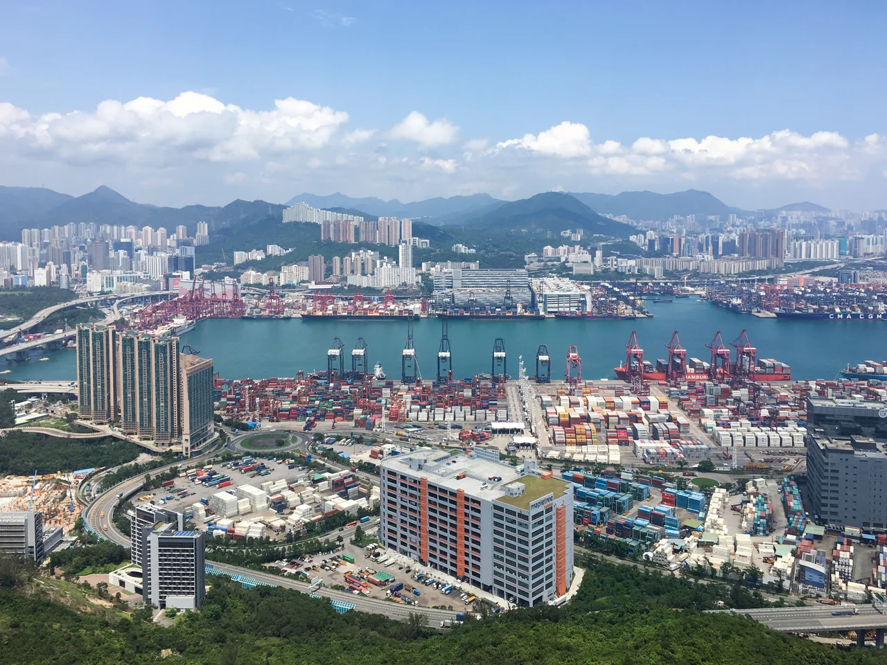

Kwai Tsing Container Terminals
In early 1967, a government committee delivered a warning: if Hong Kong did not build the capacity to handle containerized cargo, its port would be bypassed by Singapore and Japan, and the territory's economy would suffer for it. The Container Committee, appointed by Governor Sir David Trench the previous July, had studied the containerization revolution sweeping global shipping and concluded that Hong Kong had to act. Their recommended site was Kwai Chung, along the Rambler Channel between the mainland peninsula and Tsing Yi Island. Two small islands — Mong Chau and Pillar Island — were levelled and buried under the new facility. On 5 September 1972, the first container vessel, the Tokyo Bay, called at the new terminal.
From Warning to World Record
The speed of what happened next was extraordinary. Hong Kong's port grew through the 1970s as global trade expanded and containerization transformed the economics of shipping. The original four berths of Kwai Chung Container Port grew to six in the 1980s, then expanded further with two additional terminals adjoining Stonecutters Island in the 1990s. When Container Terminal 9 was completed on Tsing Yi Island in the 2000s, the facility was renamed Kwai Tsing Container Terminals to reflect its spread across the broader area. Along the way, the port surpassed the Port of New York and New Jersey in 1986 to become the world's second-busiest container port, then overtook Rotterdam in 1987 to claim the top spot. That a city-state of six million people, on a narrow strip of reclaimed land, briefly operated the world's busiest container port is a striking measure of what Hong Kong's economy was doing in those decades.
The Geography of Freight
The terminals occupy reclaimed land along Rambler Channel, the narrow waterway that separates Kwai Chung from Tsing Yi Island. Looking at the facility from the water, the scale is almost abstract: cranes rising forty meters above the wharf, container stacks stretching hundreds of meters, vessels from Maersk and COSCO and Evergreen queuing in the channel. Kwai Chung Road was built specifically to connect the port to Kowloon while the terminal was still under construction, and Container Port Road links the facility to Hong Kong's industrial areas. Infrastructure followed the port, and the port accelerated the transformation of Kwai Chung from a district of villages and light industry into the logistics hub it is today. Beneath the reclaimed land, the remains of a ship's hull lie buried — a detail that reminds you that what looks like solid ground is relatively recent geography.
Nine Terminals, One Port
The facility now consists of nine container terminals operated by a consortium of companies including Hongkong International Terminals (HIT) and others. The berths accommodate vessels with drafts of 14 to 16 meters, deep enough to handle the large modern container ships that could not call at older, shallower ports. By 2019, Kwai Tsing had fallen to the eighth-busiest container port in the world, and the slide has continued since. By 2024, the World Shipping Council ranked Hong Kong twelfth globally — the first time it had fallen outside the top ten. The rise of Chinese mainland ports, particularly Shenzhen and Guangzhou, which handle much of the trade that once moved through Hong Kong, has reshaped the regional rankings. But the terminals remain a central artery of Hong Kong's economy, handling tens of millions of twenty-foot equivalent units of cargo annually.
In the Frame
The terminals found their way into popular culture in 1991, when the action film Double Impact, starring Jean-Claude Van Damme, used Kwai Tsing as a filming location. The stacked containers and cranes provided the industrial backdrop that action cinema tends to favor. But the more enduring story is the economic one: a government committee in 1967 looked at a channel between a peninsula and an island, looked at the future of global shipping, and made a bet. Two former islands were erased from the map to make room for what they envisioned. The bet paid off in ways that reshaped the geography of Hong Kong and the economics of East Asian trade.
From the Air
The Kwai Tsing Container Terminals are centered at approximately 22.341°N, 114.125°E along Rambler Channel, between Kwai Chung and Tsing Yi Island. From the air, the terminals are one of the most distinctive features visible around Hong Kong — rows of container cranes lining the waterfront, stacked multicolored containers visible from several kilometers, and vessel traffic in the channel. Tsing Yi Island is immediately to the west; the Tsing Ma Bridge (connecting to Lantau) is visible to the southwest. Hong Kong International Airport (VHHH) is approximately 15 km west on Lantau Island. The terminals are best appreciated at 4,000–6,000 feet on an approach from the east, where the full scale of the port complex becomes visible against the surrounding water and hills.
Nearby Stories
- Chapel of St. Francis Xavier 3.5 km away
- Cuiheng 4.1 km away
- 2015 Shenzhen Landslide 16 km away
- Shunde 31 km away
- Wanshan Archipelago 37 km away
- Nanxiong Formation 96 km away
- Heyuan 149 km away
- Checheng Fu'an Temple 629 km away