
Kwun Yam Shan (Yuen Long District)
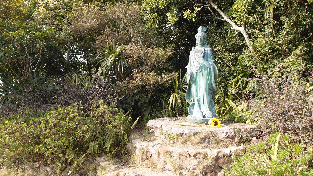
The mountain got its name from a deity. Kwun Yam — the Chinese interpretation of the Bodhisattva Avalokiteśvara, the figure of boundless compassion — was believed to have a presence on this summit, and a temple once stood there to mark it. The San-on County Gazetteer, the historical record of what is now the Shenzhen-Hong Kong region, singled the peak out: its shape was distinct, its rise dramatic, its spiritual character unmistakable. That was the 18th century. Today the temple is gone, replaced by a statue of Kwun Yam and a pair of Dragon and Phoenix Pillars at the summit entrance, but the mountain's character — sharp, commanding, a little otherworldly — has not changed.
A Peak Between Two Districts
Kwun Yam Shan reaches 546 metres (1,791 feet), placing it firmly in the upper tier of Hong Kong's hills without quite reaching the heights of its neighbour Tai Mo Shan, the territory's tallest mountain at 957 metres. The peak sits at the border of Tai Po District and Yuen Long District, within the grounds of Kadoorie Farm and Botanic Garden — a conservation and education centre that sprawls across the mountain's lower slopes. The summit itself is the high point of the farm's land. Getting there doesn't require a serious hike: a shuttle bus runs to the top, making the peak accessible to visitors who come to the farm for its wildlife rehabilitation work and organic gardens as much as for the elevation.
Volcanic Ancestry
What lies beneath Kwun Yam Shan is older than any name it carries. Geologists originally classified the rock as granodiorite — a coarse-grained igneous stone. In 2008, the Hong Kong Geological Survey reclassified it: the mountain is composed of altered intrusive rhyolitic hyaloclastite, a rock type associated with volcanic activity. During the ancient Shing Mun Formation, Kwun Yam Shan may have sat on or near a vent feeder — a conduit through which magma moved toward the surface. The rock still shows its turbulent past. Large quartz crystals run through it, cut by mineral veins of quartz, pyrite, and galena. The mountain is, in the most literal sense, the product of fire.
The Mist at the Top
In winter, something unusual happens at the summit: warm, misty air rises from a hole called the Hot Pots. The phenomenon gives the peak a particular atmosphere in the cold months — steam curling up from the ground while the temperature drops, a reminder that the mountain is not entirely inert. At the entrance to the summit stand the Dragon and Phoenix Pillars, and beyond them the statue of Kwun Yam looks out across the northern New Territories. On a clear day the view extends over Yuen Long Plain, toward the border with mainland China. The bodhisattva's gaze, which the statue renders in stone, falls across a landscape that has changed enormously since the mountain was first named — and across geology that has barely changed at all.
A Garden at Its Feet
Kadoorie Farm and Botanic Garden, which encompasses the mountain's peak, was founded in the 1950s to help Hong Kong farmers modernize their methods. It has since evolved into one of the territory's most important conservation institutions — a facility for rescued wildlife, a seed bank for native plants, and an environmental education centre. The farm's presence means that Kwun Yam Shan is not simply a wild peak but a managed one, accessed through a working institution rather than a trailhead. Cherry blossoms on the slopes attract visitors in spring. The shuttle bus to the summit carries people who might otherwise never reach 546 metres. The mountain named for a bodhisattva has become, in a quiet way, a place that practices what the name implies: making something otherwise unreachable a little more accessible.
From the Air
Kwun Yam Shan sits at approximately 22.4264°N, 114.1191°E in the northern New Territories, Hong Kong, within the Kadoorie Farm and Botanic Garden grounds. At 546 metres, the peak is one of the more prominent high points visible from the air north of Kowloon. Tai Mo Shan, Hong Kong's highest mountain, lies to the south. From 5,000–8,000 feet, the northern New Territories spread below with the Yuen Long Plain visible to the west and the Shenzhen border to the north. The nearest international airport is Hong Kong International Airport (VHHH) on Lantau Island, approximately 22 nautical miles to the southwest.
Nearby Stories
- Chapel of St. Francis Xavier 3.5 km away
- Cuiheng 4.1 km away
- 2015 Shenzhen Landslide 16 km away
- Shunde 31 km away
- Wanshan Archipelago 37 km away
- Nanxiong Formation 96 km away
- Heyuan 149 km away
- Checheng Fu'an Temple 629 km away