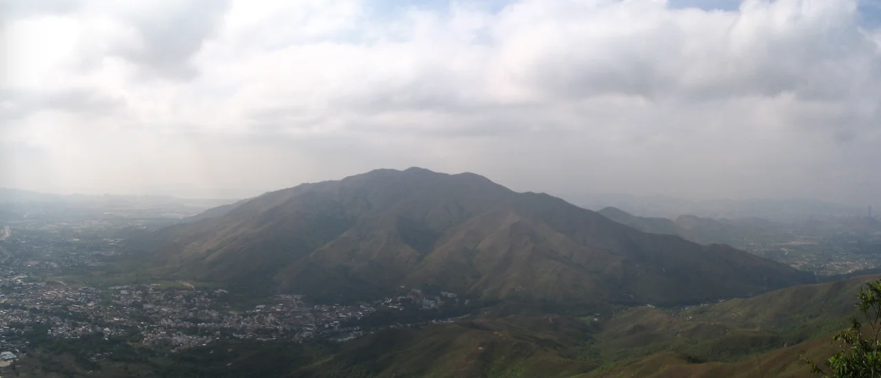

Lam Tsuen Country Park
Fan Kam Road cuts straight through Lam Tsuen Country Park, dividing it neatly in two. On one side, the Tai To Yan range; on the other, the Kai Kung Leng range. The road doesn't intrude — it clarifies. Each half of the park has its own character, its own ridge-lines, its own summits. Together they cover parts of three different administrative areas — Tai Po, Fanling, and Yuen Long — which gives some sense of how much ground a visitor can cover before running out of park. Opened in 1979, Lam Tsuen was one of Hong Kong's early country parks, part of the system that protects roughly 40 percent of the territory from development.
Two Ranges, One Park
The Kai Kung Leng range occupies the eastern half of the park. Its highest point is Lo Tin Deng at 585 metres, closely followed by Tai Lo Tin — also known as Kai Kung Leng, and formerly as Kwai Kok Shan — at 572 metres. Kai Kung Shan, lower in the range at 374 metres, marks the southern end. Across Fan Kam Road, the Tai To Yan range mirrors this structure with its own hierarchy: Tai To Yan at 566 metres, and Pak Tai To Yan at 480 metres. These are not trivial elevations. In a territory where the skyline is famously vertical with concrete, these ridges offer unobstructed views across the New Territories and, on clear days, over the water toward Lantau and beyond.
The Valley Below
The park takes its name from the Lam Tsuen Valley, which lies at its feet. This is farming territory — the broader Yuen Long Plain stretches to the west, one of the few areas in Hong Kong where large-scale agriculture has historically been possible. The village of Sam Tin sits within or near the park boundaries, and Liying School — listed among the park's features — is a reminder that this is not empty wilderness but a landscape that has been farmed, schooled, and lived in for centuries. The country park designation doesn't erase that history; it sits alongside it, protecting the hillsides while the valleys continue their older functions.
A City's Green Boundary
Hong Kong's country park system is one of the territory's defining achievements. Established under the Country Parks Ordinance of 1976, the parks were created partly in response to rapid urbanization and partly to protect Hong Kong's water catchment areas. Lam Tsuen, opened in 1979, came in the middle of that founding wave. Its position in the northern New Territories gives it a particular role: it forms part of the green buffer between the dense urban development of the Kowloon Peninsula and the less developed areas closer to the mainland border. From the peaks of either range, the contrast is stark — city on one horizon, hills and farmland stretching toward the other. The park holds that boundary.
On the Ridges
Hikers who come to Lam Tsuen find the ridges rewarding rather than punishing. The elevation is genuine — Lo Tin Deng at 585 metres is higher than much of what casual walkers tackle elsewhere in Hong Kong — but the trails are established and the access points from surrounding villages and roads are practical. The park connects to the broader network of country parks that wraps around the New Territories, meaning that a determined walker can link Lam Tsuen to neighboring Kam Shan, Tai Po Kau, or the Pat Sin Leng range to the northeast. For most visitors, though, the draw is simpler: clear air, open sky, and the particular silence of a hillside just far enough from the city to feel like somewhere else entirely.
From the Air
Lam Tsuen Country Park sits at approximately 22.468°N, 114.099°E in the northern New Territories, Hong Kong. The park's twin ranges — Tai To Yan and Kai Kung Leng — are visible from the air as the prominent ridge system north of the urban belt, with peaks exceeding 550 metres. The Lam Tsuen Valley runs along the park's southern edge. Hong Kong International Airport (VHHH) on Lantau Island lies approximately 25 nautical miles to the southwest. From 8,000–10,000 feet, the country park's green ridges contrast clearly with the dense urban development of Kowloon to the south and the flatter farmland of Yuen Long Plain to the west.
Nearby Stories
- Chapel of St. Francis Xavier 3.5 km away
- Cuiheng 4.1 km away
- 2015 Shenzhen Landslide 16 km away
- Shunde 31 km away
- Wanshan Archipelago 37 km away
- Nanxiong Formation 96 km away
- Heyuan 149 km away
- Checheng Fu'an Temple 629 km away