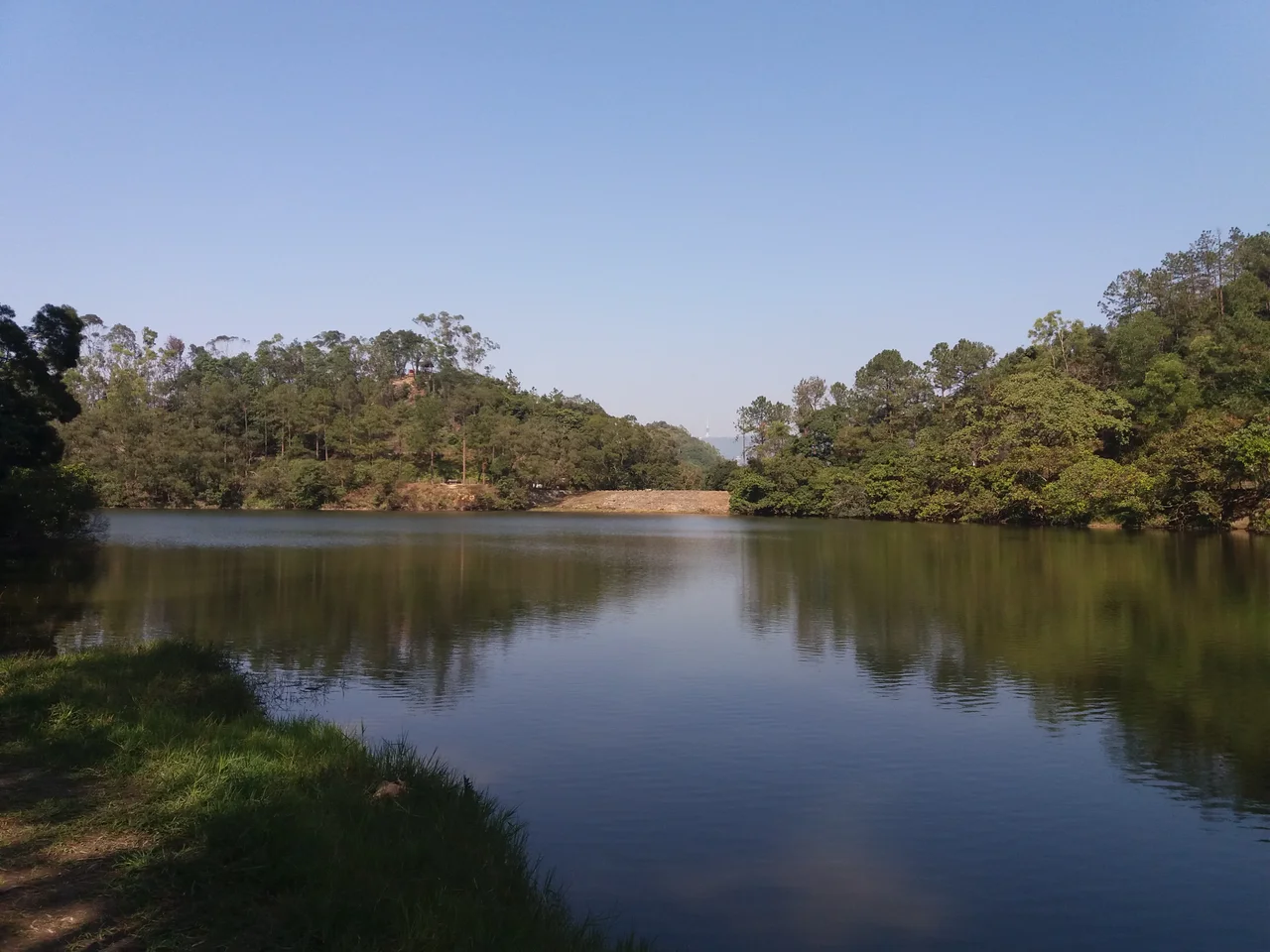

Lau Shui Heung Reservoir
In April 2018, hikers descending through Pat Sin Leng Country Park found something they had not expected: they could walk to the bottom of Lau Shui Heung Reservoir and keep going. The water was gone. The reservoir that locals called the 'mirror of the sky' — for the way its deep green surface reflected the clouds and ridgelines above — had cracked open to reveal a dry lakebed of sand and fractured mud. People who had come expecting a serene green pool found instead a geology lesson, the floor of the reservoir exposed for the first time in recent memory. It was a striking sight, and an unsettling one — a reminder that what looks permanent often is not.
Built to Move Water
Lau Shui Heung Reservoir was not built to be beautiful, though it became so. Construction began in 1966 and finished in 1968, as part of the engineering programme that created the much larger Plover Cove Reservoir nearby. While Plover Cove was the primary storage facility — one of Hong Kong's most ambitious water supply projects, impounding an entire marine bay — Lau Shui Heung served a different role: collecting runoff from the northwestern slopes of the Pat Sin Leng range and channeling it through a conveyance tunnel to supply the larger reservoir. The main dam is a concrete gravity structure 24 meters high and 54.9 meters long; a secondary earth dam stands 7.3 meters high. Small by any measure — the reservoir covers just 3.5 hectares with a storage capacity of 170,000 cubic meters — it was designed as a component in a system, not as a destination. It also serves as an irrigation reservoir for nearby farmland, feeding the Kwan Tei River and ultimately the Ng Tung River beyond.
Mirror of the Sky
The engineering purpose never explained why the place was so good to look at. Set inside a valley within Pat Sin Leng Country Park, Lau Shui Heung is enclosed by wooded ridges and ringed by rows of Melaleuca trees — a genus of paperbark known for its white, peeling bark and the reflective quality it gives to standing water. The reservoir sits deep enough that its color shifts to green, a consequence of both depth and the filtering of light through the surrounding canopy. On still mornings, the surface becomes genuinely mirror-like, reflecting clouds, ridges, and sky with a clarity that has made it a popular subject for photographers and a draw for hikers who come for the views along the Lau Shui Heung Country Trail. The trail passes directly through the reservoir area, making it accessible without special access. The fish below — including Channa asiatica, a small snakehead species uncommon in Hong Kong — move through a substrate of sand and rock that the reservoir's depth and clarity make visible.
The Year the Mirror Cracked
The 2018 dry season was worse than usual. A winter with below-average rainfall, combined with irrigation demand from surrounding farmland and, authorities suspected, groundwater drainage from the nearby Lung Shan Tunnel construction project, left the reservoir severely depleted by April. Cracks appeared at the bottom. The Water Supplies Department confirmed the situation and attributed it primarily to drought and irrigation draw. What made the case puzzling was that Hok Tau Reservoir — a nearby irrigation pond of similar size — did not dry up. The comparison suggested something specific had happened at Lau Shui Heung, not just a regional drought effect. Then the rains came. In early June, Tropical Storm Ewiniar brought outer rainbands across northern Hong Kong. Nearly 100 millimeters fell in three days — more than the previous two months combined. In the northern New Territories, more than 200 millimeters fell in a single 24-hour period. The cracked lakebed filled. The mirror was restored.
The Country Park Setting
Pat Sin Leng Country Park, which surrounds the reservoir, takes its name from the ridge that defines its skyline — Pat Sin Leng translates roughly as 'Eight Immortals Ridge,' a reference to the eight peaks that compose it. The park covers rugged terrain in the northeastern New Territories, between Tai Po and the mainland border, and is less visited than more accessible parks closer to the urban core. That relative quiet is part of Lau Shui Heung's appeal. The Lau Shui Heung Country Trail connects the reservoir to broader trail networks in the area, linking to routes through Fung Yuen and beyond. The woodlands are mature and diverse, the valleys secluded. Barbecuing at the reservoir has become a local tradition — the combination of accessible flat ground, scenic water, and shade making it a natural gathering place for families who make the journey from Fanling and Sheung Shui to the south.
Water in a Crowded Place
Hong Kong's water supply story is one of constant engineering against scarcity. The city receives substantial annual rainfall but lacks the land area and natural storage to hold it; reservoirs are essential, and they are numerous — more than a dozen serve different parts of the territory. Lau Shui Heung is among the smallest, but its function in the Plover Cove system illustrates how interdependent these structures are. When one dries, the chain is disrupted. When the rains return, as they did in June 2018, the whole system resets. The 'mirror of the sky' is a nickname earned by appearance, but it also describes something true about the reservoir's relationship to the weather: what you see on that surface is a direct reflection of what the clouds have recently given or withheld.
From the Air
Lau Shui Heung Reservoir is located at approximately 22.496°N, 114.169°E within Pat Sin Leng Country Park, northeastern New Territories, Hong Kong. From 3,000–5,000 feet, the reservoir appears as a small green or dark oval set in a forested valley. The Pat Sin Leng ridgeline is visible to the south and east; the Sheung Shui-Fanling Plain opens to the southwest. Hong Kong International Airport (VHHH) is approximately 45 km to the southwest. The area is best observed in clear winter conditions; summer haze limits visibility over the upland reservoirs. There are no airports closer than VHHH — the site is deep in the New Territories interior.
Nearby Stories
- Chapel of St. Francis Xavier 3.5 km away
- Cuiheng 4.1 km away
- 2015 Shenzhen Landslide 16 km away
- Shunde 31 km away
- Wanshan Archipelago 37 km away
- Nanxiong Formation 96 km away
- Heyuan 149 km away
- Checheng Fu'an Temple 629 km away