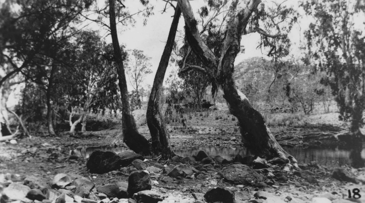
Laura to Maytown Coach Road
Freight was the killer. Not the heat, not the fever, not even the country itself, though all three took their share. What broke men on the Palmer was the simple cost of moving things across it. In February 1874 it cost a fortune to haul a single ton of supplies inland from Cooktown over Macmillan's freshly surveyed track, and the price of everything that reached the diggings rose to match. The Laura to Maytown Coach Road is the scar that effort left on the land: a hand-cut route clawing south from Laura through some of the harshest ranges in North Queensland, toward a gold town that no longer exists.
The Road to the Gold
In 1873 the explorer James Venture Mulligan came back from the Palmer River carrying 102 ounces of gold, and the news detonated across the colony. Within a year Cooktown had swollen from nothing to thousands of people, all of them facing the same problem: the gold lay roughly 140 kilometres inland, behind ridge after ridge of broken sandstone. This road was the answer, and its surveyor, Archibald Campbell Macmillan, fought the terrain by easing the worst gradients and building stone retaining walls on the most dangerous pitches. Competition eventually drove freight rates down by 1875, the year mining output peaked, but the isolation of the Palmer was never truly conquered. It only became survivable.
Cobb & Co Comes Through
By May 1880, after the Hann Divisional Board chipped in on improvements, a regular Cobb & Co coach service finally rolled the length of the road. Picture the arrival: a team of horses lathered with sweat and red dust, a driver who knew every washout and pinch by feel, passengers stiff from hours of being flung against each other on the cuttings. The route ran from Chalmers, eleven kilometres west of Laura, down the eastern bank of the Little Laura River past a string of wayside pubs with names worn smooth by retelling, Patricks, Ned's, Folders at the foot of the Conglomerate Range. Where the wet season threatened to swallow the track, the road simply split in two, one branch held in reserve for the rains.
Gardens in the Wilderness
The road tells a quieter story too, one written in the soil beside it. Among the more than twenty thousand Chinese who came to the Palmer between 1874 and 1877, some turned from the diggings to the far surer business of feeding the field. The three largest market gardens along this road survive as place-names today: Garden Creek at the 14 Mile, a site between Jessops Hill and Jessops Creek, and the Lone Star, known also as Tommy Ah Toy's garden. In a landscape where a wilted cabbage could cost a day's wages, the men who coaxed vegetables out of this country held a kind of power the prospectors never understood.
What the Ranges Kept
Maytown, the road's destination, was once almost unimaginable. By 1876 it carried twelve hotels, six stores, bakers, banks, a post office. Then the gold thinned, the people drained away, and by the 1920s the capital of the Palmer was a ghost town swallowed by scrub. The road outlived the town. Listed on the Queensland Heritage Register on 21 October 1992, it is one of the few access routes onto the Palmer never smoothed over by modern grading. Between Cradle Creek and the North Palmer River the original handiwork still shows plainly, the steep pinches and stone drains cut by men who could not have known they were building something that would last longer than the fortune that drove them.
From the Air
The Laura to Maytown Coach Road runs through rugged sandstone country south of Laura on Queensland's Cape York Peninsula, centred near 15.99 degrees S, 144.31 degrees E. The route threads between the Little Laura River and the North Palmer River, with the Conglomerate Range a key landform along its course. Best appreciated from 3,000 to 5,000 feet AGL in the dry season (May to October), when low scrub and exposed rock make the cuttings and creek crossings legible from the air; wet-season haze and cloud build rapidly here from November. Nearest airfields are Laura (a remote strip just north) and Cooktown Airport (YCKN) about 50 km to the northeast; Cairns (YBCS) is the major gateway roughly 250 km south.
Nearby Stories
- Nuggety Gully Water Race and Chinese Camp 12 km away
- Palmer River Gold Company Dredge 28 km away
- Old Laura Homestead 36 km away
- Daintree National Park 41 km away
- Cooktown Cemetery 47 km away
- OK Mine & Smelter 49 km away
- Musgrave Telegraph Station 101 km away
- Georgetown: The Piece of North America in the Outback 238 km away