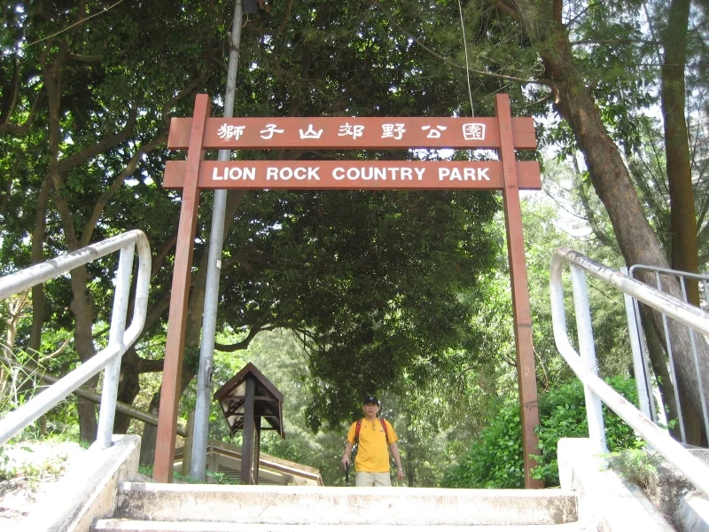

Lion Rock Country Park
Hong Kong has a symbol, and it lives in the hills. The Lion Rock — a granite ridge above the northwestern edge of Kowloon — earns its name from a specific angle of view, where the rock formation resolves into the silhouette of a lion crouching on a ridge. From below, in the dense neighborhoods of Wong Tai Sin and Sha Tin, the lion is always there on the skyline. Over time it became shorthand for something larger: the spirit of Hong Kong people who built their lives under its gaze. Lion Rock Country Park, established on 24 June 1977, protects the rock and the 5.57 square kilometers of hillside around it — granite, pine, myth, and macaque.
Three Peaks, Three Stories
The park's landscape is organized around three dominant features, and each carries its own history. Lion Rock itself is the centerpiece — the crouching granite silhouette visible from much of Kowloon and, on clear days, far beyond. Mong Fu Shek, known in English as Amah Rock, carries a legend: a faithful wife who climbed the hills each day carrying her son, watching for her husband's return, not knowing he had drowned at sea. According to the story, the Goddess of the Sea took pity on her devotion and turned her to stone so that her spirit could join his. The formation still stands, the woman and child rendered in rock, perpetually watching. Beacon Hill, the third peak, has a more martial history — Qing dynasty soldiers lit warning fires on its summit to alert surrounding areas to threats from pirates and intruders. A radar station and a police transmitter occupy that summit today.
What Lives in the Hills
Two species define the park's wildlife in particular ways. Black-eared kites — migratory raptors that range across Asia and Australia — nest in the wooded ridge at Eagle's Nest, drawn by the tall pines and the ready food supply of the harbor below. They are scavengers: offal, carrion, refuse, dead fish. Watching one bank above Kowloon on a clear morning is a reminder of what the land was before the city. The long-tailed macaques are a stranger presence. They are not native wildlife but descendants of monkeys released in 1920, and they have flourished in the intervening century. Signs throughout the park remind visitors that feeding the macaques is illegal — and that the animals, particularly during mating season or when they have young, can bite. The geology beneath all of this is granite: Sung Kong, Cheung Chau, and Ma On Shan varieties, cut through in places by quartz veins carrying wolframite, a tungsten-bearing mineral.
Climbers, Hikers, and the View from the Ridge
The first modern rock climbs in Hong Kong were completed on Lion Rock in the 1950s by RAF personnel stationed at Kai Tak Airport, and the crag remains a favorite for multi-pitch climbing today. The park serves a much broader range of visitors beyond climbers. An extensive footpath network connects nearly every part of the terrain, and two of Hong Kong's great long-distance trails pass through: MacLehose Trail Stages 5 and 6, running from Sha Tin Pass to Shing Mun Reservoir, and Wilson Trail Stage 6, from Tai Po Road to Shing Mun Reservoir via Smugglers Ridge. There is no road access; every visit begins on foot, entering from Hung Mui Kuk, Tsok Pok Hang in Sha Tin, Wang Tau Hom in Kowloon, or via the catchwater footpath from Tai Po Road near the Kowloon Reservoir.
The View That Makes Everything Legible
From the slopes of Golden Hill and the western ridge, the panorama makes the geography of Hong Kong suddenly comprehensible. To the north: Tai Mo Shan, the territory's highest peak, and Needle Hill. To the south: the density of northern Kowloon dropping toward Victoria Harbour, with Stonecutters Island and the container port of Kwai Tsing visible at the western anchorage. Sha Tin New Town fills the valley to the northeast. The whole of Tsing Yi Island, its industrial edges sharp against the water, extends toward Tsuen Wan. To stand on the Lion Rock ridge is to understand why Hong Kong was built the way it was — harbor-facing, ridge-defined, squeezed between hills and sea. The lion looks down on all of it.
From the Air
Lion Rock Country Park spans approximately 22.335°N–22.375°N, 114.155°E–114.215°E across the boundary between the New Territories and northern Kowloon, about 12 km northeast of Hong Kong International Airport (VHHH). On approach to VHHH from the east, the Lion Rock ridge is one of the most distinctive terrain features visible — the granite spine separating the Sha Tin valley to the north from the Kowloon lowlands to the south. Best viewed at 3,000–5,000 feet on a clear day, when the silhouette of the crouching lion is visible from the northwest.
Nearby Stories
- Chapel of St. Francis Xavier 3.5 km away
- Cuiheng 4.1 km away
- 2015 Shenzhen Landslide 16 km away
- Shunde 31 km away
- Wanshan Archipelago 37 km away
- Nanxiong Formation 96 km away
- Heyuan 149 km away
- Checheng Fu'an Temple 629 km away