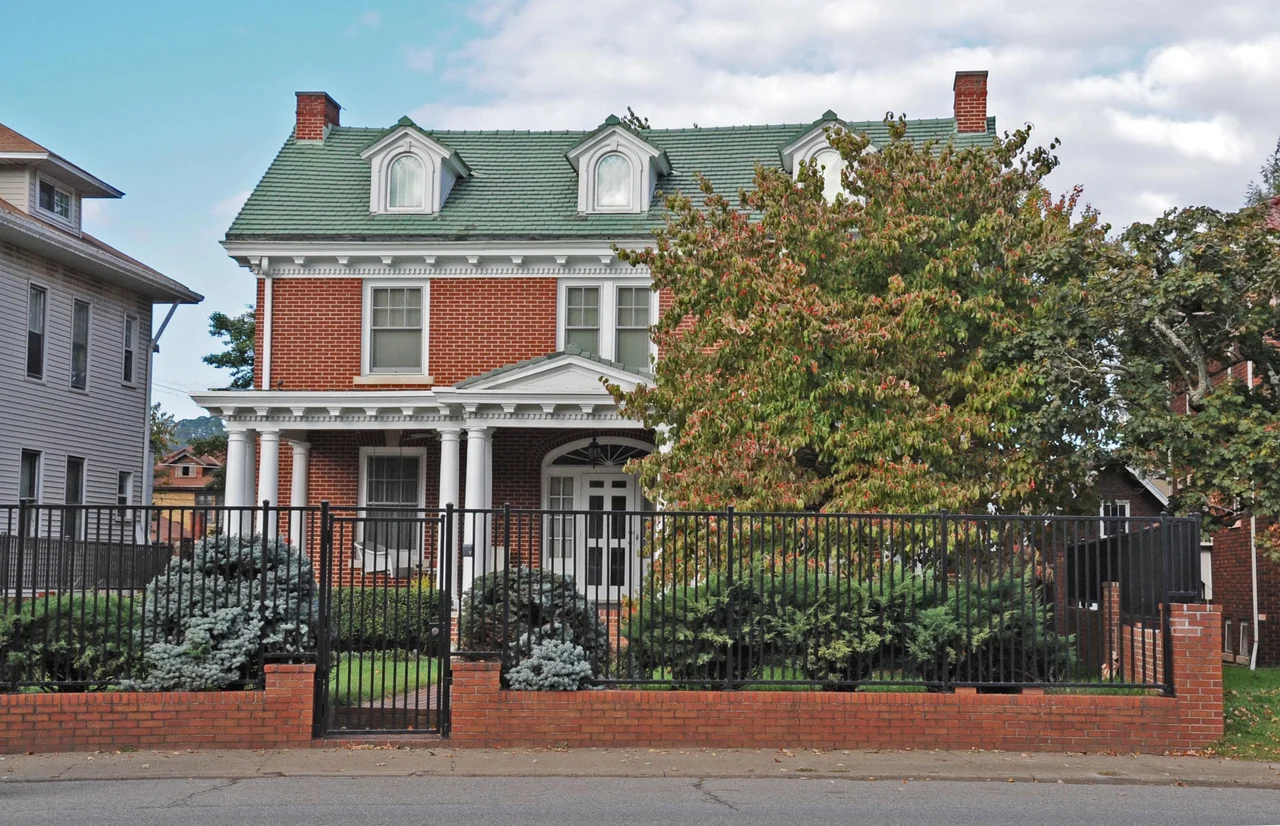

Luna Park Historic District
Before the houses, there was an amusement park. From 1912 to 1923, a portion of Charleston's West Side was occupied by Luna Park - one of the dozens of small American amusement parks built in the early twentieth century to give working families a place to spend a Saturday afternoon. There was a wooden roller coaster, a carousel, a bandstand, a swimming pool, and a fenced lot full of the lights and noise that the name 'Luna' was meant to evoke. The park closed in 1923. Within a few years, developers had platted the land into residential lots, and through the second half of the 1920s and into the early 1930s the West Side was built up with the kind of houses American families wanted in the boom years before the Depression: foursquares, bungalows, Tudor Revivals, and Colonial Revivals. The neighborhood today bears the park's name. The Luna Park Historic District encompasses 444 contributing buildings, and most of them stand on land that was once a Ferris wheel away from the Kanawha.
Lights, Music, and a Roller Coaster
Luna Park in Charleston was one of the many amusement parks built across America in the 1900s and 1910s that took their names and inspiration from the original Luna Park at Coney Island. The Charleston park opened in 1912 on land along the north bank of the Kanawha River, on the West Side of the city. It featured a wooden coaster, a carousel, picnic grounds, a swimming pool, and various concessions. The Kanawha Valley Traction Company's streetcar lines provided easy access from downtown and the surrounding suburbs. Such parks were the social outlets of an industrial working class - a Saturday at Luna Park was the equivalent of a Saturday at a modern multiplex or shopping mall. The park operated for eleven seasons before financial pressures and changing entertainment habits brought it to a close in 1923.
From Amusement to Subdivision
Land that has been an amusement park is generally cleared, graded, and served by utilities by the time it changes hands - which makes it convenient for residential development. After Luna Park closed, the property was platted and sold off in standard-size suburban lots. The timing was nearly perfect. Charleston's chemical and coal economies were expanding through the 1920s, the population of the city was growing rapidly, and middle-class families wanted houses with porches, side yards, and a quick streetcar ride to downtown. Construction of the residential blocks that now form the historic district was concentrated in the mid-to-late 1920s and early 1930s. By the time the Depression slowed building nationwide, the West Side neighborhood was substantially complete. Streets were laid out in a grid, with consistent setbacks and tree-lined sidewalks. The result is a neighborhood that reads as a coherent unit of a specific decade - which is precisely what makes a historic district.
The Architectural Catalogue
The houses of the Luna Park district are a textbook of late-1920s American domestic architecture. The American Foursquare - that big square box of a house with a hipped roof, central dormer, and full-width front porch - is well represented; it was the default upper-middle-class American house of the early twentieth century. The American Craftsman bungalow, with its low-pitched roof and broad eaves, is even more common, reflecting the dominant taste for bungalow style during the 1920s. Tudor Revivals - half-timbered upper stories, steeply pitched front gables, brick chimneys - appear in clusters where developers wanted to give blocks a higher architectural profile. Colonial Revival houses, including a substantial Dutch Colonial Revival contingent with their distinctive gambrel roofs, round out the district. The materials are predominantly brick and frame; the workmanship is consistent; the period stylistic coherence is unusually strong for an American neighborhood that filled in over a decade rather than all at once.
What the Park Left Behind
The Luna Park Historic District was added to the National Register of Historic Places in 2012. The nomination form documented 444 contributing buildings - meaning structures that were built during the period of significance and that retained enough of their original character to support the district's historic identity. That is a substantial inventory for a single residential district in a city Charleston's size. A boundary amendment in 2018 refined the listing. The amusement park itself is gone - no buildings or rides survive - but the neighborhood that took its name continues. Locals still refer to the area as Luna Park. Streets in the neighborhood follow the rough outlines of what were once park access lanes. And once in a while, on a hot summer night with the windows open, you can imagine you hear the carousel music drifting up from the river. That, of course, is the kind of thing only the imagination provides. But the name persists. The houses persist. The neighborhood, built on the bones of an amusement park, continues to be lived in.
From the Air
The Luna Park Historic District sits in Charleston's West Side neighborhood at 38.36 degrees north, 81.65 degrees west, on the north bank of the Kanawha River about a mile northwest of downtown Charleston. Best viewed at 2,500 to 4,500 feet AGL: look for the dense residential street grid west of the Elk River confluence with the Kanawha, with the I-64 corridor running south of the neighborhood. Yeager Airport (KCRW) is about three miles east. The Kanawha River, the gold-domed state capitol downstream, and the I-64 corridor are reliable orientation landmarks.
Nearby Stories
- Mystery Hole 6.5 km away
- West Virginia Colored Children's Home 9.4 km away
- Clay, West Virginia 13 km away
- Staats Mill Covered Bridge 14 km away
- Hobet Coal Mine 23 km away
- Appalachia 23 km away
- Fred M. Vinson Museum and Welcome Center 30 km away
- Ponn Humpback Covered Bridge 43 km away