
Ma Liu Shui
The horse refused to leave. According to Hakka legend, a government official from Bao'an County was riding through this stretch of the New Territories when his horse descended to a lake, drank, played in the water, and simply would not go. The villagers watching interpreted this as a sign that the animal had come home — that some bond between the horse and this place was stronger than the rider's command. They named the area 馬嫽水, "the water that the horses play in." Over time the character shifted to 馬料水, "the water that the horses feed on," and the phonetic settled into Ma Liu Shui, the name that now appears on MTR maps beside one of Hong Kong's most distinguished universities.
A Name With an Awkward Near-Miss
Place names carry accidents of sound. In Cantonese, Ma Liu Shui (馬料水) is phonetically close to Ma Niu Shui (馬尿水) — which translates, less elegantly, as "the water that horses urinate in." When the railway station serving this area opened as Ma Liu Shui Station, the similarity was noticed. Local pressure built for a change, and on 1 January 1967 the station sign was updated to simply "University Station" — acknowledging what had become the area's main landmark while quietly sidestepping the phonetic problem. The station has carried that name ever since, its connection to the old Hakka water-legend buried a layer deeper.
From Barren Land to University Campus
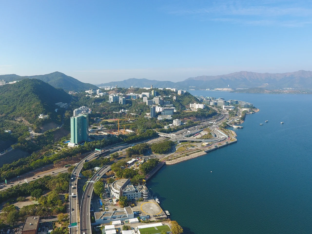
Before 1956, Ma Liu Shui was sparsely settled, its hillsides home to Hakka villagers farming land that was considered too difficult for large-scale development. That year, Chung Chi College — a Christian liberal arts institution — was granted 10 acres of Ma Liu Shui land for a new campus. A railway station opened alongside it to serve the college. Then in 1963, the Chinese University of Hong Kong was formally established, with Ma Liu Shui as its setting. Chung Chi College became one of its founding constituent colleges, joined later by New Asia College and United College, whose academic buildings shifted to the hillside campus between 1969 and 1973. What had been difficult terrain became an asset: the campus climbs the slopes above Tolo Harbour, its buildings stepping down toward the water, the views opening across the bay toward Tai Po. Yucca de Lac, a high-class western restaurant that opened near the campus in 1963, became part of the area's character for four decades before closing in October 2005.
The Ferry to the Edge of the Territory
Ma Liu Shui's ferry pier is its most particular amenity. From a small dock beside the MTR station, regular services run to Tap Mun and Tung Ping Chau — islands in the far northeast of the New Territories that are otherwise inaccessible by road. Tung Ping Chau in particular sits at the far edge of Hong Kong's territory, its coral reef waters protected as part of the Hong Kong UNESCO Global Geopark. The Ma Liu Shui pier is the only way most people reach it. On weekends the dock draws sightseers and hikers who want to reach the islands, and the gathering has a particular character — people in outdoor gear waiting for small ferries on a harbour that feels genuinely remote, despite being forty minutes from the urban core. An earlier hovercraft service to Dameisha Beach in Shenzhen, operating in the early 1980s, has long since closed.
Where Technology Meets Tolo Harbour
South of the university campus, along the coastline facing Tolo Harbour, the Hong Kong Science Park occupies Pak Shek Kok — a reclaimed promontory completed in stages from the early 2000s. Its curving low-rise buildings house research and development firms, start-ups, and university spinouts, a deliberate concentration of knowledge industries beside an academic neighbourhood. The Jockey Club Museum of Climate Change, on the CUHK campus, adds another institutional layer. Together, the university, the science park, and the Hyatt Regency hotel that serves both have turned what was barren hillside into one of the New Territories' most consequential knowledge clusters — still fed by the East Rail line station that traces its origins to the 1956 decision to give a college a piece of difficult land.
The Harbour at Your Wing
From the air, Ma Liu Shui is unmistakable. Tolo Harbour cuts a long, sheltered channel between the hills of the New Territories, and the Chinese University campus steps down the northern slope of the Ma Liu Shui area in terraced layers, its buildings green-roofed and widely spaced. The Science Park sits as a distinct cluster at the water's edge to the south. University station appears as a small transit node where the East Rail line hugs the hillside. The coordinates are 22.4164°N, 114.209°E. Hong Kong International Airport (VHHH) lies approximately 45 kilometres to the southwest. Flying over at 2,000 feet on a clear day, the narrowing throat of Tolo Harbour stretches ahead, the green hills of Plover Cove Country Park rising beyond it, and the ferry pier — tiny, functional — is visible just below the station as a small finger reaching into the calm water.
From the Air
Ma Liu Shui sits at 22.4164°N, 114.209°E in Sha Tin District, on the western shore of Tolo Harbour. Best viewed at 2,000 ft. The Chinese University of Hong Kong campus terraces the hillside visibly from altitude. Hong Kong International Airport (VHHH) is approximately 45 km to the southwest. The Ma Liu Shui ferry pier is a small dock immediately beside University station.
Nearby Stories
- Chapel of St. Francis Xavier 3.5 km away
- Cuiheng 4.1 km away
- 2015 Shenzhen Landslide 16 km away
- Shunde 31 km away
- Wanshan Archipelago 37 km away
- Nanxiong Formation 96 km away
- Heyuan 149 km away
- Checheng Fu'an Temple 629 km away