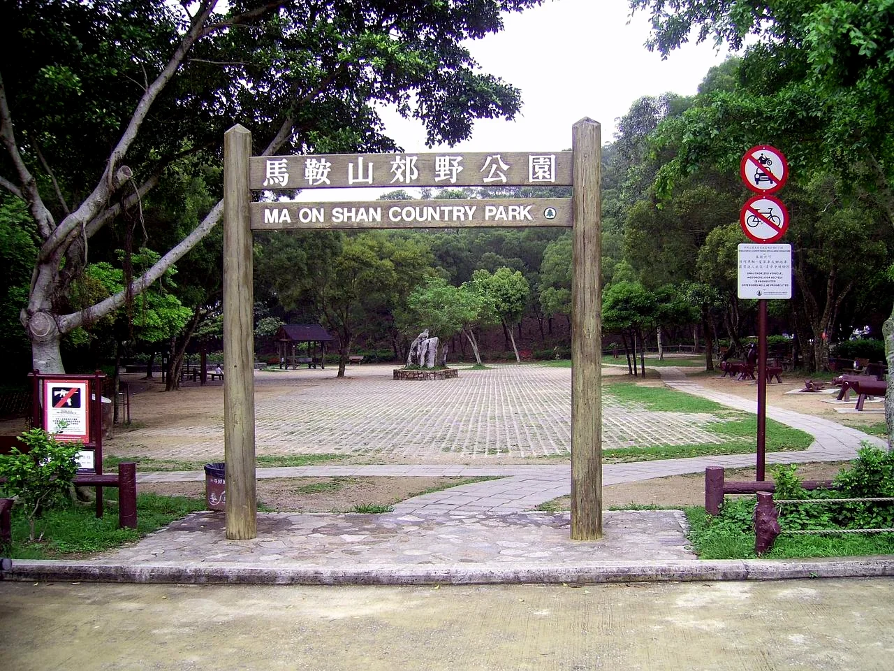

Ma On Shan Country Park
Hong Kong keeps surprising people who think they know what it is. Forty minutes from Kowloon, inside a park established in 1979, pangolins move through the undergrowth at night. Wild boar root along the lower slopes. Barking deer — shy, small, named for the sound they make when alarmed — inhabit the wooded ravines. Ma On Shan Country Park covers 28.8 square kilometres of volcanic terrain at the centre of the Sai Kung Peninsula, linking Sai Kung Country Park to the east and Lion Rock Country Park to the west into an unbroken sweep of upland that holds, somewhere in its rough geography, the traces of an iron mine that ran until 1981.
The Saddle That Names the Mountain
Ma On Shan translates literally as "horse saddle mountain" — a reference to the distinctive shape of the massif's twin peaks when viewed from certain angles, a dip between two summits that suggests the curve of a riding saddle. The park is named for this mountain and holds it, along with an impressive roll-call of other peaks: Buffalo Hill and West Buffalo Hill, Kowloon Peak, Pyramid Hill, Tate's Cairn, and Tiu Shau Ngam, among others. The Ngong Ping plateau — a high, relatively level area within the park — offers some of the most expansive views in Hong Kong, the harbour and the New Towns laid out below while the South China Sea glints at the edge of sight. Most of the park is inland, but distant water is rarely out of view from the higher ground.
Iron Under the Mountain
The Ma On Shan Iron Mine had a working life that stretched across the twentieth century, extracting iron ore from the volcanic rock of the massif. Mining operations ceased in 1976 as worldwide demand for steel fell and the contract to supply Japan was terminated; the mining lease formally expired in 1981 and was not renewed. What remains now are scars on the landscape — the characteristic patterns of extraction on hillsides that never fully recovered, though the decades since closure have allowed some vegetation to creep back. The slopes of Ma On Shan itself are described as "ruined" in places, and yet these ruined slopes grow wild rhododendrons. They harbour orchids. Unusual ferns have established themselves in the disturbed ground. The mountain that was mined is not the mountain that recovered — but the recovery is real, and it produces a kind of rough botanical richness that more sheltered hillsides in the region do not.
Bare Peaks and Hidden Pockets
The vegetation story at Ma On Shan Country Park is one of paradox. The park's hills are, taken overall, more bare than comparable parks elsewhere in Hong Kong. The main reason is historical: the inaccessibility of the terrain made tree-planting for fuel supply uneconomic, so the volcanic slopes were never systematically afforested. What grows there grows on its own terms, in conditions that suit only the hardiest species. And yet those conditions — volcanic soil, thin cover, high winds, occasional cloud — have preserved unusual plant communities that would have been replaced by plantation species in more tractable terrain. Pockets of native vegetation survive because they were too awkward to cultivate.
Three Trails Through the Massif
Hikers move through Ma On Shan Country Park on three major routes, each crossing different terrain. The Ma On Shan Country Trail runs from Ma On Shan Village to Tai Shui Tseng via the Ngong Ping plateau — a high traverse through the park's open upper ground. The Wilson Trail's Stage 4 crosses from Tseng Lan Shue to Sha Tin Pass via Tai Lo Au, cutting through the park's western section. The MacLehose Trail — Hong Kong's most famous long-distance route — crosses the park in Stages 4 and 5, moving from Kei Ling Ha to Tate's Cairn and then continuing to Tai Po Road via Sha Tin Pass. On any clear weekend, hikers from across the territory converge on these paths, drawn by the combination of genuine elevation, open views, and the knowledge that the city is close enough to retreat to by nightfall.
Seeing the Massif from Above
Ma On Shan Country Park occupies 22.412°N, 114.248°E at its approximate centre, on the Sai Kung Peninsula in the eastern New Territories. From the air at 3,000 to 4,000 feet, the massif is one of the most dramatic landforms in Hong Kong — the twin summits of Ma On Shan visible as a recognizable saddle shape, the bare volcanic slopes falling steeply toward the new towns of Ma On Shan and Sha Tin to the west, and the green interior of the Sai Kung Peninsula extending east. Tolo Harbour cuts in from the north. Clear water appears on multiple sides from the high vantage points. Hong Kong International Airport (VHHH) is approximately 45 kilometres to the southwest. The abandoned mine workings on Ma On Shan itself are visible as lighter-coloured exposed rock on the upper slopes — the mountain's industrial century still written on its face.
From the Air
Ma On Shan Country Park is centred at 22.412°N, 114.248°E in the eastern New Territories. Best viewed at 3,000–4,000 ft to appreciate the full massif. The saddle-shaped twin peaks of Ma On Shan itself are a distinctive visual marker from altitude. Hong Kong International Airport (VHHH) is approximately 45 km to the southwest. Tolo Harbour is visible to the north; the new town of Ma On Shan lies immediately to the west of the park boundary.
Nearby Stories
- Chapel of St. Francis Xavier 3.5 km away
- Cuiheng 4.1 km away
- 2015 Shenzhen Landslide 16 km away
- Shunde 31 km away
- Wanshan Archipelago 37 km away
- Nanxiong Formation 96 km away
- Heyuan 149 km away
- Checheng Fu'an Temple 629 km away