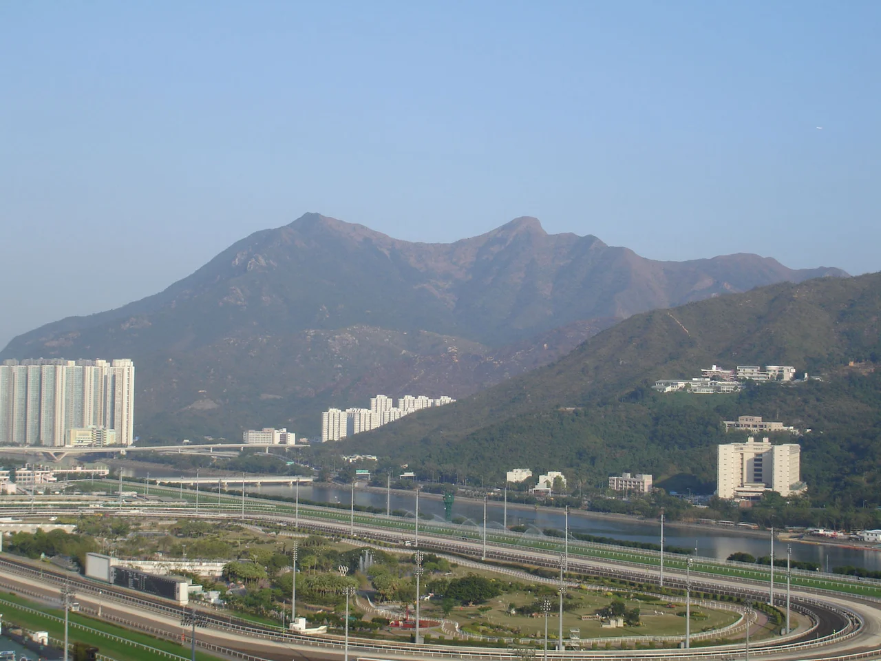

Ma On Shan Peak
The name means "horse saddle mountain," and once you see the western face from across Tolo Harbour, you understand why it could not have been called anything else. Two peaks rise on either side of a pronounced dip, creating a silhouette as recognizable as a signature. At 702 metres, Ma On Shan stands among the ten highest mountains in Hong Kong — not the tallest, but among the most distinctively shaped, the kind of mountain that forces a name upon itself.
Two Hundred Million Years in the Making
The saddle did not appear quickly. Around 160 million years ago, volcanic eruptions buried an existing layer of sedimentary rock under accumulations of tuff. Over the following tens of millions of years, those layered rocks were compressed and folded into ridges. Then, around 100 million years ago, rhyolite — a fine-grained volcanic rock — intruded into the folds. Faulting reshaped the ridges again about 60 million years ago, drawing the terrain toward its current double-peaked form. Since then, weathering has smoothed the rough edges, rounding the contours that looked jagged in their youth. The southeastern flank still shows exposed rhyolite. The base layers are sedimentary, between 60 and 120 million years old. The mountain is a compressed geological archive of the Cretaceous and Jurassic periods, legible to those who know how to read rock.
Nine Streams and a Harbour
Water flows down from Ma On Shan in nine separate streams. The largest descends from the southwest slope, near Ma On Shan Village — the settlement that once supported the iron mine workers and their families. To the west, Tolo Harbour opens wide, its calm waters edged by low hills and the beginnings of the New Territories interior. The mountain sits at the boundary of Sha Tin and Tai Po districts, a natural dividing line that the administrative map follows the landscape. East of the peak lies a cluster of villages known collectively as Shap Sze Heung, sheltering in the quieter lee of the mountain. Beyond them, Three Fathoms Cove cuts into the coastline, keeping its own counsel.
From Farming to Mining to Silence
In the 1850s, a Hakka family named Wan established the village that would bear the mountain's name. For generations, the Hakka farmers worked the lower slopes, growing what the terrain allowed. The rhythm of agricultural life on a Hong Kong hillside was unhurried and close to the ground. That changed decisively in the 1950s. As the iron mine below deepened and expanded, the mountain transformed from a farming landscape into an industrial one. Villagers left their fields for mining wages. The tunnels extended under the hill in an extensive network, shaking the rock above with the persistent tremors of underground excavation. By the time the mine closed in 1976, agriculture had long been abandoned, and the village itself was emptying out.
What Remains Underground
Even after seventy years of extraction, the mountain was not empty. As of 2006, geologists estimated that approximately 30,000 tonnes of iron ore remained locked inside Ma On Shan — ore that became uneconomical to reach when Japan stopped buying in large quantities during the 1970s. The tunnels still run beneath the slopes, silent now for decades. The mountain above them is designated a Special Scientific Interest site, its geological layering protected from disturbance. Hikers who climb the peak today walk over ground that is simultaneously a country park, a geological record stretching back to the Jurassic, and an underground archive of abandoned industry. The saddle shape catches the light differently morning and evening, the two peaks casting alternating shadows across Tolo Harbour.
From the Air
Ma On Shan peak is located at 22.4089°N, 114.2520°E, rising to 702 metres (2,303 feet) above sea level on the eastern shore of Tolo Harbour in the New Territories of Hong Kong. The distinctive saddle silhouette — two peaks with a pronounced dip between them — makes it immediately identifiable from the air. Recommended viewing altitude for a clear perspective of the saddle shape is 4,000 to 6,000 feet, approaching from the west over Tolo Harbour. Hong Kong International Airport (VHHH) is approximately 35 nautical miles to the southwest. The mountain forms part of Ma On Shan Country Park; terrain rises sharply from the harbour shore. Exercise appropriate terrain clearance when navigating the eastern New Territories.
Nearby Stories
- Chapel of St. Francis Xavier 3.5 km away
- Cuiheng 4.1 km away
- 2015 Shenzhen Landslide 16 km away
- Shunde 31 km away
- Wanshan Archipelago 37 km away
- Nanxiong Formation 96 km away
- Heyuan 149 km away
- Checheng Fu'an Temple 629 km away