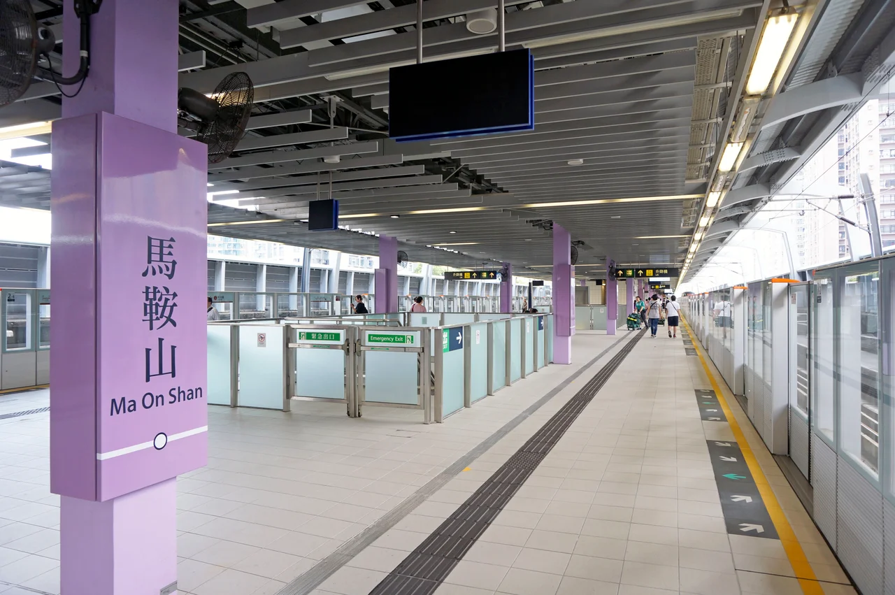

Ma On Shan New Town
Historically, the people of Ma On Shan described their home through three treasures. First, iron ore — the reason the industrial community existed at all. Second, a species of azalea that blooms on the slopes in April with flowers shading from white to light red, found in Hong Kong on almost no other site. Third, the Indian muntjac, a small barking deer so shy that some specimens, according to local records, died of fright when captured. Three treasures for a place that managed to hold the industrial and the delicate in the same hillside.
Built on a Strip
The town occupies a narrow corridor between water and mountain. To the west, Tolo Harbour opens across to the older urban fabric of Sha Tin. To the east, the twin peaks of Ma On Shan rise to 702 metres, their saddle-shaped silhouette giving the town its name and its most recognizable landmark. The town is technically part of Sha Tin District and began as an extension of Sha Tin New Town, but it has grown distinct enough to be classified separately in government reports. It stretches from Wu Kai Sha in the north to Tai Shui Hang in the south, the MTR Tuen Ma Line threading through its core. The original Ma On Shan Village, where miners and their families once lived in their thousands, still stands in the hills above — around 80 families remain.
From Mine to New Town
The iron mine that had sustained the hillside community since 1906 closed in 1976. Three years later, the New Town development program began moving in the other direction — not emptying the landscape, but filling it. Public housing construction started in the mid-1980s. Heng On Estate, the first major public estate, was completed in 1987. Chevalier Garden, a private development, followed in 1988. The deposit of iron ore in the hillside was estimated at over 7 million tonnes in total; the iron extracted between the 1950s and 1970s went almost entirely to Japan for steel production. The new town that replaced the mining economy runs on a different kind of infrastructure: rail connections, shopping centres, schools, and a population of over 200,000 as of the 2016 census, 94% of them of Chinese ethnicity.
The Azalea That Almost Didn't Have a Name
The azalea species Rhododendron hongkongense was first collected in Hong Kong between 1847 and 1851, when it was recognized as a new species. For nearly eight decades, however, it was classified under a different name. Only in 1930 did botanists formally give it the name it carries today — hongkongense — acknowledging its distinct Hong Kong identity. The species grows on Ma On Shan and a small number of nearby sites — its range is extraordinarily restricted. In April, it blooms in shades between white and light red against the green hillside. Since 2006, an annual Ma On Shan Azalea Festival has marked the flowering season, celebrating not just Rhododendron hongkongense but five other locally native azalea species. The festival has become part of the town's identity, a way of holding onto the natural landscape that surrounds the high-density housing on all sides.
Modern Connections
The MTR Tuen Ma Line, which serves Ma On Shan's stations at Tai Shui Hang, Heng On, Ma On Shan, and the terminus at Wu Kai Sha, opened as the Ma On Shan line in December 2004 and merged with the wider network in 2021. It gives residents direct rail access to Hung Hom, where connections fan out across the MTR system toward the city, the border crossings, and Lantau Island. The town centre holds two connected shopping centres — Ma On Shan Plaza and MOSTown — and the Ma On Shan Sports Ground, swimming pool, and public library provide civic infrastructure for a population that is effectively urban but lives within sight of country park. The Yan Kwong Lutheran Church, revitalized in 2015 as a heritage centre (work began in 2014), keeps the mining era visible in a neighbourhood built almost entirely after the mine closed.
From the Air
Ma On Shan new town is centered at approximately 22.4219°N, 114.2325°E, along the eastern shore of Tolo Harbour in the New Territories of Hong Kong. The town occupies the coastal strip between the harbour and the saddle-shaped Ma On Shan peak, which rises to 702 metres and is the dominant terrain feature to the southeast. From 3,000 to 5,000 feet, the town's high-density residential towers are clearly visible against the mountain backdrop. Hong Kong International Airport (VHHH) lies approximately 35 nautical miles to the southwest. The Tuen Ma Line MTR stations are identifiable by their elevated track sections through the town. Tolo Harbour to the west provides a clear coastal navigation reference.
Nearby Stories
- Chapel of St. Francis Xavier 3.5 km away
- Cuiheng 4.1 km away
- 2015 Shenzhen Landslide 16 km away
- Shunde 31 km away
- Wanshan Archipelago 37 km away
- Nanxiong Formation 96 km away
- Heyuan 149 km away
- Checheng Fu'an Temple 629 km away