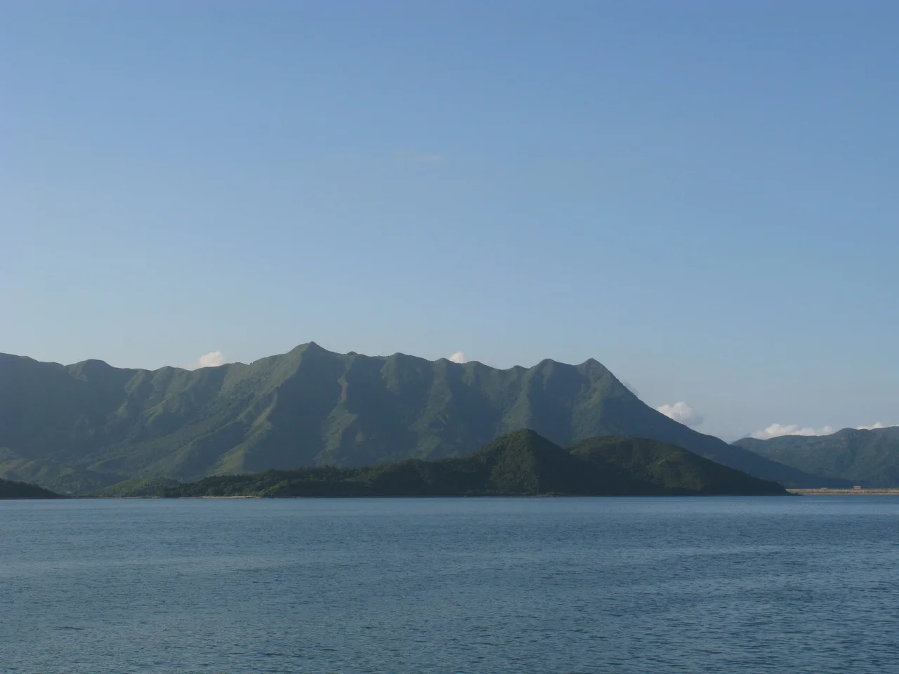

Ma Shi Chau
The island's name translates, without ceremony, as Horse Dung Island. Whatever the original reason for this unflattering choice — the shape of the rock formations, or some long-forgotten incident involving livestock and a ferry — the name has stuck for centuries while the island itself has quietly accumulated one of the more remarkable geological records in the whole of Hong Kong. Ma Shi Chau holds sedimentary rock from the Permian period, formed over 250 million years ago, predating the dinosaurs and most of the world's current mountain ranges.
The Tombolo
At low tide, Ma Shi Chau connects to its neighbor Yim Tin Tsai by a tombolo — a sand or sediment bar linking two landmasses that the sea covers when the water rises. It is traversable on foot when the tide is out, offering the particular pleasure of walking between two separate islands without a boat. Tombolos are uncommon enough in Hong Kong that this one is among the features cited in Ma Shi Chau's designation as a Special Area. The tidal rhythm determines access: visitors who misjudge the schedule find themselves either cut off on the island or wet. The crossing demands a kind of attention to natural timing that modern urban life rarely requires.
Rock Older Than Most Things
The sedimentary rock exposed on Ma Shi Chau dates to the Permian period — the era before the Triassic, which preceded the age of dinosaurs. These layers were deposited when the supercontinent Pangaea was beginning to break apart and when the most severe mass extinction in Earth's history was playing out across the planet's oceans. That extinction event, at the end of the Permian, eliminated an estimated 90% of marine species. The rock on Ma Shi Chau predates that event's aftermath. It is protected under Hong Kong law by the Special Area designation, which prohibits disturbance to the geological features. The island is part of the Hong Kong UNESCO Global Geopark, a recognition that extends across several of the territory's most significant geological sites.
The Special Area and Its Islands
Ma Shi Chau is the largest of four islands within the Ma Shi Chau Special Area. The others are Yeung Chau, Centre Island, and a small unnamed island near Yim Tin Tsai. Together they form a cluster in the northeastern part of Tolo Harbour, administered by Tai Po District and situated near the fishing village of Sam Mun Tsai on the mainland shore. The Special Area designation was formalized in 1999, giving legal protection to the tombolo, tidal features, and ancient rock. Before that legal identity, the island had carried older names: No Kot Chai and No Kot Choi both appear in historical records, suggesting layers of naming that predate the map-making that eventually standardized the current version.
0.61 Square Kilometres
Ma Shi Chau covers 0.61 square kilometres. In a territory where land is relentlessly contested and reclaimed from the sea, an island of this size that remains uninhabited and legally protected is not nothing. The Geopark offers guided half-day tours to the island, approaching it by boat and walking the geological trail that interprets the rock formations. The sedimentary layers visible at the surface include alternating bands of different composition, each band representing a different depositional environment from hundreds of millions of years ago. On a clear day, the Pat Sin Leng mountain range is visible to the rear, rising above the northern New Territories. The island that couldn't shake an unflattering name turns out to be among the oldest things you can stand on in Hong Kong.
From the Air
Ma Shi Chau is located at 22.4539°N, 114.2293°E, in the northeastern section of Tolo Harbour in the New Territories, administered by Tai Po District. From the air at 2,000 to 4,000 feet, it is visible as a distinct small landmass in the harbour, with the Pat Sin Leng mountain range rising to the north-northeast. At low tide, the tombolo connecting Ma Shi Chau to Yim Tin Tsai is visible as a narrow bar of exposed ground. The Sam Mun Tsai fishing village lies on the mainland to the north. Hong Kong International Airport (VHHH) is approximately 38 nautical miles to the southwest. The island is uninhabited; there is no airstrip or developed infrastructure.
Nearby Stories
- Chapel of St. Francis Xavier 3.5 km away
- Cuiheng 4.1 km away
- 2015 Shenzhen Landslide 16 km away
- Shunde 31 km away
- Wanshan Archipelago 37 km away
- Nanxiong Formation 96 km away
- Heyuan 149 km away
- Checheng Fu'an Temple 629 km away