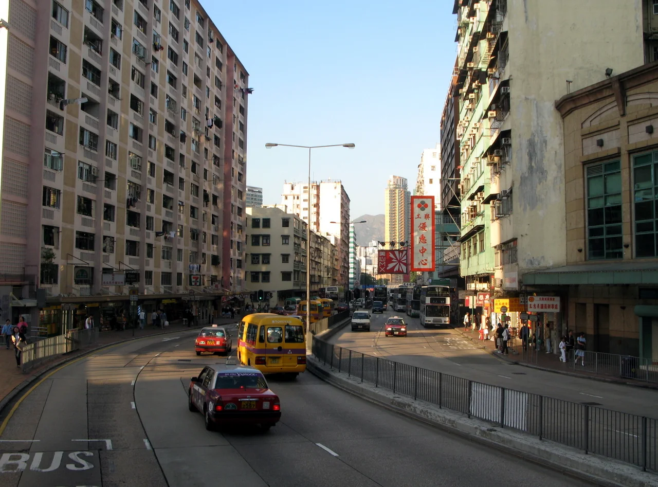

Ma Tau Chung
The creek is gone. It was buried underground decades ago, converted into drainage, its surface erased by the relentless expansion of Kowloon. But the name Ma Tau Chung — meaning roughly 'the creek of the horse's head' — persisted long after the water vanished, attached to an area that refused to be forgotten. Streets still bear the name. Maps still mark it. And beneath the ordinary texture of this urban district, layer upon layer of history waits to be uncovered.
A Creek That Named a Neighborhood
Ma Tau Chung was once a real watercourse, originating in Quarry Hill and flowing down to empty into Kowloon Bay. A village stood on its banks near the river mouth, close to what locals called the Sacred Hill. The creek gave its name to the settlement, as creeks so often did in this part of China — the character 涌 (chung) means precisely that: a tidal creek. When the creek was buried and the village absorbed into the expanding city, the name drifted. It attached itself to a road, then to a neighborhood, then to a constellation of overlapping districts — Ma Tau Wai, Ma Tau Kok, Kowloon City — each one claiming parts of the territory the original name once covered. Today, Ma Tau Chung as an official address barely exists. Official records place Chun Seen Mei Chuen in Kowloon City, not Ma Tau Chung. The aviation club on Sung Wong Toi Road carries a Kowloon City address. But older newspapers still reach for the older name, as if reluctant to let it go.
The Emperor Who Sheltered Here
Long before the creek was buried, Ma Tau Chung had already witnessed something extraordinary. According to the Gazette of Xin An County, Emperor Bing of the Southern Song dynasty — the child emperor of a dynasty in its final collapse — sheltered in Ma Tau Chung and the surrounding Sung Wong Toi area for a few months during the dynasty's desperate southward flight. This was around 1278 to 1279, as the Mongol forces of Kublai Khan closed in. The emperor was a child; the court was in flight; the dynasty was dying. The nearby rock known as Sung Wong Toi, or 'Terrace of the Sung Kings,' became a commemorative landmark, its significance so enduring that a garden and an MTR station today carry that name. That a fleeing dynasty paused here, in what is now a dense urban district of Kowloon, layers something ancient and poignant onto streets full of traffic and commerce.
The Camp on Argyle Street
The darkest chapter in Ma Tau Chung's history unfolded during the Japanese occupation of Hong Kong between 1941 and 1945. When British colonial forces surrendered, most Indian soldiers captured in Hong Kong were interned at the Ma Tau Chung Camp. The Japanese saw these men not merely as prisoners of war but as potential recruits — they pressured the Indian soldiers to join the Indian National Army of the Indian Independence League, which sought to drive the British from India by aligning with Japan. The men largely refused. Those considered anti-Japanese — some 500 to 600 soldiers — were held at Ma Tau Chung in conditions described as very unpleasant. Many died. Their graves were dug just outside the camp perimeter, near the vegetable gardens of the adjacent Argyle Street Camp, separated from their comrades by the width of a street. These were soldiers from the British Indian Army: men who had enlisted, served, and found themselves captive in a city under occupation, facing pressure to betray everything they had sworn to defend. Most did not.
Cottage Area to Housing Estate
After the war, Ma Tau Chung evolved again. The Ma Tau Chung Cottage Area, which had existed since 1938 to house refugees from mainland China, was taken over by the Hong Kong Housing Society in 1953, which later expanded the site by building further cottages in 1955. In 1962 those cottages were demolished, and Chun Seen Mei Chuen — the housing estate that stands in their place today — was completed in 1965. It was one of countless such cycles across postwar Hong Kong: informal settlements giving way to planned estates, old place names outlasting the buildings they described. The same pattern played out across Kowloon City, as the territory absorbed wave after wave of refugees and migrants and housed them in structures built faster than maps could be updated.
A Name Without a Body
What makes Ma Tau Chung unusual is precisely its persistence as a name without a clear referent. Most place names anchor to something visible — a hill, a building, a waterway. Ma Tau Chung lost its creek, lost its village, lost its cottage area, and still survived in common usage, in newspaper copy, in local memory. The MTR Sung Wong Toi station now serves the area, connecting it to the Tuen Ma Line. Ma Tau Chung Road carries the name in neon and concrete across one of Kowloon's busiest corridors. But the neighborhood itself remains a palimpsest — a place where a Song dynasty emperor, imprisoned Indian soldiers, postwar squatters, and Housing Society tenants all occupy the same few streets, separated only by time.
From the Air
Ma Tau Chung sits at approximately 22.325°N, 114.189°E in the heart of Kowloon, roughly 5 km north of Hong Kong Island. From the air, look for the distinctive grid of Kowloon City's streets and the long diagonal of Ma Tau Chung Road cutting through the urban fabric. The nearby former Kai Tak Airport runway scar is visible extending into Kowloon Bay to the east. Sung Wong Toi Garden marks the center of the district. Nearest airport: VHHH (Hong Kong International Airport) on Lantau Island, approximately 25 km to the west. For low-altitude visual navigation, the Tsing Ma Bridge is visible to the west, and the urban density of Kowloon provides clear contrast to the harbor to the south.
Nearby Stories
- Chapel of St. Francis Xavier 3.5 km away
- Cuiheng 4.1 km away
- 2015 Shenzhen Landslide 16 km away
- Shunde 31 km away
- Wanshan Archipelago 37 km away
- Nanxiong Formation 96 km away
- Heyuan 149 km away
- Checheng Fu'an Temple 629 km away