.jpg)
Ma Wan
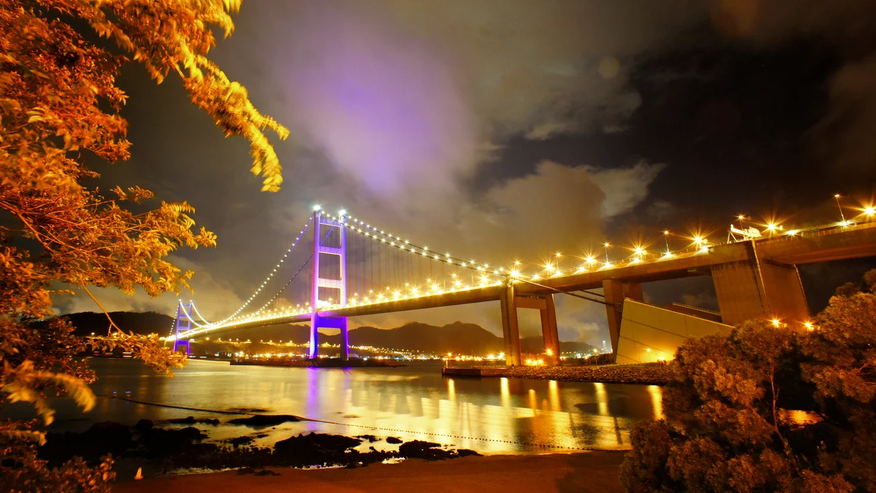
Two of the world's great bridges bracket Ma Wan without touching it. The Tsing Ma Bridge curves overhead to the east; the Kap Shui Mun Bridge spans to the west. Traffic roars across both at highway speeds, connecting Lantau Island to the rest of Hong Kong through a system that the government once declared it would be 'physically impossible' to route through Ma Wan at all. And yet the island endures — a 0.97-square-kilometer wedge of granite and history lodged between two channels, inhabited since the Neolithic, now half transformed into a luxury apartment village and half abandoned to memory.
Deep Roots in Stone
The island's geology is its oldest story. Ma Wan's granite is fine-grained and ancient, rich with quartz, orthoclase, and biotite, sliced through by younger dykes of rhyolite and basalt injected at different geological moments across the Cenozoic era. A northeast-trending fault crosses the island from its typhoon shelter to Tun Wan. The channel separating Ma Wan from Lantau Island follows a deeper structure called the Kap Shui Mun Fault, part of the vast Linhua Shan Fault System that extends hundreds of kilometers along the South China coast. These are not minor geological footnotes — they shaped the island's contours and the channels that made it significant to mariners for millennia. Archaeologists confirmed human presence stretching back to the late Neolithic: in 1997, a joint team from Hong Kong's Antiquities and Monuments Office and the Chinese Academy of Social Sciences excavated 20 tombs at the Tung Wan Tsai North site, finding complete skeletal remains spanning from the late Neolithic to the early Bronze Age. People had been choosing this island for thousands of years before anyone thought to build a bridge across it.
Fishing Villages, Pirates, and Shrimp Paste
For most of its recorded history, Ma Wan was a fishing community. The stilt houses of Ma Wan Main Street Village — the pang uk style, raised over the water — defined the island's character for generations. The local Tin Hau temples, dedicated to the goddess of the sea, anchored the spiritual life of fishing families. One of these temples is said to have been originally built by Cheung Po Tsai, the notorious local pirate who raided the Pearl River Delta in the early nineteenth century and who, according to tradition, looked after the communities he frequented. Whether the story is entirely accurate or partly legendary, the temple endures. So does the island's shrimp paste tradition: the local production of 'habe,' a pungent fermented shrimp paste, was once sundried on the shores next to Kap Shui Mun, one of those everyday crafts that coastal communities perfected over centuries. The Fong Yuen Study Hall, originally built by the Chan clan of Tin Liu before 1900 and renovated with Western influence in the 1920s and 1930s, added education to the mix — a village that fished, prayed, fermented shrimp, and schooled its children.
The Rose Garden and Its Consequences
The 1990s changed Ma Wan fundamentally. The Hong Kong government's Port and Airport Development Strategy — colloquially called the Rose Garden plan — required a new international airport on Lantau Island and a high-speed land link from that airport to the urban core. The Lantau Link, completed in the mid-1990s, threaded through Ma Wan: the Tsing Ma Bridge brought road and rail traffic overhead from Tsing Yi Island, and the Kap Shui Mun Bridge connected the island onward to Lantau. Having built two massive bridges past the island, developers saw an opportunity. Park Island, a private housing estate developed mainly by Sun Hung Kai Properties, was completed between 2002 and 2006 in six phases, eventually occupying a large portion of the island with 31 residential blocks totalling around 5,290 apartments. Villagers were rehoused in the island's northern sector, compensated with either traditional village houses or separate apartment units. The old fishing village and the new residential estate now coexist in uneasy adjacency.
Noah's Ark in the South China Sea
Ma Wan Park, the theme park built to accompany the Park Island development, opened its first phase on 1 July 2007. The park's centrepiece — a full-scale replica of Noah's Ark — followed, with the Ark itself opening to visitors in 2009 after construction completed in late 2008. The structure sits incongruously yet somehow perfectly on this small island between enormous bridges. The park's Heritage Centre approaches the island's layered history more soberly: it exhibits artifacts from the Neolithic tombs, a Tang dynasty mud kiln and a Qing dynasty brick kiln excavated on Ma Wan, and replicas of the late Neolithic skeletons found in the 1997 excavation. In a single visit, a visitor can move from Bronze Age burials to a biblical ship replica to apartment towers with harbor views. The juxtapositions are almost too much — except that Ma Wan has always been this kind of place, accumulating eras without resolving them.
Car-Free and Quiet
Despite its transformation, Ma Wan retains one quality that sets it apart from every other residential development in metropolitan Hong Kong: private vehicles are generally not permitted. The arrangement mirrors Discovery Bay on Lantau Island — residents get around by ferry, bus, or on foot. Urban taxis were only permitted access from June 2008, initially restricted to overnight hours (11 pm to 7 am), with a surcharge to cover the Lantau Link toll. The old Ma Wan Main Street Village and the Fishermen's Village have been vacated, the latter originally built in 1965 through the United States CARE program to house 24 fishing families. They stand now as a kind of ghost town beside the inhabited towers, a photogenic ruin of a way of life that the bridges rendered obsolete before the foundations had fully dried. The small red crabs still pick their way across the rocks. The Tung Wan Beach is still managed and open for swimming. The water, at least, has not changed.
From the Air
Ma Wan sits at 22.349°N, 114.060°E, clearly visible from the air as a small, distinct island between two long bridge spans. The Tsing Ma Bridge sweeps in from the northeast (Tsing Yi Island) and the Kap Shui Mun Bridge connects to the southwest (Lantau Island) — together they form the Lantau Link, one of Hong Kong's most recognizable aerial landmarks. Approaching from the east, the Park Island residential towers are the dominant visual. Recommended viewing altitude: 1,500 to 3,000 feet for the full bridge-and-island context. Nearest airport: VHHH (Hong Kong International Airport) on northern Lantau, approximately 8 km to the southwest. The airport itself is visible from this altitude, on the reclaimed land of Chek Lap Kok.
Nearby Stories
- Chapel of St. Francis Xavier 3.5 km away
- Cuiheng 4.1 km away
- 2015 Shenzhen Landslide 16 km away
- Shunde 31 km away
- Wanshan Archipelago 37 km away
- Nanxiong Formation 96 km away
- Heyuan 149 km away
- Checheng Fu'an Temple 629 km away