Makian
In July 1988, the entire population of Makian Island received an order that their ancestors had heard before: leave everything and go. The volcano was waking up. Roughly fifteen thousand people evacuated from a nearly circular island just ten kilometers wide, abandoning homes built on the fertile lower slopes of Mount Kie Besi, a stratovolcano that rises 1,357 meters from the sea. They were not the first to flee, and the island's history suggests they will not be the last.
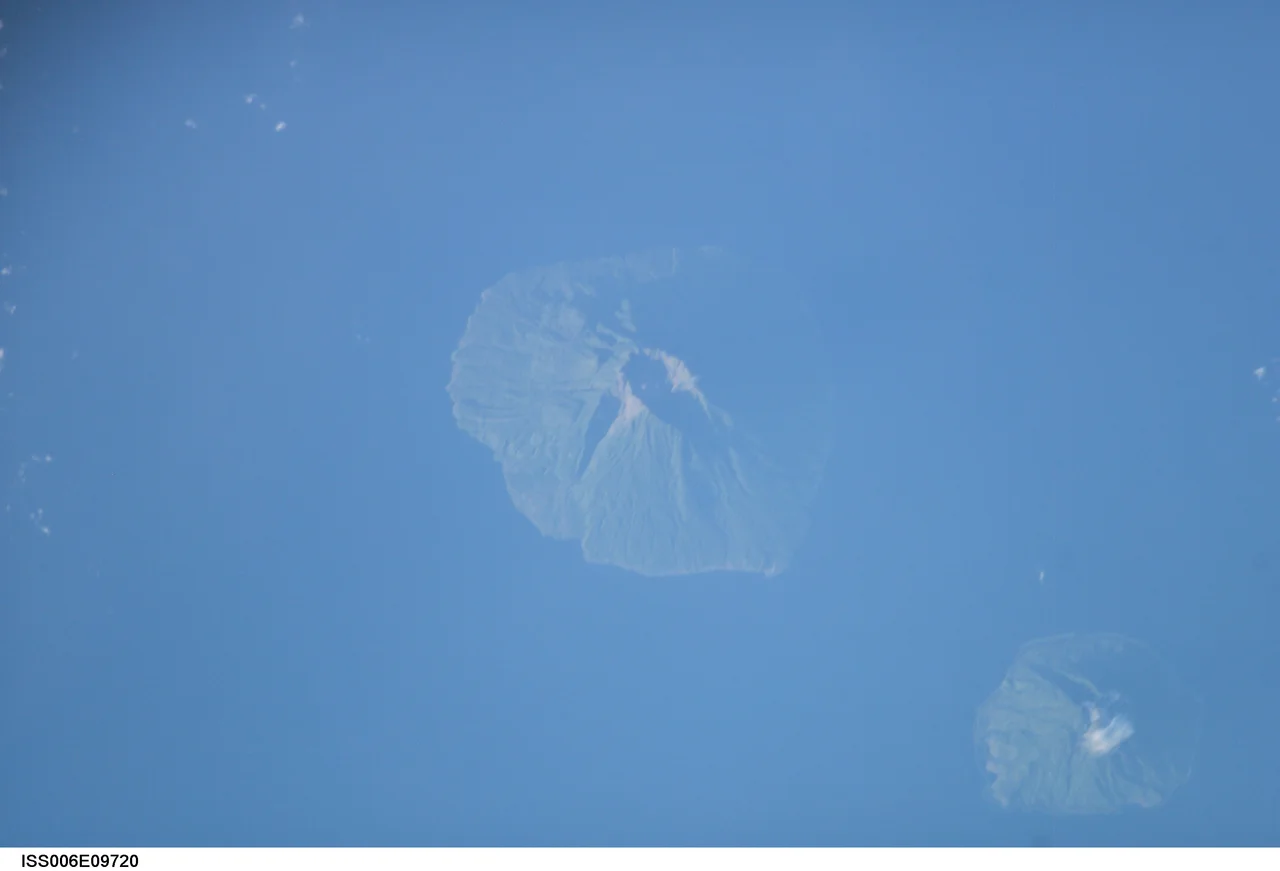
A Crater and a Lake
Seen from above, Makian is strikingly geometric: an almost perfect circle of green rising from the Halmahera Sea. The summit is crowned by a 1.5-kilometer-wide crater with a small lake tucked into its northeastern corner. Four parasitic cones bulge from the western slopes, evidence of magma finding secondary escape routes when the main vent proved insufficient. The island sits in a chain of volcanic peaks off the western coast of Halmahera, bracketed by Moti and Tidore to the north and the Kayoa archipelago and Bacan group to the south. Despite covering just 91 square kilometers, Makian supports a population of around 14,000 people spread across 22 villages in two districts.
The Violence Beneath
Makian's eruptions are infrequent but catastrophic. The first recorded eruption dates to the 1550s. Three subsequent eruptions, on July 19, 1646, September 22, 1760, and December 28, 1861, each rated 4 on the Volcanic Explosivity Index, a classification indicating cataclysmic events capable of ejecting more than a cubic kilometer of material. The 1760 eruption killed approximately three thousand inhabitants, a devastating toll for a small island community. After an eruption in 1890, the volcano fell quiet for nearly a century before the 1988 event forced the full evacuation. Each time, the island's people have returned to rebuild on the same slopes, drawn back by the rich volcanic soil that makes Makian's farmland some of the most productive in the region.
Two Tongues, One Island
Makian's linguistic geography mirrors a fault line far older than its volcanic ones. The island is split between two entirely unrelated languages. On the eastern half, people speak Taba, an Austronesian language whose relatives span from Madagascar to Easter Island. On the western half, they speak West Makian, a language belonging to the West Papuan family, with roots in the ancient populations of New Guinea. Both languages belong to the Makian people, but their speakers identify with distinct subgroups: the Tabayana in the east and the Jitine in the west. This linguistic divide on such a small island is a living reminder that the Maluku archipelago sits at one of the great crossroads of human migration, where Austronesian seafarers moving west met Papuan populations expanding east thousands of years ago.
Living on Borrowed Time
Why do people stay on an island that has tried to kill them repeatedly? The answer is rooted in the same geology that makes Makian dangerous. Volcanic soil is extraordinarily fertile, and the island's warm equatorial climate and heavy monsoon rainfall turn those slopes into productive agricultural land. Cloves once grew here as they did across the neighboring Spice Islands, making these waters some of the most contested on Earth during the age of European colonization. Today the economy is more modest, but the fundamental bargain remains unchanged: the volcano gives and the volcano takes. Makian's roughly twelve thousand residents live within the shadow of a peak that has produced four VEI-4 eruptions in recorded history, knowing that the next could come in their lifetimes. It is one of the more striking examples in the Indonesian archipelago of humanity's willingness to gamble against geological time.
From the Air
Makian is located at approximately 0.33N, 127.37E in the Halmahera Sea. From the air, the island is unmistakable: a near-perfect circle with a conical peak rising to 1,357 meters, often capped with cloud. The summit crater and its small lake are visible on clear days from higher altitudes. The nearest airport is Sultan Babullah Airport (WAMN) on Ternate, approximately 60 km to the north. Best viewed at 8,000-15,000 feet to see the full volcanic cone shape. Look for the parasitic cones on the western slopes and the chain of volcanic islands stretching north toward Tidore.
Nearby Stories
- Fort Tahula 13 km away
- The Islands That Made Wallace Faint 69 km away
- Aketajawe-Lolobata National Park 77 km away
- The Ocean's Hidden Crossroads 103 km away
- North Halmahera Regency 163 km away
- The Sea That Swallows Itself 173 km away
- Bitung 217 km away
- Tangkoko Batuangus Nature Reserve 237 km away