The River of Four Names
In the early 1600s, the Banjar Kingdom moved its capital to Martapura, upstream along a river that already bore the city's name. A few decades later, Chinese merchants had so thoroughly colonized the downstream banks that locals began calling the same waterway the China River. The Dutch East India Company acquired the delta in 1787, and the area it claimed became the heart of modern Banjarmasin. One river, four names -- Martapura, Kayutangi, Tatas, China River -- each reflecting whoever held power along its banks at the time. In South Kalimantan, geography does not just shape history. It gets renamed by it.
A Kingdom's Lifeline
The Martapura River flows 36 kilometers through southeastern Borneo, draining a watershed of nearly 454 square kilometers before joining the Barito River in the heart of Banjarmasin. Its name comes from the city of Martapura, which served as the capital of the Banjar Kingdom around 1630, in the area known as Kayu Tangi -- 'standing wood,' a reference to the dense timber along its banks, and the origin of the river's second name, Kayutangi. The river was the kingdom's commercial artery. Diamonds mined in the hills near Martapura traveled downstream to coastal traders. Pepper, forest resins, and rare woods moved the same way. With all of its tributaries included, the Martapura system extends 376 kilometers, a network of smaller channels feeding the main current like capillaries feeding a vein, connecting the forested interior to the trading ports at the coast.
Merchants, Empires, and a Delta Called Tatas
The downstream stretch of the Martapura attracted a cosmopolitan array of traders. Chinese merchants arrived in numbers large enough that the lower river became known as the China River -- a name that persisted on European maps well into the eighteenth century. Arab and Indian merchants followed, drawn by the diamond trade and the sultanate's pepper exports. Then came the Dutch. In 1787, the Dutch East India Company acquired the delta known as Tatas, a strategic triangle of land at the confluence of the Martapura and Barito rivers. That parcel of colonial real estate became the downtown core of modern Banjarmasin. The name Tatas survives as the river's third alias, a reminder that the ground beneath Banjarmasin's busiest streets was once a swampy river delta purchased from a sultanate that would not survive another century.
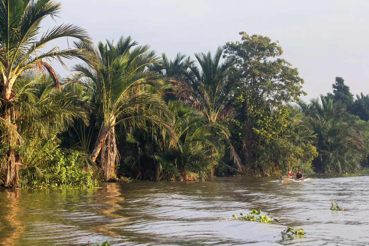
Where Life Stays on the Water
Colonial-era photographs from the Tropenmuseum show the Martapura as it looked in the late nineteenth and early twentieth centuries: drawbridges raised for passing paddle steamers, KPM shipping company vessels docked along stone quays, Madurese prahu boats moored against muddy banks. The river was Banjarmasin's main street, its harbor, and its market square simultaneously. That role has diminished but not disappeared. The floating market at Lok Baintan still operates on the Martapura's waters each morning, traders in jukung boats exchanging produce before most of the city wakes. Siring Park, Banjarmasin's central waterfront, faces the Martapura with gazebos, a watchtower, and the city's landmark bekantan statue. The river remains navigable, and speedboats still shuttle passengers across its width -- a practical necessity in a city where waterways often prove faster than roads.
Warm Water, Uncertain Future
The Martapura flows through a tropical rainforest climate zone where temperatures average 25 degrees Celsius year-round and annual rainfall reaches 2,767 millimeters. February is the wettest month, September the driest. The warm, sediment-rich water supports a dense ecology along its banks, but urbanization in Banjarmasin and upstream development have altered the river's hydrology. The shift from what Banjarese call 'river culture' to 'land culture' -- the transition from stilt houses and boat transport to paved roads and concrete foundations -- has changed the Martapura's relationship with its city. Fewer people live on the water. Fewer merchants trade from boats. The floating markets that once defined Banjarmasin's identity are shrinking. Yet the river endures as it has for centuries, carrying the memory of four names and the sediment of a kingdom, flowing past the city it created on its way to join the Barito and, eventually, the Java Sea.
From the Air
The Martapura River is visible as a winding tributary joining the much wider Barito River in the heart of Banjarmasin, southeastern Borneo. Coordinates: 3.30S, 114.62E. From altitude, look for the confluence point in central Banjarmasin where the Martapura meets the Barito -- the urban area clusters densely along both banks. Nearest airport: Syamsudin Noor International Airport (ICAO: WAOO, IATA: BDJ), approximately 25 km southeast. The city of Martapura, the river's namesake and source area, lies about 36 km upstream to the east. Best viewed at 3,000-6,000 feet to trace the river's path through the city.
Nearby Stories
- Sixty Seconds Over Banjarmasin 58 km away
- The Million-Hectare Mistake 73 km away
- The Great Dayak River 95 km away
- Borneo Orangutan Survival 136 km away
- Forty Hours in the Masalembo Sea 198 km away
- The Destroyer That Almost Changed History 200 km away
- The Ocean's Hidden River Between Two Worlds 239 km away
- Two Minutes of Distraction 316 km away