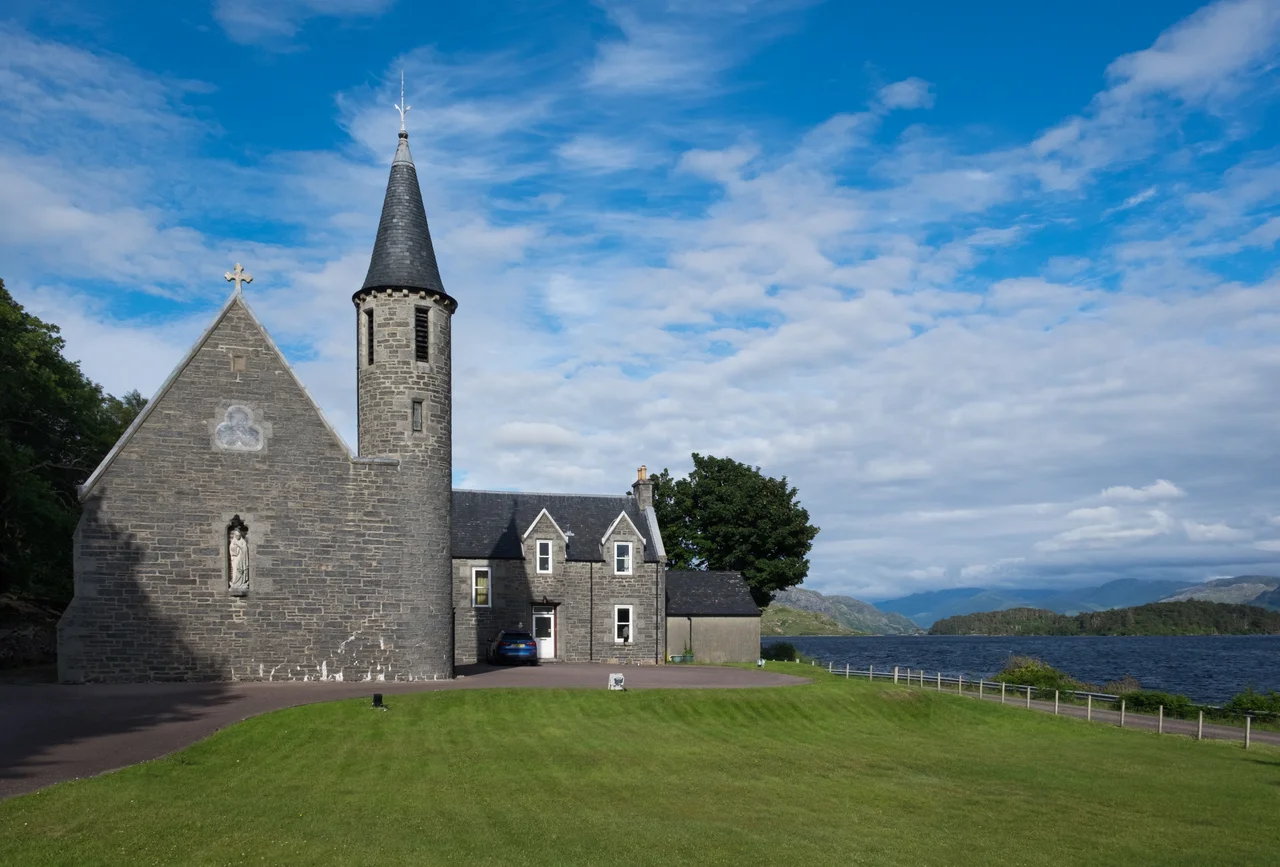

Morar
Loch Morar drops 1,020 feet beneath its surface, the deepest body of fresh water in the British Isles, and the village above it has only existed in regular usage since the early twentieth century. The 1911 census did not yet recognise Morar by that name - it listed instead the older crofts of Bourblach, Beoraid Beg, and Beoraid Mor. The village grew around the railway station, then the road, and finally around what the rest of the world came to know it for: the beaches. The White Sands of Morar stretch south of the village, blindingly bright against the Sound of Sleat, with Skye and Eigg rising in the distance.
A Kingdom Called Garmoran
Long before village or railway, Morar belonged to a vanished polity called Garmoran. After Viking raids absorbed the area into the Norwegian Kingdom of the Isles, the 1266 Treaty of Perth ceded it to the Scottish crown. The MacRory ruled here through marriage and inheritance until a tangled succession landed the lordship with Clan Ranald. By the late 14th century the brothers and cousins of Ranald MacDonald were fighting each other openly. The killing grew bad enough that in 1427, King James I summoned the highland magnates to Inverness, imprisoned them on arrival, and executed Alexander MacGorrie after what the records describe as a quick showtrial. The Lordship of Garmoran was declared forfeit. The Siol Gorrie - Alexander's family - never recovered, and play no further part in this story.
The Prince Passes Through
After Culloden in 1746, Royal Navy crews under Captains Fergussone and Duff portaged overland to Loch Morar, hunting Jacobite veterans who were thought to be meeting on the loch's island chapel. The Jacobite leaders slipped away in time, but the crew of HMS Furnace searched the caves and captured Lord Lovat. Father Alexander Cameron, a Roman Catholic priest who had served as a non-combatant chaplain, was taken near Morar and held aboard the Furnace. He died of torture and the hardships of imprisonment on 19 October 1746. Charles Edward Stuart himself - Bonnie Prince Charlie - passed briefly through Morar after arriving from Skye and Raasay, before crossing to Borrodale Bay near Arisaig and, eventually, to exile.
Cleared, Emigrated, Remembered
During the Highland Clearances that followed, the boats that left Morar carried families to Quebec, to Glengarry County in Ontario, and to the Strait of Canso in Nova Scotia. Sailings in 1790 and 1826 took whole communities across the Atlantic. Anna NicGillìosa, a Gaelic poet born in 1759, emigrated in 1786 and settled in South Glengarry; her poem in praise of her new home survives in Canadian Gaelic literature, and she lies buried beside St Raphael's Church there. She was one of many. Whole crofting families learned new geographies in places that smelled different and froze harder, and brought their language with them to keep what they could of where they had come from.
Spies, Symphonies, and Sand
During the Second World War, houses scattered across Morar served as covert training schools for the Special Operations Executive, preparing agents for missions into occupied Europe. The Land, Sea and Islands Centre in Arisaig now displays artefacts from that hidden chapter. In between the wars, the English composer Sir Arnold Bax made winter pilgrimages to Morar through the 1930s, working on his Third Symphony and each subsequent symphony at the Station Hotel - his music carrying somewhere inside it the sound of this loch and these hills. Morar Beach later doubled as Rob Roy MacGregor's blackhouse in the 1995 film Rob Roy, and the place where Ramirez and Connor MacLeod raced along the sand in Highlander (1986). BBC weather forecaster Carol Kirkwood, born 1962, grew up here. Mostly, though, Morar is the beaches - the White Sands that gave Local Hero its closing shot - and the loch behind them, dropping deeper than anyone has yet had cause to measure.
From the Air
Coordinates 56.9695°N, 5.8216°W, roughly 3 nm south of Mallaig. From 3,000-4,000 ft AGL, the contrast is dramatic: brilliant white sand of Morar Bay opening to the Sound of Sleat, with the dark trough of Loch Morar - 1,020 ft deep - stretching east-northeast into the hills for nearly 12 miles. The West Highland Line and A830 corridor are clear navigation references. Nearest fields: Plockton (EGPO) 22 nm north, Oban (EGEO) 50 nm south. Watch for orographic turbulence off the Morar peninsula in westerlies.
Nearby Stories
- Rùm 4.7 km away
- Eden (2016 TV Series) 6.2 km away
- Plockton 9.7 km away
- Wiay, Inner Hebrides 11 km away
- Ballachulish 14 km away
- Stand-off at the Fords of Arkaig 19 km away
- Coll 22 km away
- Affric-Beauly hydro-electric power scheme 29 km away