_100.jpg)
Morrinhos, Goiás
The town is named for three hills: Ovo, Catraca, and Cruz. In Portuguese, morrinhos means "little hills," and they anchor the horizon here the way landmarks do in flat country. The name is modest, but the town it identifies is not. By 2000, Morrinhos ranked sixth out of 242 municipalities in Goias on the Human Development Index, a rare achievement for a farming community. It is also the gateway to Caldas Novas, Brazil's most famous hot-water resort town, which sits 52 kilometers to the east.
A Donated Town
In 1845, Captain Gaspar Martins Veiga gave away the land that would become Morrinhos. The donation created a settlement that took the pious name Nossa Senhora do Carmo. Antonio Correia Bueno, along with his brothers Inacio and Pedro, had come from Patrocinio in Minas Gerais at the start of the century. Only Antonio stayed. The pattern repeats throughout Goias history: Minas Gerais families seeking new land, carrying saint-names with them, establishing ranches that slowly grew into towns. The settlement rose to district status with the new name Vila Bela de Morrinhos, and in 1855 became a full municipality. By 1882 it had earned city status and dropped the ornamentation, becoming simply Morrinhos. Over the following decades the municipality spun off its districts one by one. Caldas Novas broke away in 1911. Santa Rita do Paranaiba had separated in 1909. Goiatuba left in 1931.
The Tomato Capital
Drive across the municipality and you will count 114 center-pivot irrigation systems, the slowly-rotating quarter-mile arms that keep plants alive in dry season. Morrinhos uses them for tomatoes, making it the largest tomato producer in the state of Goias. Sugarcane, coffee, passion fruit, hearts of palm, and citrus also grow here. The cattle herd runs to 258,170 head, with 66,690 of those being dairy cows. That herd places Morrinhos among Goias's top three milk producers, at over 67 million liters a year. The poultry count reaches 347,000. Two dairies anchor the processing side, and fives bank branches stay busy serving an agricultural economy that somehow manages diverse specialization rather than the monoculture that dominates much of central Brazil.
A Park of Names
The Jatobá Centenário ecological park opened in 1996 to protect half a square kilometer of virgin forest. Two kilometers of trails wind through it. The name comes from a single giant jatobá tree, the park's centenary landmark and its crown jewel. Natural lakes hold cold, clear water. The fauna list reads like a Brazilian field guide: capuchin monkeys the locals call macacos-pregos, armadillos, tamanduas, capybaras, wolves, foxes, deer, jabutis, ducks, egrets, hawks, toucans, jaos, partridges, the flycatcher called bem-te-vi, and joão-de-barro, the ovenbird that constructs mud nests shaped like small clay ovens. For a town of under forty thousand, the park is a significant commitment of municipal land, and the Jatobá tree that gives it its name continues to impress visitors who come expecting an ordinary reserve.
The Road to Caldas Novas
The reason travelers pass through Morrinhos is not Morrinhos itself but its famous neighbor. Fifty-two kilometers east lies Caldas Novas, a town built over a geothermal field whose hot springs have drawn bathers for more than a century. The resort complex there pipes thermal water directly into hotel pools. Morrinhos sits on the highway to it, eight kilometers west of BR-153, the main artery linking Goiania to São Paulo. The position gives the town a small second economy of travelers stopping for fuel, meals, or a night on the way. The neighboring municipalities form a tight cluster: Piracanjuba to the north, Buriti Alegre and Goiatuba to the south, Caldas Novas and Rio Quente east, Jovania and Pontalina west. This is the reliable middle of Goias, where farms blur into highway and highway blurs into farms, and where a hill town gets along on tomatoes, milk, and a good location.
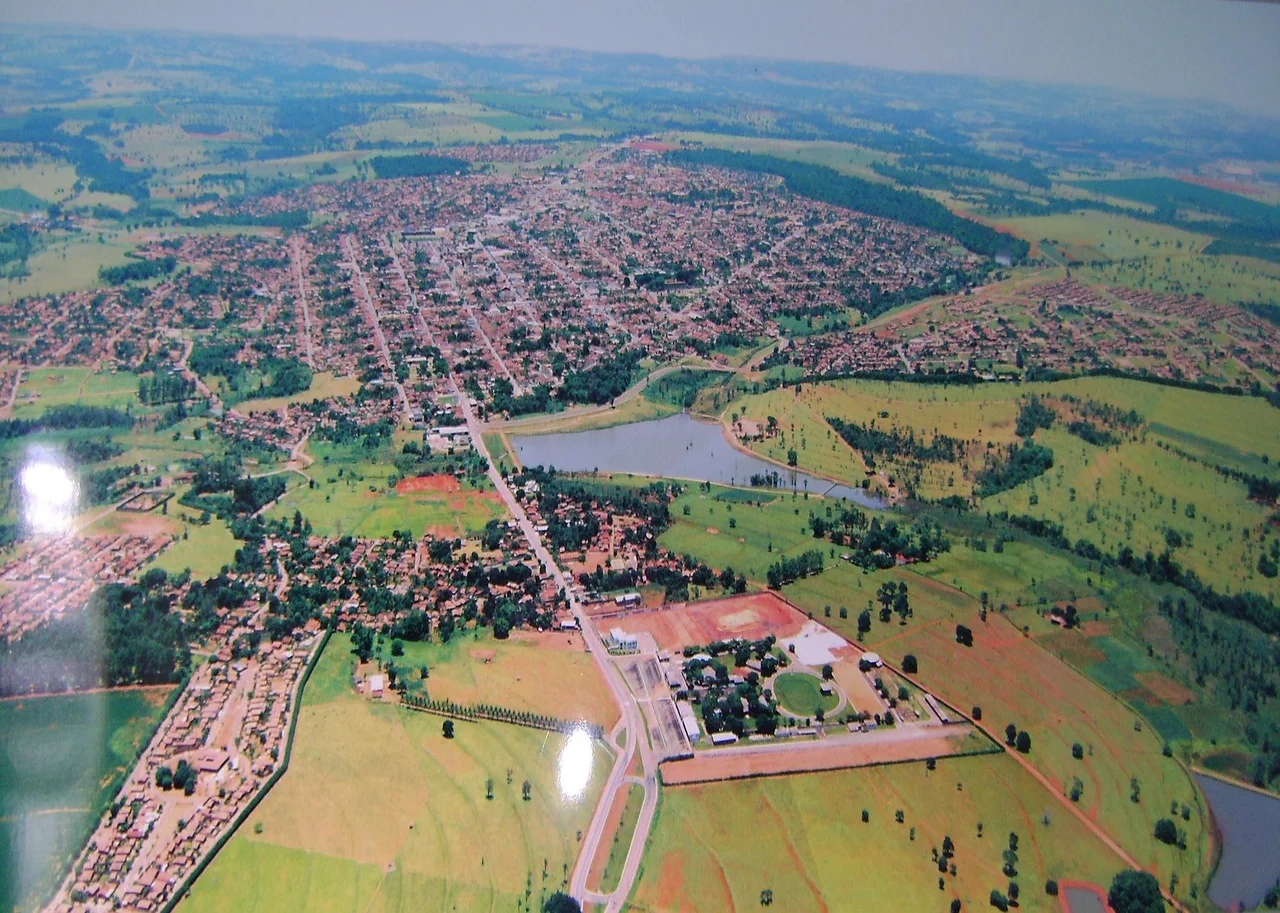
From the Air
Located at 17.73 degrees south, 49.10 degrees west, 128 kilometers south of the state capital Goiania and 8 kilometers west of the BR-153 federal highway. Nearest commercial airport is Goiania's Santa Genoveva (SBGO). The terrain is flat-to-wavy cerrado, and from altitude the landscape is marked by circular center-pivot irrigation patterns, particularly the 114 pivots dedicated to tomatoes. Caldas Novas resort and its airstrip lie 52 kilometers east, and the distinctive forested block of the Jatobá Centenário park breaks the agricultural mosaic near the urban core.
Nearby Stories
- Pires do Rio 27 km away
- Goiatuba 35 km away
- Ipameri 38 km away
- Catalão 66 km away
- Aparecida de Goiânia 68 km away
- Quirinópolis 110 km away
- Anicuns 113 km away
- Rio Verde, Goiás 145 km away