Pires do Rio
The town is named for the man who built the railroad. In 1922, when a metal bridge finally spanned the Rio Corumba and steel rails pushed into the central Goias interior, the station needed a name. Engineers chose Jose Pires do Rio, the Minister of Transportation and Public Works whose signature had authorized the line. The name stuck to the depot, then to the settlement that sprouted around it, then to the lives of everyone who followed the whistle into town.
The Plan That Nobody Followed
Coronel Lino Teixeira Sampaio and Balduino Ernesto de Almeida saw the railroad coming and made a gamble that paid off badly at first. They donated land from their ranches, drew up a proper town plan, and reserved an orderly grid where the new community was supposed to rise. Then the settlers arrived and promptly ignored the blueprint, building their houses wherever the land felt right. The planned town never quite happened. What happened instead was Pires do Rio: a place that grew the way people actually wanted to live, not the way engineers had sketched it on paper. The hamlets of Engenheiro Balduino and Soldado Esteves still carry the names of those early days, quiet reminders that the founders' ambitions outpaced their control.
Poultry Country
Drive through Pires do Rio today and the numbers speak for themselves: 1.7 million head of poultry against a human population of roughly 28,000. The ratio tells you everything about what this corner of Goias does for a living. Cattle graze on the 50,000 hectares of natural pasture surrounding town, soybeans fill another 5,200 hectares, and the red clay beneath it all feeds brick and roof-tile kilns. Pineapple, rice, coffee, beans, manioc, and corn round out the roster. A dairy and a meat-packing plant anchor the processing end. The town sits 144 kilometers from Goiania on highways that lace together Bela Vista, Cristianopolis, and Santa Cruz de Goias, a functional agricultural hub rather than a showpiece.
A Seventy-Meter Drop
For visitors, the draw is not the town but the water around it. Cachoeira do Marata falls seventy meters in a single plunge, and the pool at the bottom has become a destination for swimmers, campers, and skydivers who use the cliffs above as a launch point. A few kilometers away, the abandoned Usina do Salto hydroelectric plant from 1930 still stands, its concrete bones now colonized by kayakers and inner-tube floaters who navigate the channels where turbines once spun. Neither attraction is famous beyond the state, which is part of their appeal. You can have a waterfall mostly to yourself on a weekday afternoon.
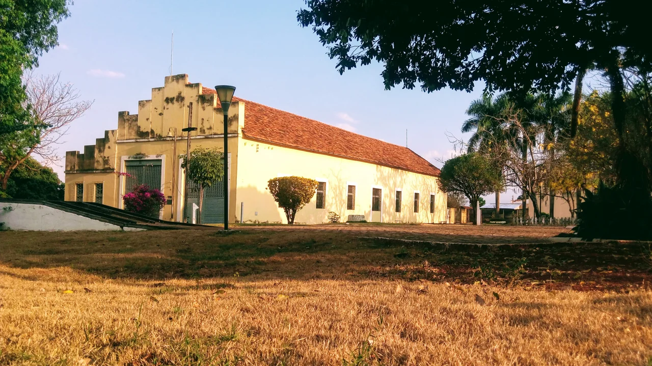
The Museum of the Line
The railroad built Pires do Rio, and the railroad is what Pires do Rio remembers. A small museum in town holds the artifacts of the age when steam and steel defined everything: signal lamps, timetables, conductor's punches, photographs of uniformed men beside locomotives that no longer run. The line that made the town eventually bypassed it, the way lines often do when the economics shift. But the name on the depot never changed, and neither did the memory. The minister from Rio de Janeiro who signed the construction order is probably forgotten in his home city. In Goias, his name is still spoken every time someone buys a bus ticket to Pires do Rio.
The Cerrado Horizon
From the air above 17 degrees south, Pires do Rio reads as a small grid of streets in a vast patchwork of pasture and cropland. The Brazilian cerrado stretches in every direction, its trees stunted and twisted from the hard dry season, its horizons broken only by the occasional buriti palm marking a stream. Neighboring municipalities - Caldas Novas, Ipameri, Orizona, Palmelo, Vianopolis - dot the landscape at ranch-sized intervals. The roads wind between them, red dust trailing behind pickup trucks. The railroad is mostly quiet now. The cattle, the chickens, and the soybeans keep moving.
From the Air
Coordinates: 17.30 S, 48.28 W. Central Goias plateau at roughly 700 meters elevation, typical cerrado terrain. Nearest major airports: Santa Genoveva Airport (SBGO) at Goiania, 144 km northwest; Brasilia International (SBBR) roughly 280 km northeast. Visual landmarks: the railroad line running east-west, Cachoeira do Marata waterfall to the north, the Corumba river crossing. Clear-air visibility from cruise altitudes is typically excellent in the dry season (May through September).
Nearby Stories
- Orizona 5.2 km away
- Ipameri 25 km away
- Morrinhos, Goiás 30 km away
- Cristalina 38 km away
- Aparecida de Goiânia 48 km away
- Goiânia 82 km away
- Vazante 106 km away
- Unaí 144 km away