Orizona
Forty-two people voted. That was the entire electorate for the 1943 public contest to rename the Goias town of Campo Formoso. Dr. Raphael Leme Franco submitted the winning entry: Orizona, from oriza meaning rice and zona meaning region. Region of Rice. The other finalists were Caruaba, Coema, Manhana, Porangatu, Potira, Jubara, and Oriza. The rice association has largely faded, but the bet on a concise geographic name has held up. Today Orizona produces something else besides rice, and it produces enough of it to send exports abroad. About thirty small distilleries here turn sugarcane into cachaça, the Brazilian spirit that is not rum but close enough to cause international confusion.
From Chapel to Contest
The town began in 1850 when Joaquim Fernandes de Castro and Jose Pereira Cardoso began building a chapel on the banks of the Ribeirao Santa Barbara, a tributary of the Corumba River. The pattern is familiar across central Brazil. Chapel, then village, then district, then city, each stage measured in decades. In 1890, the settlement became the district Capela dos Correias. In 1909, it was promoted to city status under the name Campo Formoso. That name lasted thirty-four years. Then came the 1943 contest. A name can say something about a town's self-image, and Orizona told a specific story about rice country, a place defined by what grew in its flooded fields. Other names had to settle for runner-up. The town kept the winner and moved on.
The Cachaça Question
Cachaça is not rum, and people in Orizona take this seriously. Rum is distilled from molasses, a byproduct of refining sugar. Cachaça is distilled from freshly-pressed sugarcane juice, which gives it a cleaner, more vegetal flavor profile. Brazilians call it pinga, caninha, aguardente, cana, or simply me. Orizona has about thirty small distilleries producing high-quality cachaça, some of it bound for export markets. The scale is boutique compared to the industrial cachaça operations of Minas Gerais or the Northeast, but the small-distillery model allows for careful aging and careful claims about terroir. For a town of roughly fourteen thousand people, thirty distilleries is a meaningful concentration. The sugarcane fields that feed them share space with the corn, soybeans, rice, coffee, and passion-fruit plantings that diversify the farm economy.
Milk in Quantities
Orizona is the fifth-largest milk producer in Goias. Several milk processing factories receive over a million liters a day. Out of roughly two thousand milk producers, about 90 percent are small farmers, which means the dairy economy here is built on a dense network of small operations rather than a handful of industrial feedlots. The cattle herd numbers 127,000 head. Poultry runs higher, at 931,400. The corn and soybean acreage is substantial too, 3,300 hectares and 25,000 hectares respectively. Along with the dairies, the town hosts mining companies extracting phosphates and sand from the local geology. The brickworks provide a small additional layer of industry. Two financial institutions, Banco Itau and Banco do Brasil, serve the local economy, a modest presence that reflects the town's modest scale.
The Rural Share
Something unusual for Goias shows up in the census data. A large part of the Orizona population still lives in the countryside. In 2007, 7,673 people lived in the urban area, and 6,707 lived in the rural area. That is close to a fifty-fifty split, in a state where most municipalities have gone 85 or 90 percent urban. The geographic position helps explain it. Orizona sits 138 kilometers from Goiania and 200 from Brasilia, which makes it close enough to the state capital to trade with but far enough to avoid being absorbed. It is part of the Pires do Rio microregion, a cluster of small farm municipalities between Goiania and the Minas Gerais border. Two rivers bathe the town, the Corumba and the Piracanjuba, both running toward the Paranaiba watershed. The land here slopes gently, the rainfall is reliable, and the farmers have stayed.
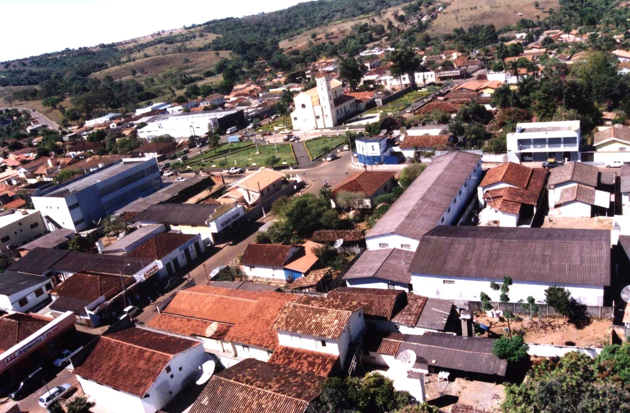
From the Air
Located at 17.03 degrees south, 48.30 degrees west, 138 kilometers from Goiania and 200 from Brasilia at roughly 850 meters elevation. Nearest commercial airport is Goiania's Santa Genoveva (SBGO). The terrain from altitude is classic cerrado mosaic: crop fields broken by gallery forest along streams, pastureland on the slopes, and the urban cluster at the intersection of GO-330 with municipal roads. The Corumba River runs northwest through the area, visible as a thin green corridor. Brasilia International (SBBR) sits to the east-northeast; route-planning to and from Goias benefits from Orizona as a waypoint in the highland plateau.
Nearby Stories
- Pires do Rio 10 km away
- Silvânia 29 km away
- Cristalina 30 km away
- Altamiro de Moura Pacheco State Park 35 km away
- Aparecida de Goiânia 43 km away
- Morrinhos, Goiás 61 km away
- Federal District (Brazil) 102 km away
- Vazante 128 km away