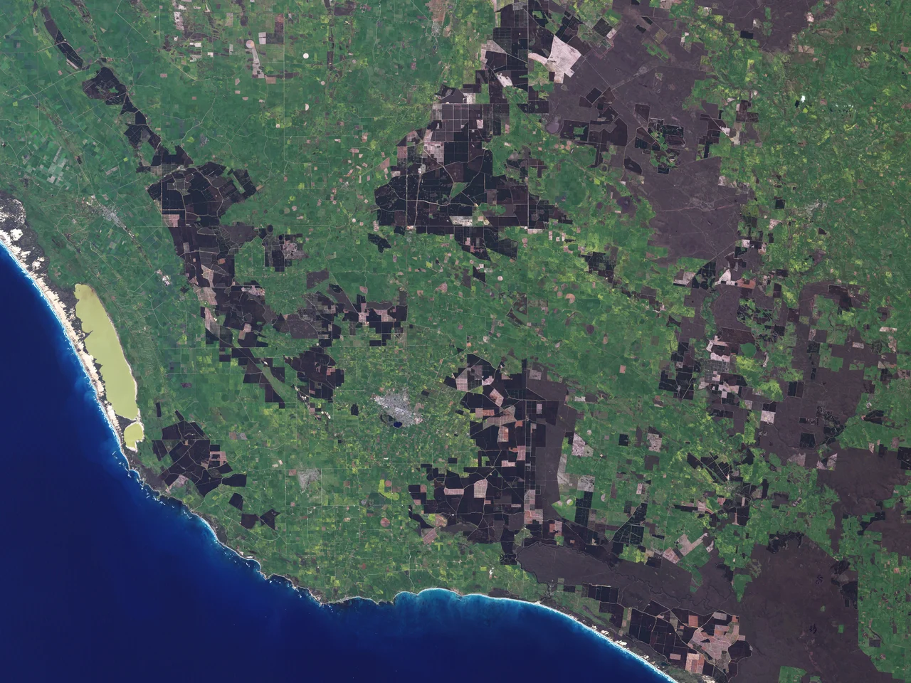

Mount Gambier
Each year, sometime in November, a lake in South Australia performs a trick that science still cannot fully explain. For half the year the Blue Lake of Mount Gambier sits in its crater a sullen, wintry grey. Then, as summer warms the water, it transforms - over a few weeks the whole 70-metre-deep lake floods to a vivid cobalt blue so intense it looks retouched. By autumn it fades back to grey. The Bungandidj people knew this country long before anyone gave the lake a colour for a name; to them the volcano was Berrin, and they have watched it sleep for far longer than the city built on its slopes.
The Lake That Changes Colour
The Blue Lake fills one crater of a maar volcano - a broad, shallow basin blasted out when rising magma met groundwater and exploded into steam. The water is artesian, clean enough to supply the city, and around 75 metres deep at its lowest point. The summer colour shift is thought to come from tiny calcium carbonate crystals forming in the warming water and scattering blue light, though the effect remains stubbornly hard to pin down. Stranger still, the lake hides fields of stromatolites - mounded rock structures built by microbes, among the oldest forms of life on Earth, and a genuine rarity in freshwater. A diving survey found them along the north-eastern wall, down to about 40 metres.
A City Full of Holes
Mount Gambier sits at the heart of the Limestone Coast, and limestone, given enough time and groundwater, dissolves. The result is a townscape pocked with sinkholes and water-filled caves, some of them in the middle of the city itself. The Cave Garden, known to the Bungandidj as Thugi, drops away right in the centre of town, a rose garden ringing the lip of a sinkhole that once supplied the settlement's water. A short distance away, the Umpherston Sinkhole - Balumbul - has been planted into a sunken terraced garden where ferns and hydrangeas spill down walls that were once a cave roof, floodlit at night so possums come out to feed. Engelbrecht Cave runs beneath suburban streets and draws cave divers from around the world into its flooded passages. Beyond the city, the surrounding plains are dotted with cenotes - deep, clear sinkholes whose crystalline water has made this one of the great cave-diving regions on the planet.
Berrin and the Bungandidj
The Bungandidj people are the traditional owners of this country. They called the peak Berrin and spoke of it as the home of the eagle hawk. When pastoralists arrived in the 1840s, the land was taken rapidly and violently: shepherds and settlers clashed with the original inhabitants over sheep and territory, and Bungandidj people were shot and dispossessed as the stations spread. It is a history this region no longer hides. In February 2022 the city restored Bungandidj names to its most significant places - the Blue Lake became Waawor, the Umpherston Sinkhole Balumbul - and plans are advancing to dual-name the city itself Berrin, the name it has carried in the local Aboriginal community all along.
A Sighting and a Tower
The crater was first noted by colonists in December 1800, when Lieutenant James Grant, sailing the survey brig Lady Nelson past the coast, spotted the peak and named it for Lord Gambier, an admiral of the British fleet - the first place the British named in what would become South Australia. A century later, in 1901, locals raised the Centenary Tower on the summit to mark that sighting; it still crowns the highest point and rewards the climb with a view across all the crater lakes at once. The town that grew below has since become the largest city in South Australia outside Adelaide, a service hub for timber, tourism, and a region that lives, quite literally, on hollow ground.
From the Air
Mount Gambier lies at 37.83°S, 140.78°E in south-east South Australia, about 17 km from the Victorian border. From the air the volcanic complex is unmistakable: a tight cluster of circular crater lakes - Blue, Valley, Leg of Mutton and Browne - set into the plain, with the Blue Lake's summer colour visible from a considerable distance. The cone topped by Centenary Tower marks the high point. Mount Gambier Airport (YMTG) sits a few kilometres north of the city off the Riddoch Highway and is served by regional turboprops to Adelaide and Melbourne; Naracoorte (YNRC) lies about an hour north. Expect cool, often blustery conditions exposed to the Roaring Forties, with relatively few completely clear days.
Nearby Stories
- Naracoorte Caves National Park 65 km away
- Avenue Range Station massacre 101 km away
- Grampians National Park 105 km away
- Mount Arapiles 133 km away
- The Twelve Apostles 160 km away
- Loch Ard Gorge 206 km away
- Coorong National Park 214 km away
- Chatham Islands 3647 km away