
Grampians National Park
Drive west from Melbourne across hours of flat farmland and the Grampians simply rear up - a wall of tilted sandstone ridges marking the end of the Great Dividing Range, ramparts catching the last of the Wimmera plain before it gives out. The Jardwadjali and Djab Wurrung peoples have known this place for tens of thousands of years and call it Gariwerd. On the orange rock of its overhangs and shelters they left the densest gathering of rock art in south-eastern Australia - hand stencils, animal tracks and human figures painted in ochre, some of them more than twenty thousand years old.
The Oldest Galleries
Gariwerd holds the overwhelming majority of Victoria's known rock art - by most counts around four-fifths of it - concentrated in roughly sixty sites across the ranges, together preserving thousands of individual motifs. Most are fragile and unmarked, but a handful are open to visitors. At Gulgurn Manja, the 'Flat Rock' shelter, small hand stencils press against the stone, several of them children's hands. At Ngamadjidj, the 'Cave of Ghosts,' rows of white human figures stand out against the rock. These are not relics of a vanished people. The Jardwadjali and Djab Wurrung communities remain custodians of this Country, and at Brambuk, the cultural centre near Halls Gap, descendants of five Aboriginal communities tell the story of Gariwerd in their own voice.
A Name Returned
The mountains carried Aboriginal names long before Major Thomas Mitchell, passing through in 1836, renamed them for the Grampian range of his native Scotland. Restoring the older name proved unexpectedly contentious. In 1991 the park was officially titled Grampians (Gariwerd) National Park, only for the decision to be reversed the following year after a change of state government. The dual names endured anyway: under later place-naming law, the Jardwadjali and Djab Wurrung names for peaks, shelters and landscape features were progressively reinstated across the ranges. Today Gariwerd and Grampians sit side by side on the maps - a small, hard-won acknowledgement of who named this country first.
Into the Sandstone
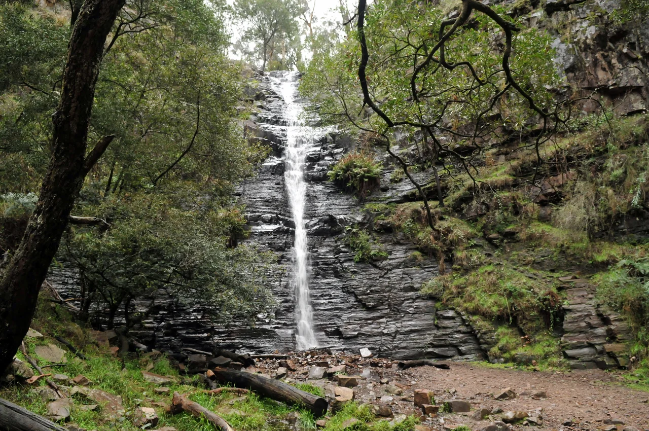
The Grampians are uplifted, tilted and weathered sandstone, the same ancient river-laid rock that crops up across western Victoria, here folded into dramatic escarpments. More than 160 kilometres of walking trails thread through them. The signature route climbs through a narrow, boulder-choked canyon to the Pinnacle, a lookout perched on the edge of a sheer drop with Halls Gap laid out far below. Lookouts at Boroka and the Balconies open onto plains that run to the horizon, and waterfalls thread the gullies after rain. The same featured rock that draws walkers makes the range a serious destination for climbers and abseilers - though here, as elsewhere in Gariwerd, access is increasingly weighed against the need to protect the cultural sites woven through the cliffs.
The Living Park
Gariwerd teems with wildlife that arranges itself almost on a timetable. In the late afternoon, kangaroos drift out of the bush to graze the open ground around Halls Gap, sometimes right by the town's shops. Koalas doze in the high branches for anyone patient enough to look up, and emus pick their way across the clearings. The most memorable performance is at dusk, when hundreds of corellas - pink-and-white cockatoos - wheel over Halls Gap in screeching flocks and settle into the trees in a racket that drowns out everything else, the laughing call of a kookaburra cutting through it. The ranges are as famous for their plants as their birds: come spring, the slopes ignite with wildflowers, including native orchids and other species found nowhere else on Earth. Set against the silent sandstone, all that colour and noise is part of what makes the place unforgettable.
From the Air
Grampians (Gariwerd) National Park lies at 37.21°S, 142.40°E in western Victoria, rising sharply from the Wimmera plains. From the air the range is a striking, sharply defined chain of north-south sandstone ridges - all the more dramatic for the flat farmland surrounding it - with Halls Gap nestled in a valley near the centre and Dunkeld at the southern end below Mt Abrupt and Mt Sturgeon. The main road access turns off the Western Highway at Stawell to the north-east. Nearest airfields are Stawell (YSWL) and Ararat (YARA) to the east; Horsham (YHSM) lies to the north-west and Hamilton (YHML) to the south. Mountain terrain can produce turbulence and rapidly changing local winds; clear days give long views across the plains in every direction.
Nearby Stories
- Mount Arapiles 25 km away
- Ballarat 69 km away
- Sovereign Hill 82 km away
- Bendigo 107 km away
- Naracoorte Caves National Park 111 km away
- Eureka Rebellion 118 km away
- Mount Gambier 118 km away
- Echuca 214 km away