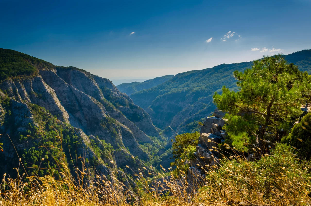

Mount Ida (Turkey)
Three goddesses arrived at a sacred spring on this mountain, and one shepherd's choice brought ten years of war. That is the myth; the mountain is real. Kaz Dağı — Goose Mountain in Turkish, ancient Mount Ida in Greek — is a 700-square-kilometer upland massif in northwestern Turkey, some 30 kilometers southeast of the ruins of Troy. It sits between Balıkesir Province and Çanakkale Province, its forested slopes draining south into the Gulf of Edremit, while the Karamenderes River — the ancient Scamander — flows west from its other flank through what English speakers have long called the Vale of Troy. The summit reaches 1,774 meters. Below it, groves of Trojan fir — Abies nordmanniana subsp. equi-trojani, a species named for this very place — cover the upper slopes. The mountain that Homer gave to Zeus is still there, and it is still extraordinary.
The Judgment and the Gods Who Watched
Homer's Iliad returns to Mount Ida again and again. Zeus himself stationed at its summit, at the peak called Gargarus, watching the battle rage on the plains below. When Hera wanted to distract her husband long enough for Poseidon to intervene on behalf of the Greeks, she chose the slopes of Ida — where her powers were magnified — to seduce him. The mountain is the backdrop for the story that started everything: the Judgment of Paris. Paris, the son of Priam who had been raised in exile as a shepherd on these slopes, was chosen to award a golden apple inscribed 'for the fairest' to one of three goddesses — Hera, Athena, or Aphrodite. He chose Aphrodite, who promised him Helen of Sparta. Hera and Athena never forgave the Trojans for it. Before Paris grew into a prince, the mountain also witnessed the abduction of Ganymede, snatched from Mount Ida by Zeus in the form of an eagle to serve as cupbearer to the gods. Anchises, father of Aeneas, was tending sheep here when Aphrodite seduced him — a union that, in Roman mythology, would eventually produce the founder of Rome.
Sacred Before the Greeks
The mountain's sacred history predates Homer. In the Greek world, Mount Ida was consecrated to Cybele, the great earth goddess, whom the Romans called Magna Mater deorum Idaea — 'the great Idaean mother of the gods.' The oldest collection of Sibylline oracular utterances, the Sibylline Books, was said to have originated here, at Gergis on Mount Ida, attributed to the Hellespontine Sibyl. From Gergis, this collection passed to Erythrae, became famous as the Erythraean Sibyl's oracles, and eventually found its way to Cumae and then to Rome. The name 'Ida' itself may have arrived with the Tjeker people from Crete — the Bronze Age inhabitants of the nearby Çanakkale coast — who carried the name from Mount Ida on Crete to this Anatolian peak. Xerxes marched his Persian army past the mountain on his way to invade Greece in 480 BCE, an event recorded by Herodotus. The mountain has been sacred to someone for a very long time.
A Forest at the Edge of Two Climates
What makes Kaz Dağı ecologically remarkable is its position at the boundary between mild Mediterranean and colder central Anatolian climate zones. Endemic plant species — survivors stranded here after the Ice Age — persist on the slopes, finding refuge in microclimates that the surrounding lowlands no longer provide. Rainfall averages between 631 and 733 millimeters annually. The Trojan fir that covers the upper forest is considered by some botanists a distinct species, Abies equi-trojani, named for the horses of Troy. Deer and wild boar are common. Jackals still move through the valleys. Wolves, brown bears, lynx, and Anatolian leopards once ranged these ridges — gone now, mostly, due to decades of overhunting. The summit is windswept and bare, the treeline suppressed by exposure. The coastal lowlands have grown hotter and drier as deforestation has changed the microclimate. An area of approximately 21,450 hectares is formally protected as Kaz Dağı National Park, established in 1994 — modest for a massif of 700 square kilometers.
A Mountain Worth Protecting
In July 2019, protests erupted over a mining operation that demonstrators accused of destroying thousands of trees on Mount Ida. The situation was contested: the mine operated by Canadian company Alamos Gold was located some 40 kilometers from Mount Ida's boundaries, in the adjacent Biga Mountains near Balaban Hill — not within the national park itself. Turkish law prohibits mining in national parks, natural preserves, archaeological sites, and wildlife protection areas. Nonetheless, the visual scale of land clearance and plans to use cyanide for gold extraction alarmed the public. A 'Water and Conscience Watch' began on July 26, followed by a 'Great Water and Conscience Meeting' on August 5, at which protesters symbolically planted trees within the mine site. Artist and writer Zülfü Livaneli addressed an open letter to UNESCO about the threat to the region's natural environment. In 2021, Alamos Gold filed an investment treaty claim exceeding one billion dollars against Turkey. The episode revealed how fiercely people identify this ancient mountain as something worth defending — not merely as real estate, but as the landscape that Homer gave to Zeus.
From the Air
Mount Ida / Kaz Dağı lies at approximately 39.70°N, 26.83°E, a prominent massif rising to 1,774 meters above the Gulf of Edremit. Approaching from the west or south at 6,000–8,000 feet, the mountain is the dominant terrain feature north of the Gulf — a wide, forested ridge distinct from the coastal plain. The Vale of Troy (the Karamenderes/Scamander valley) is visible to the northwest. The ruins of Troy lie roughly 30 kilometers to the northwest, beyond the ridge line. The nearest airport is LTFD (Balıkesir Koca Seyit Airport, near Edremit), roughly 20 kilometers south of the massif. LTBG (Bandırma Airport) provides a regional alternative to the northeast. Mountain weather builds quickly on the upper slopes; turbulence is common in afternoon thermal conditions. Maintain safe terrain clearance on the northern approaches, where terrain rises steeply from the Gulf of Edremit.
Nearby Stories
- Troy 13 km away
- 1953 Yenice–Gönen Earthquake 16 km away
- Mithymna 16 km away
- Ayvalık 18 km away
- Altıkulaç Sarcophagus 30 km away
- Balıkesir 40 km away
- Agia Paraskevi, Lesbos 44 km away
- Akhisar Museum 62 km away