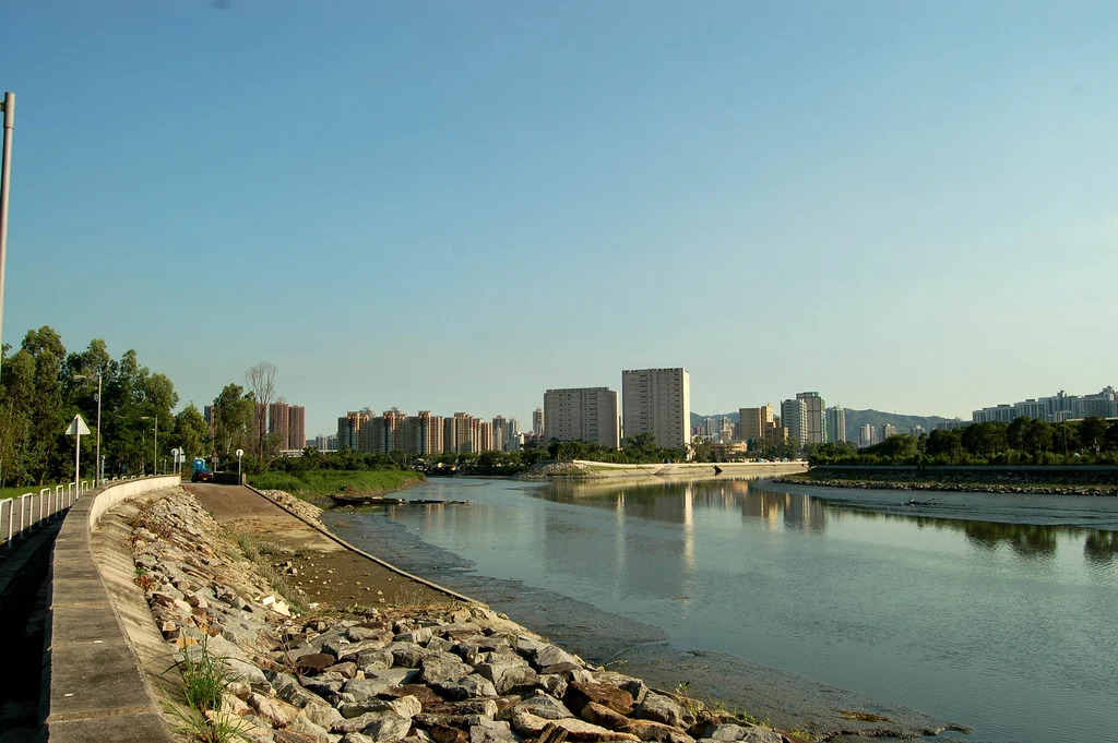

Nam Sang Wai
To get to the heart of Nam Sang Wai, you cross the Kam Tin River on a small boat. It is not a scheduled ferry; it is a single vessel that makes short passages for visitors and locals across the narrow water, connecting the wetland to the village of Shan Pui Tsuen on the other side. That boat — the simplest possible technology for a simple need — captures something essential about this place: in one of the world's most vertical, most engineered cities, there is still a roughly triangular pocket of reeds, rivers, and sky where migratory birds stop to rest on their long journeys through Asia.
A Wetland Holding Its Own
Nam Sang Wai sits in San Tin, in the Yuen Long District of Hong Kong's New Territories, bordered by the Shan Pui River to the west and the Kam Tin River to the east and south. Its roughly triangular shape is defined by those waterways, and the landscape within them is exactly what you would not expect to find this close to one of Asia's major urban centres: reed beds, mangroves, open water, and the kind of quiet that draws birds. Northern pintails (Anas acuta), eastern spot-billed ducks (Anas zonorhyncha), and black-faced spoonbills (Platalea minor) — a globally threatened species — stop here during migration. Seagulls work the edges. The area is considered ecologically significant, and on weekends it fills with Hong Kong residents who come for exactly the absence of the city.
Decades of Contested Ground
Since the 1990s, a consortium of Henderson Land and KHI Holdings Group has proposed various forms of large-scale development at Nam Sang Wai. The first approved plan, dating to 1996, included a 43-hectare golf course and 2,550 homes. That permission was extended three times. Then in 2010 the Town Planning Board declined a further extension and rejected a revised submission on the grounds that the new proposal differed too substantially from the original conditions. Appeals went up through the planning system, with the TPB, the Town Planning Appeal Board, and the courts each having their say at various points. The developers eventually petitioned the Court of Final Appeal, which declined their request in February 2017. A third proposal — 28 high-rises ranging from 19 to 25 storeys, 140 houses, and a new vehicular bridge — was rejected by the Town Planning Board in February 2017 as well.
Fire, Watchfulness, and the Question of Intent
The fight over Nam Sang Wai has not been purely procedural. Environmental groups raised alarms about fires on the land owned by the development company — fires that advocates described as suspicious and "professionally started." A blaze in early 2017 was followed by two more in March and April 2018. Police investigated. A video clip emerged showing two potential witnesses near one fire site, though police reported finding no CCTV footage there. The Agriculture, Fisheries and Conservation Department, WWF Hong Kong, the Conservancy Association, and other bodies have consistently opposed development, with the AFCD stating that it treated avoidance of ecological impact as a priority over compensation. The ongoing pattern of fires in a disputed wetland has remained a point of concern for those who have watched this contested ground for years.
What Remains
Nam Sang Wai is not a nature reserve or a protected park in the formal sense — it is private land on which successive development applications have been refused. That distinction matters: the wetland persists because planning law has, so far, said no, not because it has been affirmatively protected. This gives the place an unusual character. It is photogenic in the way that contested, partially wild landscapes often are: the reeds catching afternoon light, the wide sky reflected in the Kam Tin River, the small boat making its crossing. Hikers, photographers, and birdwatchers come on weekends. The black-faced spoonbills do not know they are on disputed ground. A road, Nam Sang Wai Road, runs along the eastern and most of the western edge of the wetland, making it accessible without requiring any particular effort — which may be one reason it has become a popular escape from the density of Yuen Long just to the south.
From the Air
Nam Sang Wai is located at approximately 22.46°N, 114.04°E in the Yuen Long District of Hong Kong's New Territories, north of Yuen Long town. From the air at 2,000–3,500 feet, the wetland's triangular shape is clearly defined by the Shan Pui and Kam Tin rivers — a patch of low, open, green-brown terrain against the surrounding urban and suburban development. Hong Kong International Airport (VHHH) is approximately 15 km to the southwest. Aircraft on the VHHH approach from the northeast sometimes pass over or near this area at low altitude. The adjacent Yuen Long Industrial Estate, visible to the west across the Shan Pui River, provides a useful landmark for orientation.
Nearby Stories
- Chapel of St. Francis Xavier 3.5 km away
- Cuiheng 4.1 km away
- 2015 Shenzhen Landslide 16 km away
- Shunde 31 km away
- Wanshan Archipelago 37 km away
- Nanxiong Formation 96 km away
- Heyuan 149 km away
- Checheng Fu'an Temple 629 km away