
Ng Tung Chai
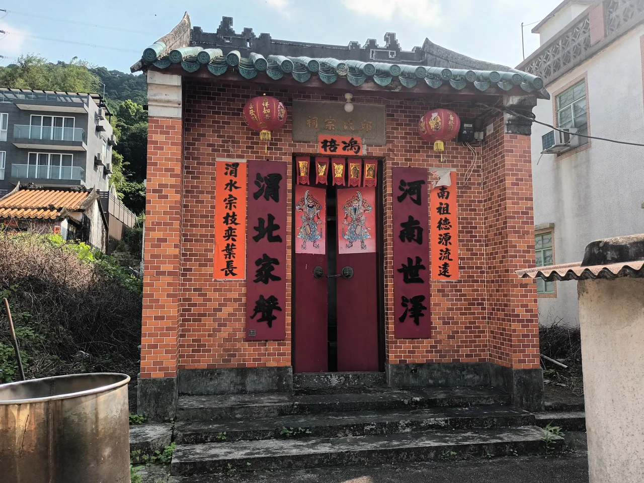
The trail begins quietly enough, climbing through fern-covered slopes on the northern side of Tai Mo Shan, Hong Kong's highest peak. Then the sound arrives before the view does — water falling a long way onto rock. Ng Tung Chai sits at the foot of this trail, a Hakka village established in 1739 or possibly earlier, its three ancestral halls and narrow lanes largely unchanged while the city below transformed beyond recognition. Most visitors pass through the village quickly, eager to reach the waterfalls. But the village itself carries its own layered story, one the waterfalls have made easy to overlook.
A Hakka Settlement in the Hills
The Hakka people — whose name means 'guest families' — were late arrivals in many parts of the Pearl River Delta, occupying hillside land that the longer-established Cantonese clans had passed over. Ng Tung Chai was primarily home to members of the Yau, Sham, and Koo families, who built not only homes but the full institutional infrastructure of a self-sufficient village: three ancestral halls for clan worship and community gathering, and two study halls for education.
The Shum Study Hall ran a night school for adults and children well into the twentieth century, closing only in 1950. Its ruins still stand. The Tung Hing Tong, built by a village trust and rebuilt in 1983, remains intact. At the time of the 1911 census, 129 people lived in Ng Tung Chai — 61 of them male. That modest count reflects the reality of Hakka hill villages: large enough for community, small enough that everyone knew everyone, balanced precariously against the rhythms of marginal agricultural land.
The Waterfalls of Tai Mo Shan
South of the village, four waterfalls descend the northern slope of Tai Mo Shan Country Park in sequence. Hikers encounter them in ascending order: Bottom Fall, also called Well Falls; Middle Fall, known as Horse-tail Falls for the way water fans across the rock face; Main Fall — also called Long Fall — which drops 35 metres in a single unbroken curtain and is considered the highest waterfall in Hong Kong; and Scatter Falls, where water disperses across a broad rock face near the top of the ravine.
The falls are at their most dramatic after heavy rainfall, when the combined volume of Tai Mo Shan's drainage channels thunders through the ravine in near-continuous sound and spray. On drier days, the same route becomes a meditative scramble through secondary forest, bamboo groves, and mossy boulders. The trail connecting the waterfalls is not long, but the terrain is steep enough to make the ascent feel earned.
A Ravine of Extraordinary Richness
What makes Ng Tung Chai more than a pretty waterfall destination is the ecology of the ravine around it. The gorge on the north-west of Tai Mo Shan covers 226 hectares and is, according to botanical surveys, one of the floristically richest places in Hong Kong. The sheltered microclimate — cooler, moister, and more protected than the exposed ridge — creates conditions for species that struggle elsewhere in the territory.
Among the plants recorded here are dysoxylum hongkongense and dendrobenthamia hongkongensis, both named for Hong Kong, suggesting the city holds significant populations of them. Bird's nest fern (asplenium nidus) colonises trees and rock faces throughout the ravine. Perhaps most culturally resonant is Aquilaria sinensis — the Incense Tree — which occurs in natural woodland on lower slopes and in the fung shui woods that traditionally protect village settlements from behind. The area was formally designated a Site of Special Scientific Interest in 1979, recognising what careful observers had long known: this ravine is unusual.
What the Village Holds
Ng Tung Chai is easy to walk through without fully registering. The entrance gate, the ancestral halls, the ruined study hall — these are easy to miss if you are already thinking about the waterfalls. But Hakka villages like this one operated with a kind of social architecture that repays attention: the ancestral hall as the centre of clan memory and collective decision-making, the study hall as the vehicle for educational ambition in communities with limited access to formal schooling, the fung shui woods as both ecological protection and spiritual boundary.
The village sits within a larger landscape that has been designated both country park and Site of Special Scientific Interest, which means it is, paradoxically, among the better-protected rural settlements in Hong Kong. The pressure that hollowed out so many other New Territories villages — redevelopment, urban encroachment, the departure of younger generations for city work — has been less acute here, partly because the terrain resists it and partly because the waterfalls keep drawing people back.
From the Air
Ng Tung Chai is located at approximately 22.437°N, 114.128°E on the northern slope of Tai Mo Shan in Tai Po District. At 1,500–2,500 feet, the ravine and waterfall trail are visible as a deeply incised green cleft on the mountain's northern face. Tai Mo Shan itself (957 m) is the dominant landmark, identifiable as the highest point in the New Territories. The nearest airport is Hong Kong International (VHHH), roughly 35 km to the southwest on Lantau Island.
Nearby Stories
- Chapel of St. Francis Xavier 3.5 km away
- Cuiheng 4.1 km away
- 2015 Shenzhen Landslide 16 km away
- Shunde 31 km away
- Wanshan Archipelago 37 km away
- Nanxiong Formation 96 km away
- Heyuan 149 km away
- Checheng Fu'an Temple 629 km away