
Nilpena Ediacara National Park
In 1946, a young geologist crouched over a slab of rust-red rock in the Ediacara Hills and saw something that should not have existed. Pressed into the stone were the soft outlines of animals - frond-shaped, disc-shaped, segmented - and they were impossibly old. Reg Sprigg had stumbled onto the oldest known fossils of complex animal life on the planet, creatures that swayed and crept across a shallow seafloor some 550 million years ago, long before anything had a shell, a bone, or a backbone. Today the ground he was kneeling on sits inside Nilpena Ediacara National Park, a stretch of former cattle station in the northern Flinders Ranges that holds, by scientific consensus, the most complete fossil record of these animals anywhere on Earth.
The Animals With No Ancestors
Charles Darwin had been troubled by a gap. The fossil record seemed to begin suddenly, with the hard-shelled creatures of the Cambrian, and nothing came before. The Ediacara biota are what came before - the missing pages. These were not animals as we picture them. Some resembled quilted mattresses, others ribbed fronds anchored to the mud, others soft discs the size of a dinner plate. Among Sprigg's finds was the first evidence of an animal with a distinct head end, a segmented creature later named Spriggina in his honour. They drifted and grazed in a world without predators, without teeth, without the violence that the Cambrian would soon unleash. For a few million years, before complex life learned to eat itself, the sea was strangely peaceful.
A New Chapter of Time
It is rare for science to add a wholly new period to the geological calendar. In 2004, the International Union of Geological Sciences did exactly that, ratifying the Ediacaran Period - the first new period defined in roughly 120 years, and the first ever anchored in the southern hemisphere. Its formal starting point, a marker geologists call the "golden spike," was driven into a creek bed at Enorama Creek in Brachina Gorge, a short drive from here. Of the dozens of such markers worldwide, this is the only one below the equator. The name itself comes from the Ediacara Hills, and its origin in local Aboriginal language is debated - some suggest a term linked to water, others a phrase meaning hard, stony ground, a fitting description of the dolomite flats at the area's heart.
Reading the Old Seafloor
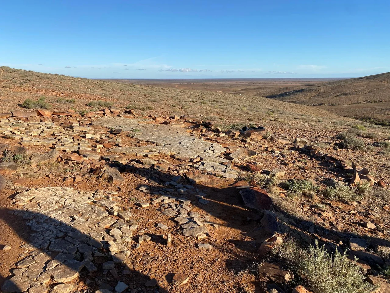
What makes Nilpena extraordinary is not single fossils but entire fossilised seafloors, lifted and turned over so that an ancient community can be studied as it lived. American palaeontologist Mary Droser has travelled here from California for more than two decades, working with researchers from the South Australian Museum to excavate these beds bed by bed. By flipping massive slabs of sandstone, they read whole ecosystems - who lived next to whom, how the creatures fed, how they moved. It is less like digging up bones and more like turning the pages of a 550-million-year-old photograph album, each layer a frozen moment from a vanished world.
From Sheep Run to Sanctuary
For generations this was Nilpena Station, grazing land worked by the Fargher family, who came to understand the treasure beneath their paddocks and quietly protected it. In 2019 the South Australian government bought a large portion of the station, enlarging the protected area roughly tenfold. The park was proclaimed in 2021 and opened to visitors in April 2023. Ross and Jane Fargher stayed on as caretakers of the fossil beds. The whole landscape lies on the traditional country of the Adnyamathanha people, whose deep connection to this land stretches back tens of thousands of years - a continuity of human presence almost as humbling, in its way, as the deep time written in the rock. The site anchors a bid for UNESCO World Heritage listing for the Flinders Ranges.
From the Air
Nilpena Ediacara National Park sits at 30.81 degrees south, 138.13 degrees east, on the arid plains west of the northern Flinders Ranges and east of the great salt expanse of Lake Torrens. From the air the country reads as low rust-coloured ridges fraying into pale flats - the Ediacara Hills marking the fossil ground. The nearest sealed airstrip is Leigh Creek (YLEC), roughly 30 km to the north-east; Hawker (YHAW) lies further south, and the regional hub of Port Augusta (YPAG) is the main gateway. Recommended viewing altitude is 4,000-6,500 ft AGL for the interplay of ridge and salt-flat. Skies are typically clear in the dry inland air, but summer heat brings strong thermals and afternoon dust; morning light best reveals the folded geology.
Nearby Stories
- Flinders Ranges 13 km away
- Leigh Creek, South Australia 39 km away
- Wilpena Pound 50 km away
- Olympic Dam mine 59 km away
- Arkaroola 84 km away
- Pichi Richi Railway 137 km away
- Strangways Springs 207 km away
- Acraman Impact Structure 215 km away