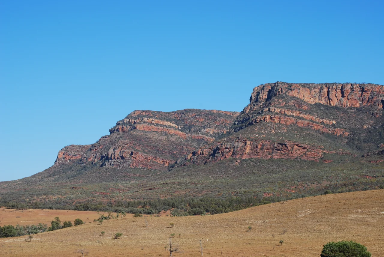

Flinders Ranges
These are mountains in their old age. Once, around 540 million years ago, the Flinders Ranges stood as a soaring new range thrust up by colliding crust; ever since, wind and water have been wearing them down to the long, quartzite-ribbed spine that runs north from near Adelaide for more than 400 kilometres. What remains is not height but depth - depth of time, depth of story. This is the largest range in South Australia, the homeland of the Adnyamathanha people for tens of thousands of years, and the place where the rock itself preserved the dawn of animal life. Few landscapes hold so much in so little elevation.
Ikara, the Meeting Place
The signature landmark needs no exaggeration. Wilpena Pound - Ikara in the Adnyamathanha language, a word meaning "meeting place" - is a vast natural amphitheatre of rock, a sickle-shaped rampart of cliffs enclosing some 80 square kilometres of valley floor. Its rim holds St Mary Peak, at 1,189 metres the highest point in the range. From the ground the Pound looks like a fortress raised by giants; from the air it reveals itself as a single tilted bowl of upturned quartzite, the Pound Quartzite outcropping in a great curved syncline. To the Adnyamathanha it is not scenery but story, woven into creation accounts that locate meaning in every ridge and waterhole.
Forty-Nine Thousand Years
Long before any European set eyes on these ranges, people lived here. The Adnyamathanha - the name means "hill people" or "rock people" - are the traditional owners, and the archaeological record of their presence is staggering. At the Warratyi rock shelter, excavations revealed human occupation reaching back roughly 49,000 years, among the oldest evidence of people anywhere in arid Australia. Across the ranges, rock engravings and cave paintings record that long custodianship; some engravings are thought to be among the oldest artwork on Earth, dating back tens of thousands of years. The state government and the Adnyamathanha now work together on protecting this cultural heritage, with elders insisting that the creation stories be carried forward alongside the science.
The Shadow at Aroona
Colonisation came hard to this country. When the first pastoral leases were marked out in 1851 over land the colony dismissed as "unoccupied waste lands," the people who had lived here for millennia were pushed aside. At Aroona - a name drawn from an Adnyamathanha word for running water - a head station was built beside a permanent waterhole that local Aboriginal people had always relied on, but they were no longer welcome there. In 1852, in the country near Brachina Gorge, that tension turned to bloodshed in what is remembered as the Brachina Gorge massacre. The settler Hayward claimed he had fired in self-defence; two Aboriginal men were arrested and later released for lack of evidence and the want of an interpreter. The land kept his chosen names. Descendants of the Adnyamathanha are telling this history now, on their own terms, as part of caring for country.
Where Time Got Its Name
The Flinders Ranges did something no other place on Earth has done: they gave a name to a chapter of geological time. In the Ediacara Hills within the range, fossils of the first complex animals were found, creatures that lived some 550 million years ago. In 2004 scientists formally recognised the Ediacaran Period - the first new period added to the geological time scale in roughly 120 years, and the only one defined by a marker in the southern hemisphere, a "golden spike" driven into Enorama Creek in Brachina Gorge. It is fitting that this ancient, eroded country should be where deep time is measured. Seven separate sites across the Flinders, including the new Nilpena Ediacara National Park, anchor a bid for UNESCO World Heritage listing.
The Painter's Gums
Artists have long understood that the magic of the Flinders is light. The painter Hans Heysen made the river red gums of these ranges famous - gnarled, silver-limbed giants standing in dry creek beds, blazing against the blue of distant hills. The long-distance Heysen Trail carries his name; the Mawson Trail, named for the Antarctic geologist Sir Douglas Mawson, threads the ranges too. The climate is semi-arid and theatrical: summer days climbing past 38 degrees, winter frosts in the mornings, and, on rare occasions, snow dusting Wilpena Pound. Around it all live the emus and wedge-tailed eagles, the galahs and goannas, and the worn red ramparts that have been quietly shedding their height for half a billion years.
From the Air
The Flinders Ranges run roughly north-south through the centre of South Australia; this entry is anchored near 30.92 degrees south, 138.62 degrees east, in the heart of the range near Wilpena Pound. From the air the great curved rampart of Wilpena Pound / Ikara is unmistakable - a single enclosed bowl ringed by cliffs, with St Mary Peak (1,189 m) on its rim - while the parallel ridgelines of quartzite march away in long folds and gorges such as Brachina cut clean cross-sections through them. Hawker (YHAW) is the nearest town airstrip to the central ranges; Leigh Creek (YLEC) serves the north and Port Augusta (YPAG) is the principal regional airfield to the south-west. Recommended viewing altitude is 6,000-9,000 ft AGL to appreciate the scale of the Pound and the folded geology; higher still on clear days for the full sweep of the range. Inland air is usually crisp and visibility long, but summer brings powerful thermals, turbulence over the ridges and afternoon dust - early morning gives the smoothest air and the richest raking light on the rock.
Nearby Stories
- Nilpena Ediacara National Park 5.6 km away
- Mount Chambers Gorge 15 km away
- Leigh Creek, South Australia 28 km away
- Arkaroola 33 km away
- Wilpena Pound 51 km away
- Birdsville Track 105 km away
- Pichi Richi Railway 138 km away
- Honeymoon Uranium Mine 154 km away