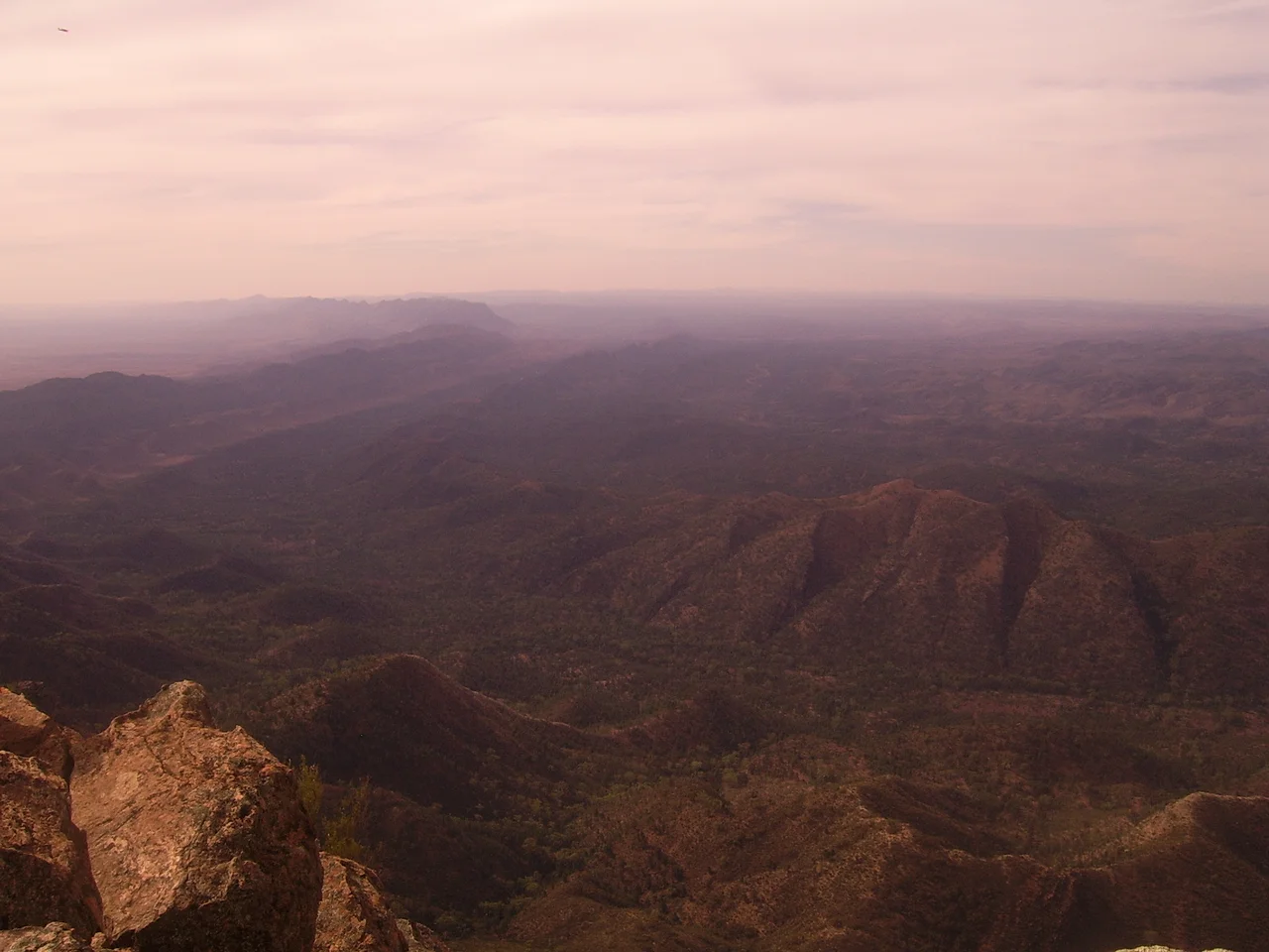

Wilpena Pound
From the air, it looks like a crater left by something falling out of the sky. Seventeen kilometres long and eight wide, Wilpena Pound is a ring of mountains that walls off an entire valley, its quartzite ridges rising like the rim of a shallow bowl tilted toward the rising sun. For a long time, people assumed it had to be a volcano. It isn't. And to the Adnyamathanha, whose ancestors have read this landscape for tens of thousands of years, the explanation was never geological at all. They call the place Ikara, the meeting place, and they say two giant serpents are lying here still.
Two Serpents, Sleeping
The Adnyamathanha story is told in Yura Muda, the body of law and knowledge passed down through generations. Two akurra, immense serpents, came to a great gathering of people. They ate so many of those assembled that they grew too heavy to move, and they curled themselves around the feast and stayed. Their coiled bodies became the walls of the Pound. The head of one rose into St Mary Peak, the highest point in the Flinders Ranges at 1,189 metres; the Adnyamathanha name it Ngarri Mudlanha, which carries the sense of dizzy thoughts. In recent years, some Adnyamathanha have asked visitors not to climb the final stretch to the summit, because it is sacred ground. To walk into the Pound, then, is not to enter an empty natural wonder. It is to step inside something that is, in the deepest sense, alive.
The Oldest Animals on Earth
The rock here is almost incomprehensibly old. The ridges of the Pound are built from Rawnsley Quartzite and Bonney Sandstone, laid down during the Ediacaran Period more than 540 million years ago, when the first complex life on the planet was just stirring in ancient seas. The Flinders Ranges hold some of the finest Ediacaran fossils in the world, so significant that the wider Ediacara Hills sit on a global list of geological heritage sites. In 2020, scientists working in these rocks described Ikaria wariootia, a grain-of-rice-sized worm that may be the oldest known ancestor of every animal with a front and a back, including us. It is a strange thing to stand among mountains and realise you are looking at the cradle of animal life itself.
A Place to Farm, a Place to Leave
Pastoralists arrived in the 1850s, and the surveyor H.C. Rawnsley found, on reaching the southern wall, that locals had already named the great bluff after him before he got there. By the early twentieth century the natural enclosure was put to use the way its English name suggests, a pound for holding stock. In 1901 the Hill family took on the lease and tried something never attempted so far north of Goyder's Line, the surveyor's famous boundary marking where reliable rainfall ended. They cut a road through the torturous gorge at Wilpena Gap, built a homestead that still stands, and coaxed crops from the interior. It worked, for a while. Then in 1914 a flood tore out the road. Unable to face starting over, the Hills sold to the government, and the Pound passed slowly toward the national park it is today, now co-managed with the Adnyamathanha and renamed Ikara-Flinders Ranges in 2016.
One Tree, Standing
In 1937 the photographer Harold Cazneaux came here and aimed his camera low at a single river red gum on the plain below the ranges. He exhibited the image at the London Salon of Photography as A Giant of the Arid North, and later called it his most Australian picture, the qualities he loved being exactly those the tree demanded of itself to survive this hard, dry country. In 1941, after his son was killed in the Second World War, he retitled it The Spirit of Endurance — the gnarled gum becoming a symbol of Australian grief and resilience. The tree still stands, gnarled and weathered, listed on South Australia's register of significant trees. It is a fitting emblem for the whole place. Wilpena rewards patience: the light that floods the Pound at dawn, the wildflowers that follow rare rain, the wedge-tailed eagles riding thermals off the ramparts. Come ready to walk, and to listen.
From the Air
Wilpena Pound sits at 31.56 degrees south, 138.57 degrees east, in the heart of the Ikara-Flinders Ranges National Park, roughly 429 km north of Adelaide. From the air it is unmistakable: a near-continuous oval ring of mountains, St Mary Peak (1,189 m) marking the high north-eastern rim, with the single notch of Wilpena Gap breaking the eastern wall where Wilpena Creek drains out. The nearest airfield is Hawker (Wilpena Pound) Airport, ICAO YHAW (IATA HWK), about 6 km north-east of Hawker township, elevation 321 m, a gravel strip serving light aircraft and scenic flights; the resort and Rawnsley Park also have unsealed strips. Recommended viewing altitude is 6,000-8,000 ft AGL to take in the full bowl and surrounding ranges. Be alert to mountain turbulence and rapidly changing visibility; summers are hot, and conditions over the ridges can be deceptive.
Nearby Stories
- Mount Chambers Gorge 36 km away
- Flinders Ranges 42 km away
- Nilpena Ediacara National Park 54 km away
- Pichi Richi Railway 60 km away
- Beltana Station 96 km away
- Port Augusta 115 km away
- Honeymoon Uranium Mine 138 km away
- Radium Hill 147 km away