North Holland
Most people who come to North Holland think they are coming to Amsterdam, and stop there. They miss what surrounds it. Drive twenty minutes in any direction outside the ring road and the country opens into something almost theatrical in its Dutchness: green polders so flat the horizon is a ruled line, windmills working the same drainage they have worked for four centuries, a cheese market that runs on a thousand-year-old guild, a beach you can walk for thirty kilometers without crossing a road, an island called Texel that you reach by ferry and that has more sheep than people. North Holland is the busiest, most-visited province in the Netherlands, and also the province where a quiet bike ride in any direction will turn up something the guidebooks did not warn you about. It is small. It is dense. It is the Dutch idea of itself, concentrated.
The Land Beneath the Water
Almost everywhere you stand in North Holland, you stand on something that used to be lake. The Beemster polder, drained between 1607 and 1612 by a coordinated battery of windmills, joined the UNESCO World Heritage list in 1999 - partly because its geometric grid of fields is one of the cleanest examples of Renaissance land planning anywhere, and partly because (according to a tradition that may or may not be accurate) the planners of Manhattan are said to have used the Beemster as a model. The Schermer was drained in 1635. The Wieringermeer, the youngest of the major polders, came up out of the IJsselmeer in the 1930s. Each polder sits a few meters below sea level, kept dry by a relentless choreography of pumps and dykes. Drive any rural road and you can read the system in the landscape: the road runs along a ringdijk, the fields drop away beside it, and somewhere in the distance the white blade of a windmill turns slowly above the green. None of this is decoration. It is the country, functioning.
Cheese, Beer, and Genever
Holland is cheese country and North Holland is the heart of it. The Edam wheel, the Beemster, the protected-origin Noord-Hollandse Gouda - all are made within an hour of each other in farms that look exactly like the ones in seventeenth-century Dutch paintings. Alkmaar still stages a Friday cheese market from late March through late September, with white-suited carriers in colored hats sliding stretchers of yellow wheels across the Waagplein. Edam runs a smaller summer market of its own. Hoorn has one too. The breweries of the province are no smaller a story. Heineken built its empire from a brewery in southern Amsterdam, and you can still tour the original site as the Heineken Experience. Older and stranger is jenever, Dutch gin - the malty, juniper-forward spirit that crossed the Channel in the seventeenth century and turned into English gin somewhere along the way. The Bols distillery in Amsterdam has been making it since 1575. Order a glass at a brown cafe and you get it filled to the absolute brim, set on the bar; you bend forward to take the first sip without lifting it. The Dutch call this the kopstootje, the little head-butt.
Villages on the Water
Twenty kilometers north of Amsterdam, the Zaanstreek-Waterland flattens into a landscape of canals, dykes, and green wooden farmhouses that has been preserved with deliberate care. The Zaanse Schans is the most visited - an open-air museum with functioning windmills, working clog-makers, and a cheese farm you can walk through. Volendam, on the IJsselmeer shore, used to be a fishing village before tourism rebuilt its economy; the harbor is still authentic, the costumed photographs less so. The quieter alternatives are nearby: Marken on its former island, reached now by a causeway, with its dark wooden houses raised on pilings against floods that no longer come. Edam, with its cheese shop and its silent canals. Monnickendam and Broek in Waterland and the very small village of Ransdorp, which sits at the end of a single road and contains almost nothing besides a 16th-century tower that the village ran out of money to finish. The medieval Muiderslot castle, twenty minutes east of Amsterdam, is the kind of fairy-tale moated keep that looks like a child drew it and someone built it anyway.
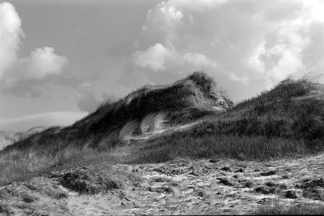
Sand and Sea
The west coast of North Holland is one long ribbon of dune. The Schoorlse Duinen rise into actual ridges by Dutch standards - some of them over fifty meters, which counts here as a mountain range. Behind them stretch forests and heath; in front, broad pale beaches that on a good summer day are filled with families and on a winter morning are entirely empty. Zandvoort, near Haarlem, gets crowded and has a Formula One circuit. Bergen, Egmond, and Bloemendaal are quieter. Further north, on the island of Texel - the first of the West Frisian chain, reached by a twenty-minute ferry from Den Helder - the beaches grow wilder and the wind grows stronger. Texel has more sheep than residents, a lighthouse that has been guiding traffic into the Wadden Sea for two centuries, and a small museum about beachcombing built around the wreckage of cargo that has washed ashore there. It is one of the few places in the Netherlands where you can disappear.
Forts, Fortresses, and the Amsterdam Ring
Between 1880 and 1920 the Dutch built a 135-kilometer ring of 42 forts around Amsterdam called the Stelling van Amsterdam. The idea was that, in the event of attack, the surrounding polder lands could be deliberately flooded to a depth of about thirty centimeters - deep enough to stop infantry and artillery, shallow enough that boats could not be used. The forts covered the dykes and bridges that controlled the flooding. The aeroplane made the whole system obsolete almost the moment it was finished. The forts now sit in green fields, some abandoned, some converted to wineries or theatres or apartment buildings, the whole ring inscribed on the UNESCO list since 1996. Closer in, Naarden - just east of Amsterdam - has one of the most perfectly preserved seventeenth-century star-fortifications in Europe, complete with its outworks and water moat. From above it looks like a brick snowflake. From the ramparts, on a clear evening, you can see for kilometers across the lakes and lowlands of the Gooi.
From the Air
North Holland is the peninsula extending north from Amsterdam (52.37 N, 4.90 E) to Den Helder (52.96 N, 4.76 E), roughly 80 km tip-to-base. From cruising altitude the province is unmistakable: a flat green expanse divided into rectangles by canals and dykes, with the dark line of the IJsselmeer to the east, the North Sea and the parallel ribbon of dunes to the west, and Amsterdam's denser grid in the south. The Beemster polder grid is visible from 10,000 ft as a distinctly regular pattern; the Afsluitdijk forms a 32 km causeway sealing the IJsselmeer off from the Wadden Sea to the north. Major airport: Amsterdam Schiphol (EHAM), the fourth-busiest in Europe. Small fields at Hilversum (EHHV), De Kooy (EHKD), and Texel (EHTX). Best viewing on clear days at 3,000-8,000 ft when the polder geometry and canal patterns dominate.
Nearby Stories
- Koopvaarders Lock 4.9 km away
- Enkhuizen 6 km away
- Blauw-Wit Amsterdam 6.3 km away
- Princess Amalia Wind Farm 6.4 km away
- Hollandse Kust Zuid Offshore Wind Farm 7.2 km away
- The Green Cathedral 7.4 km away
- Tjaskers in Friesland 19 km away
- Action of 22 September 1914 33 km away