Northern Negros Natural Park
Seventeen cities and municipalities in Negros Occidental drink from the same source: the mountainous forests of the Northern Negros Natural Park. At over 80,000 hectares, this protected area is the province's largest watershed, a biological reservoir that sustains both the ecological health of the island and the daily water supply of the Bacolod metropolitan area. That a park this vital exists at all is the product of nearly a century of legislative attention, beginning in 1935 when a colonial governor-general set aside the land, and continuing through repeated acts of political will to keep development at bay.
From Forest Reserve to Natural Park
The protection of northern Negros began on April 28, 1935, when Governor-General Frank Murphy signed Administrative Act No. 789, establishing a forest reserve spanning 107,727 hectares across the mountainous interior of the island. Eleven years later, on August 7, 1946, President Manuel Roxas reduced the reserve to its present area of 80,454.5 hectares through Proclamation No. 798. The land remained classified as a forest reserve for nearly six decades until 2005, when President Gloria Arroyo signed Proclamation No. 895, converting the area into a natural park under the National Integrated Protected Areas System Act. Each designation carried stronger protections. Each reflected a growing understanding that the forests of northern Negros were not just timber reserves but functioning ecosystems whose value lay in leaving them standing.
The Summer Capital in the Canopy
The municipality of Salvador Benedicto sits within the park's boundaries, two-thirds of its entire land area falling inside the protected zone. Pine trees line the main highway through town, and the cooler mountain elevation has earned Salvador Benedicto the unofficial title of Summer Capital of Negros Occidental. The town's relationship with the park is both privileged and constrained. Negros Occidental Representative Julio Ledesma IV once filed a bill seeking to carve out a 200-hectare townsite from the proposed 500-hectare government property within the park. Governor Alfredo Maranon pushed back, opposing any encroachment into the protected area and instead offering to convert land in the municipal proper for development. The negotiation captures the central tension of the park's existence: communities live within and depend upon a landscape that conservation requires them to leave largely untouched.
A Watershed Under Pressure
The park spreads over five municipalities and six cities, a jurisdictional complexity that makes coordinated management difficult. As Negros Occidental's primary watershed, the forested mountains capture rainfall and release it gradually through streams and rivers that feed reservoirs and irrigation systems downstream. Without the forest canopy, rainfall would erode the mountain slopes, silt would choke the rivers, and the steady water supply that the Bacolod metropolitan area relies on would become erratic. The stakes extend beyond ecology. Agriculture, municipal water systems, and the province's economic engine all trace their water back to these mountains. Every hectare of forest cleared upstream translates directly into reduced water security downstream.
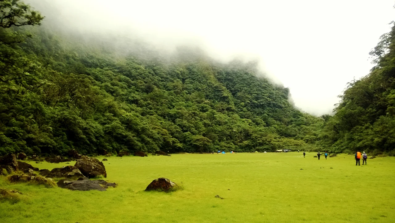
What the Mountains Hold
Northern Negros is part of one of the most biologically significant islands in the Philippines. The Visayan region harbors endemic species found nowhere else on Earth, and the mountainous forests of this park represent some of the last intact habitat for those species. The park has been identified by BirdLife International as an Important Bird Area, and its elevation range, from lowland forest through mossy montane zones, supports a diversity of life adapted to each altitude band. For visitors, the park offers trails through primary forest, views across the Visayan Sea, and an encounter with a landscape that has been fought over, legislated about, and ultimately preserved because the alternative was too costly to accept.
From the Air
Located at 10.63N, 123.22E in the northern mountainous interior of Negros Island. The park covers a vast area visible from altitude as continuous forest canopy in the island's northern highlands. The nearest major airport is Bacolod-Silay International Airport (RPVB), approximately 30 km to the west on the coastal plain. From cruising altitude, the contrast between the forested mountains and the sugarcane flatlands of the coast is striking. Salvador Benedicto is visible as a small settlement within the green expanse.
Nearby Stories
- Hacienda Rosalia 8.5 km away
- Fort San Pedro (Iloilo) 14 km away
- Cebu 17 km away
- Guimaras Oil Spill 27 km away
- Jalaur Dam 40 km away
- 2012 Negros Earthquake 45 km away
- November 2023 Mindanao Earthquake 579 km away
- Sinking of MV Sewol 2604 km away