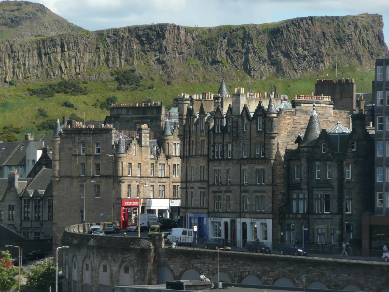

Old Town, Edinburgh
Picture a glacier. Twenty thousand years ago, ice scoured west to east across what would become central Scotland, grinding the soft soil away and splitting around a plug of harder volcanic rock. The glacier left a steep crag with a long tapering ridge trailing east of it - geologists call the shape a crag and tail. The crag became Castle Rock. The tail became the Royal Mile. The medieval city that grew along that ridge between the Castle and Holyrood Abbey is what we now call the Old Town. It has been continuously inhabited for nearly a thousand years, and since 1995 it has shared UNESCO World Heritage status with the Georgian New Town a few blocks north.
The Royal Mile and Its Closes
The name Royal Mile is a 20th-century invention; legally the street runs through Castlehill, Lawnmarket, High Street, Canongate, and Abbey Strand, in five named segments from Castle to Palace. Off this main spine, narrow alleys called closes drop steeply north and south, some no more than a few feet wide. Mary King's Close, sealed off in the 17th century and buried under the City Chambers, is now a tourist attraction. Advocates Close cuts down to Cockburn Street. Each close is a fragment of medieval Edinburgh's street pattern, preserved because the topography was too tight to rebuild. Anyone walking the Mile today is walking essentially the same line that pilgrims, monarchs, and witnesses to executions walked for centuries.
Vertical Living, Sixteenth-Century Style
The Old Town is famous for inventing the high-rise. The defensive walls and the narrow ridge meant there was nowhere to spread, so Edinburgh grew up. From the 16th century onwards, tenements of six, eight, and even fourteen storeys lined the closes. Rich and poor lived in the same building, with merchants on the middle floors and servants and labourers above and below. Many of these towers burned down in the Great Fire of 1824, which destroyed most of the south side of the High Street between Saint Giles' Cathedral and the Tron Kirk. When the rebuilding raised the ground level, it created the labyrinth of vaults and tunnels under the modern street, which is why Edinburgh tours can promise underground passages and actually deliver them.
Buildings That Tell the Story
Saint Giles' Cathedral sits midway down the Mile, its crown spire one of the city's signature silhouettes. The General Assembly Hall of the Church of Scotland looks out over the Mound. The National Museum of Scotland and the Old College of the University anchor the Old Town to the south. Parliament House, where the Court of Session sits, occupies a corner near Saint Giles'. The Scottish Parliament Building, opened in 2004, sits at the foot of the Mile near Holyrood Palace, its modernist forms deliberately contrasting with everything around them. Underground, the Edinburgh Vaults below South Bridge once housed taverns, illicit workshops, and the poorest of the city's poor.
The Geology Beneath
The crag-and-tail landform shaped everything. Castle Rock sits 80 metres above the surrounding ground because it is the eroded plug of an extinct volcano. The ridge of the Royal Mile slopes downward at a steady gradient because the glacier left it that way. To the north of the ridge, where the New Town now stands, lay the Nor Loch, a marshy artificial lake that served as both a defensive moat and a sewage dump until it was drained in the 1760s. To the south lay the Cowgate, a low road through what was once marshland. The Old Town's distinctive vertical drama is entirely a product of the underlying rock, and it is why Edinburgh looks like nowhere else in Britain.
Festival City
Every August, the Old Town becomes the centre of the world's largest arts festival. The Edinburgh International Festival and the Fringe pull thousands of performers into the High Street, Hunter Square, and venues squeezed into every basement and church hall. Street performers work the cobbles. The Royal Mile becomes impassable. In December 2002, the Cowgate fire destroyed a dense block of old buildings including the Gilded Balloon comedy club and much of the University's Informatics Department, taking with it the famous artificial intelligence library that had been built up over decades. The site was rebuilt by 2014. Archaeology before each new construction has steadily revealed more of the medieval city, including burgage plots from the 16th century, a tannery from the 1830s, and parts of the 12th-century boundary ditch under Saint Mary's Street.
From the Air
Coordinates 55.9476 N, 3.1916 W, with the Royal Mile running roughly east-west along a ridge between Edinburgh Castle (west) and Holyrood Palace (east). From the air, the crag-and-tail landform is exceptionally clear: Castle Rock rises as a vertical cliff on a 250-foot dolerite plug, with the Old Town tapering east. The Old Town and New Town together comprise the UNESCO World Heritage Site (red-line boundary). Edinburgh Airport (EGPH) is about 8 nm west; arrivals often pass north of the city. Best altitudes for orientation 3,000 to 5,000 feet AGL. Watch for the distinctive crown spire of Saint Giles' Cathedral mid-ridge.
Nearby Stories
- Ardoch Roman Fort 2.2 km away
- Craignethan Castle 3.1 km away
- Haddington 3.8 km away
- Balvaird Castle 4.3 km away
- Battle of Kilsyth 9.4 km away
- Siege of St Andrews Castle 9.9 km away
- Neidpath Castle 11 km away
- Melrose Abbey 15 km away