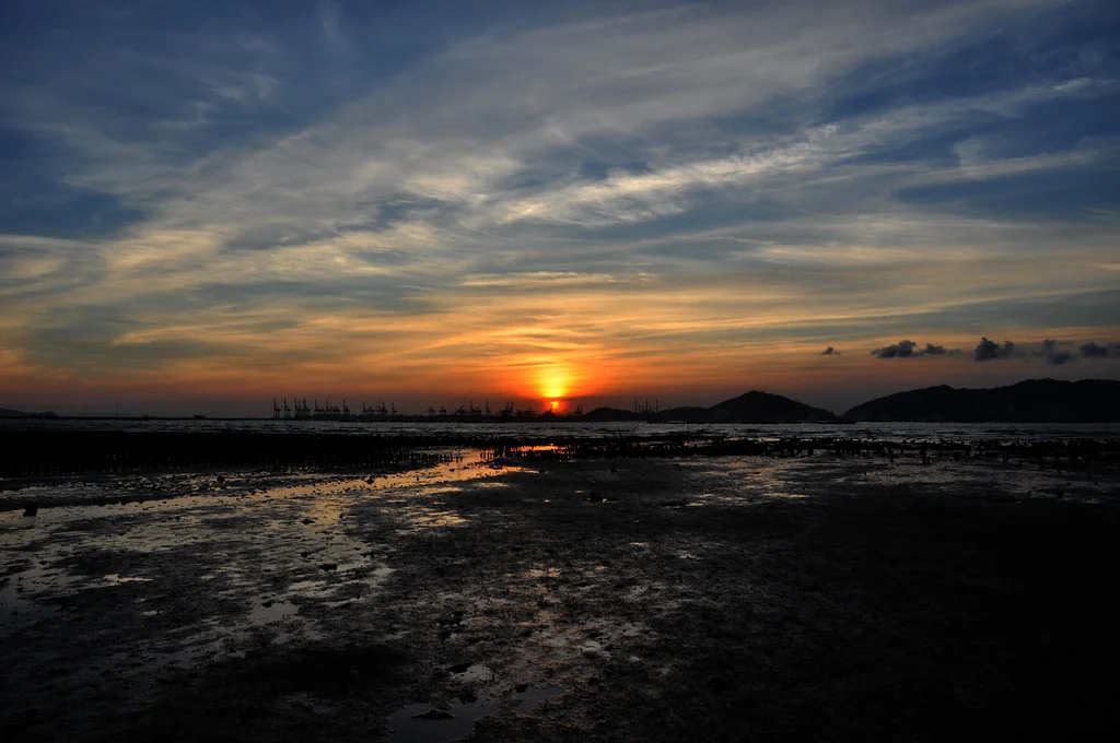

Pak Nai
Horseshoe crabs have been crawling across these mudflats for 450 million years. Longer than the dinosaurs. Longer than most things. At Pak Nai, on the western edge of Hong Kong's New Territories, the tidal flats of Deep Bay — also called Shenzhen Bay — expose a shoreline where creatures that have barely changed since the Ordovician period still gather to breed. Their blue blood, copper-based rather than iron-based, is used in medical laboratories around the world to detect bacterial contamination in pharmaceuticals. The animals that produce it predate Hong Kong, China, and human history itself. Standing at the junction of Deep Bay Road and Nim Wan Road at dusk, watching the light collapse over Shenzhen, it is possible to feel both the weight of deep time and the particular beauty of a city's forgotten edge.
Mud, Mangrove, and Living Fossils
Ha Pak Nai's 6-kilometre shoreline carries one of Hong Kong's most intact wetland ecosystems. Mangroves root in the intertidal zone, their exposed root systems filtering the water and providing nursery habitat for dozens of species. The mudflats are a designated Site of Special Scientific Interest — a classification that reflects the richness of what lives here. The area was historically an oyster bed, and remnants of those shells still crust the flats in places, a record of an earlier economy written in calcium. Among the crab species found here — Perisesarma bidens, Ilyoplax tansuiensis, Uca arcuata, Sesarma sinensis — the horseshoe crab is the most closely watched. Not an actual crab but a chelicerate more closely related to spiders and scorpions, the horseshoe crab's lineage reaches back 450 million years. The copper in its blood turns blue when exposed to oxygen, giving these ancient animals an otherworldly quality that matches the strangeness of the flats they inhabit.
Sand Dunes, Stone Stoves, and Revolution
Beneath the visible wetland, the ground holds older histories. In May 1997, archaeologists from the Antiquities and Monuments Office excavated the Chen's homeland relic — a sand dune with two culture levels, containing four postholes, nine stone stoves, three kilns, and one grave. The excavation produced the first examples in Hong Kong of what are called sun and moon utensils, objects whose significance connects the site to ancient ritual practices along the Pearl River coast. Nearby, at No. 55 Ha Pak Nai, a fortified structure carries a different kind of weight. Tang Yam-nam, a core member of the Hsing Chung Hui — the Revive China Society founded by Sun Yat-sen — built the structure around 1910. Hsing Chung Hui members used Lower Pak Nai as a base for preparations to overthrow the Qing dynasty, and the structure served as a surveillance point across the Deep Bay coast. The 1911 revolution that ended the Qing dynasty is one of the defining events of modern Chinese history, and this fortified building is the only physical evidence connecting that movement directly to this coastline. It is now a declared monument.
The Hour Before Dark
Ha Pak Nai means Lower White Mud in Cantonese. It is known — and this is not contested — as one of the best places in Hong Kong to watch the sun go down. The bay faces due west, toward Shenzhen and the Pearl River estuary beyond. On clear evenings the sky above Deep Bay takes on colours that the concrete and glass of Central or Mong Kok never allow a viewer to fully appreciate: amber pooling at the horizon, then rose, then a purple that fades slowly into the bay. Photographers arrive early to claim positions along the shore. Dating couples follow. The 5-kilometre cycling route along Nim Wan Road has become a local institution, the kind of route that appears in lifestyle articles about Hong Kong's outdoor spaces. The mudflats that edge the shore reflect the changing light with unusual depth. Oyster shells catch it. The silhouettes of fishermen sometimes cross it. The horseshoe crabs, indifferent to it all, continue their ancient business in the shallows.
Pressure and Preservation
Not long ago, Pak Nai faced the kind of development pressure that has reshaped most of the New Territories' coastline. A private proposal for development on the wetland — including, at one point, a golf course — generated significant opposition from conservationists, local villagers, and the public. The proposal was eventually dropped. The Site of Special Scientific Interest designation and the declared monument at No. 55 provide some protection. Reaching Pak Nai requires effort: it sits at the far western end of the New Territories, accessible by minibus number 33 from Tai Fung Street in Yuen Long, or by taxi. That relative inaccessibility has contributed to its survival. The mudflats do not advertise themselves. They simply persist — as the horseshoe crabs persist, as the mangroves persist, as the memory of a revolution that swept away the last Chinese dynasty persists in a small fortified building by the water.
From the Air
Pak Nai lies at 22.437°N, 113.948°E along the western shore of the New Territories, facing Deep Bay (Shenzhen Bay) toward Shenzhen. From the air, the wetland coastline is distinctly different from the developed land to the east — dark mudflats edged with mangrove green, extending into the bay. The Shenzhen skyline is visible across the water to the north. The nearest airport is Hong Kong International (VHHH), approximately 18 km to the south on Lantau. Mai Po Marshes Nature Reserve lies to the southeast along the same bay shoreline. At 2,500 feet, the contrast between the preserved wetland fringe and the dense urban grid of Yuen Long immediately inland is clear.
Nearby Stories
- Chapel of St. Francis Xavier 3.5 km away
- Cuiheng 4.1 km away
- 2015 Shenzhen Landslide 16 km away
- Shunde 31 km away
- Wanshan Archipelago 37 km away
- Nanxiong Formation 96 km away
- Heyuan 149 km away
- Checheng Fu'an Temple 629 km away