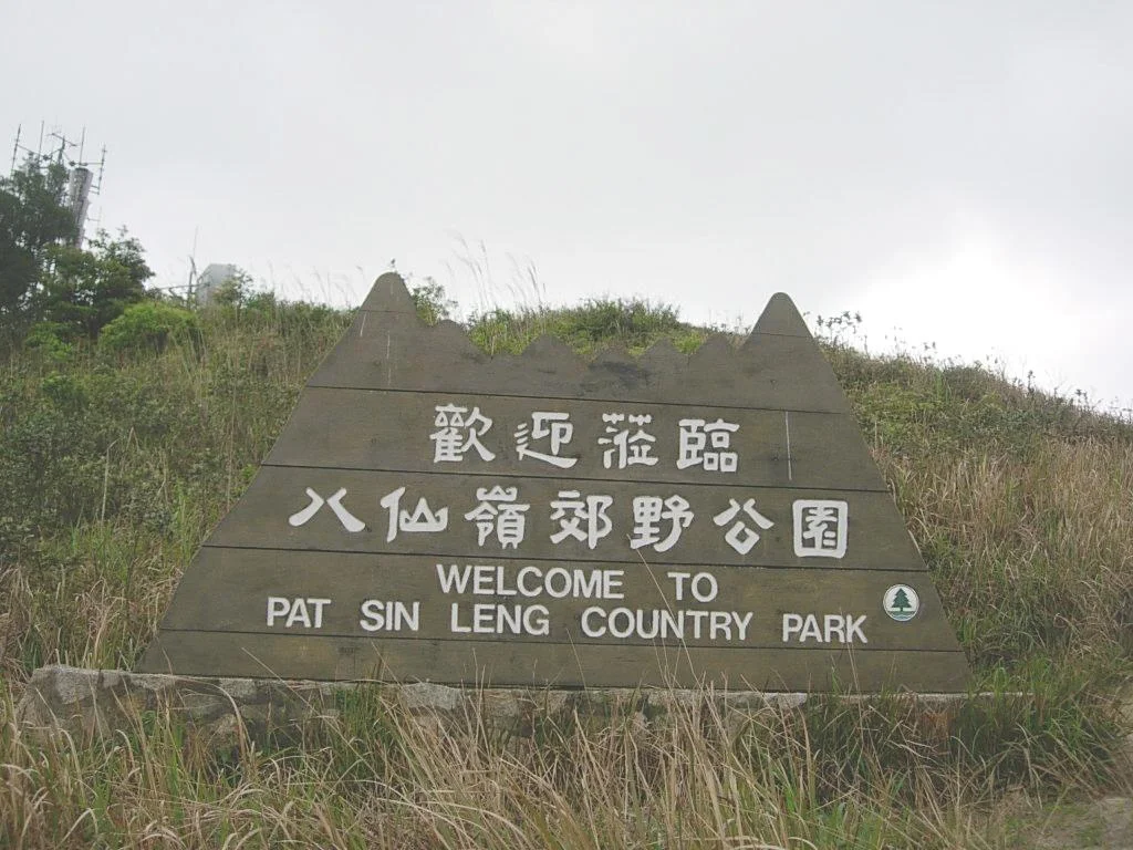

Pat Sin Leng Country Park
Forty minutes by road from the glass towers of Mong Kok, a leopard cat pauses on a forest track, listens for a moment, and slips silently into the dark. This is Pat Sin Leng Country Park — 3,125 hectares of ridgeline, reservoir, and wet forest tucked into Hong Kong's northeastern New Territories, gazetted on 18 August 1978 and still largely wild. Most visitors come for the hiking. A few come for the birds. The Chinese pangolin, armored and increasingly rare, does not care why anyone is here.
A Ridge Named for Gods
Pat Sin Leng means 'Ridge of the Eight Immortals,' and the mountain range at the park's heart takes that mythology literally: each of its eight summits bears the name of a different xian from Chinese Taoist tradition. The highest of the eight, Shun Yeung Fung at 590 metres, is named for Lü Dongbin, the scholar-swordsman who leads the Immortals. The lowest, Choi Wo Fung at 489 metres, honors Lan Caihe, the eccentric wanderer who travels with a basket of flowers. Walk the ridge from west to east and you trace a pantheon — eight peaks, eight names, eight figures whose stories stretch back more than a thousand years. On clear days the view from the top spans the broad glitter of Plover Cove Reservoir to the south and the sprawl of Shenzhen's towers to the north, a panorama that collapses centuries into a single glance.
The Wild Tenants
The park's forests shelter an improbable density of wildlife for a place hemmed in by one of the world's most densely populated cities. Birders know the catchment forests well: crested bulbuls and hwamei compete in the canopy, Oriental magpie robins claim sunny clearings, and the Chinese francolin — a partridge-like ground bird rarely seen in urban Hong Kong — calls from the scrubby hillsides. Chinese kingfishers flash blue along the streams. The mammals are quieter but no less varied. Malayan porcupines shuffle through the undergrowth after dark. Masked palm civets, with their raccoon-masked faces, patrol the tree lines. And somewhere in the denser slopes lives the Chinese pangolin, a scale-covered insectivore listed as critically endangered — a creature so reclusive that most hikers never know they have walked past one. Lau Shui Heung Reservoir, rimmed by Peking willows and Fortune's keteleeria pines, anchors the eastern end of the park and adds a calm, almost formal beauty to the wilder ridgelines above.
Where the Wilson Trail Ends
The Wilson Trail is 78 kilometres long and crosses Hong Kong Island before heading north through the New Territories. Its final two stages — nine and ten — belong to Pat Sin Leng Country Park. The section within the park — roughly 10 kilometres — leads from Cloudy Hill to Nam Chung, traversing the ridges of Wong Leng, Lai Pek Shan, and the eight peaks of Pat Sin Leng itself. For long-distance walkers, these final stages are both a reward and a reckoning: the views are extraordinary, the path is unrelenting, and there is nothing gentle about the descent into Nam Chung. Those who want something shorter can walk the Hok Tau Country Trail or the Lau Shui Heung Country Trail, both of which explore the lower valleys and reservoir edges without committing to the full ridge.
Dragonflies, Egrets, and a Protected Wetland
Not every corner of the park is upland forest. Sha Lo Tung, hidden in a valley near the park's southern edge, is one of Hong Kong's most important dragonfly and damselfly habitats — dozens of species breeding in and around its stream systems. Ting Kok, a wetland on the northeastern fringe, has been declared a Site of Special Scientific Interest; its reed beds and tidal margins attract wading birds and waterfowl year-round. And at Yim Tso Ha, one of the largest egretries in Hong Kong, hundreds of cattle egrets and little egrets nest each spring in trees above a traditional fish pond, their white plumage brilliant against the green canopy. These lowland pockets are easy to overlook when the ridge is calling, but they hold much of the park's most accessible wildlife.
Arriving at the Edge of the City
Pat Sin Leng Country Park sits at a particular kind of threshold. On one side, Hong Kong's dense urban fabric presses right up to the park boundary — housing estates, markets, light rail lines. On the other, the land falls away into territory that has looked more or less the same for centuries: granite ridges, secondary forest recovering from decades of degradation, reservoirs that catch the seasonal rains. The contrast is not subtle. From the top of Shun Yeung Fung, the geometry of Shenzhen is visible to the north, and on hazy days the Pearl River Delta makes the horizon indistinct. This is what makes the park remarkable — not that it is pristine wilderness, but that it exists at all, a protected fragment of the wild tucked into one of the busiest corners of Asia.
From the Air
Pat Sin Leng Country Park lies at approximately 22.49°N, 114.18°E in the northeastern New Territories of Hong Kong. The ridgeline runs roughly east-west, reaching 590 metres at Shun Yeung Fung. The nearest major airport is Hong Kong International Airport (VHHH) on Lantau Island, about 45 km to the southwest. Approaching from the northeast at 3,000–4,000 feet, the reservoir at Plover Cove is a clear visual reference to the east, while the Pat Sin Leng ridge itself forms a distinct east-west spine. Shenzhen's urban skyline lies immediately to the north beyond the border. Visibility permitting, the ridge is clearly distinguishable from the broader Tai Po lowlands to the south.
Nearby Stories
- Chapel of St. Francis Xavier 3.5 km away
- Cuiheng 4.1 km away
- 2015 Shenzhen Landslide 16 km away
- Shunde 31 km away
- Wanshan Archipelago 37 km away
- Nanxiong Formation 96 km away
- Heyuan 149 km away
- Checheng Fu'an Temple 629 km away