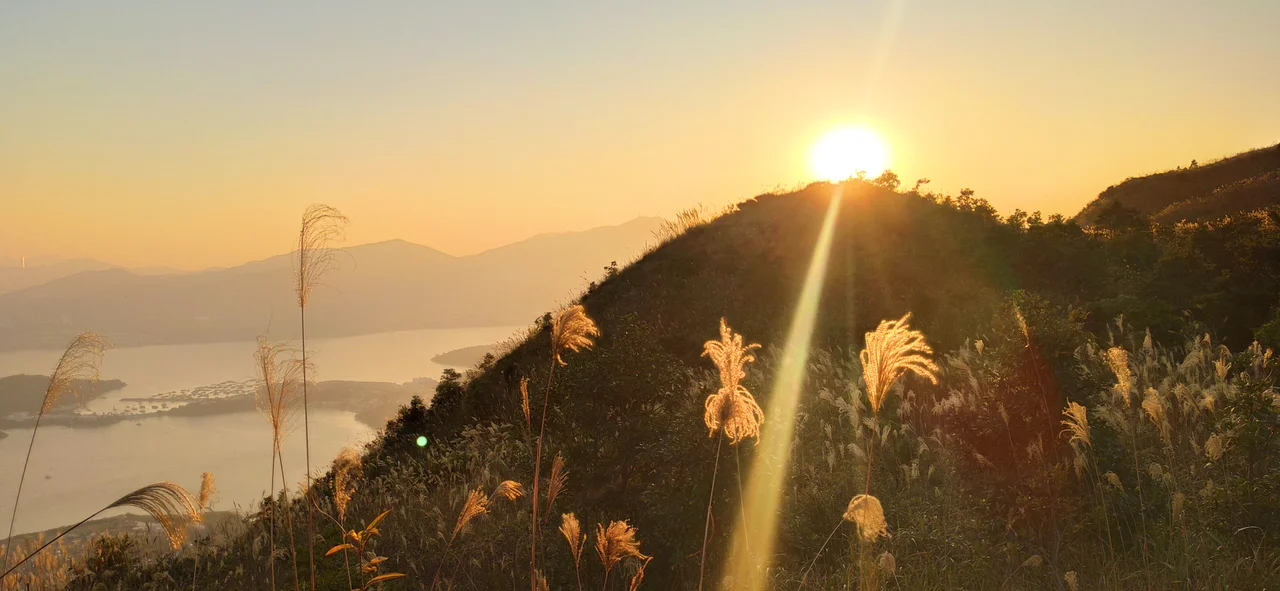

Pat Sin Leng
Eight peaks, eight names, eight immortal beings from Chinese mythology — the Pat Sin Leng ridge in Hong Kong's northeastern New Territories was named as a kind of permanent tribute, the mountains themselves dedicated to the xian of Taoist tradition. Walk the ridgeline from Shun Yeung Fung in the west to Hsien Ku Fung in the east and you move through a pantheon: each summit honors a different Immortal, from the scholar-swordsman Lü Dongbin to Immortal Woman He, the only woman among the Eight. The mountains reach between 489 and 590 metres, modest by global standards but dramatic above the dense urban fabric of the New Territories below. And near the western end, in a spot with a long view over the green hillsides, stands a small pavilion built to remember five people who should have come home.
The Immortals in Stone
The Eight Immortals — the Ba Xian — are among the most familiar figures in Chinese popular religion, their images appearing on temple carvings, ceramics, and festival decorations across the Chinese-speaking world. Each represents a different human condition: the old man, the young scholar, the cripple, the woman, the eccentric youth. Pat Sin Leng maps them onto geography. Shun Yeung Fung, the highest at 590 metres and Hong Kong's sixteenth-tallest peak, is named for Lü Dongbin, the Immortals' leader. Moving east, the ridge descends and rises through Chung Li Fung (529m, named for Zhongli Han), Kao Lao Fung (543m, for Elder Zhang Guo), Kuai Li Fung (522m, for Iron-Crutch Li), Tsao Kau Fung (508m, for Royal Uncle Cao), Choi Wo Fung (489m, for Lan Caihe), Sheung Tsz Fung (513m, for Han Xiang), and finally Hsien Ku Fung (511m, for Immortal Woman He). The naming is not decorative. It transforms a hike into something more like a procession.
Ridgeline and View
The walking here is serious. The Pat Sin Leng ridge forms part of the Wilson Trail's ninth and tenth stages, and the terrain does not flatten out between the peaks. Hikers who cross all eight summits earn views that extend, on clear days, south over the glittering expanse of Plover Cove Reservoir, west toward the urban density of Tai Po and the Tolo Harbour, and north to the towers of Shenzhen rising just beyond the border. The ridge also marks a watershed: the catchment forests on its slopes feed into the reservoirs below, making the mountains not just a scenic feature but a functional part of Hong Kong's water infrastructure. Mist settles in the gullies between peaks on cool mornings, and the wind on the exposed saddles can be sharp enough to warrant a layer even in October.
Spring Breeze Pavilion
On 10 February 1996, a group of 49 teachers and students from HKCWC Fung Yiu King Memorial Secondary School set out to hike in the Pat Sin Leng mountains. A hill fire broke out while they were on the slopes. More than two hundred firefighters and two Government Flying Service helicopters responded to the emergency. When it was over, two teachers — Chau Chi Chai and Wong Sau Mei — and three students had died. Thirteen others were injured. The fire moved fast in the dry winter conditions, and those who died were shielding and trying to guide others to safety. Spring Breeze Pavilion was built on the mountain in memory of these five people. It was inaugurated by the then-Governor of Hong Kong, Chris Patten, on 12 March 1996, just over a month after the fire. The pavilion stands quietly on the hillside, a place to rest and remember — not a monument to a catastrophe, but a small human-scaled marker for real people who were lost on an ordinary school day.
The Mountains as Living Place
Beyond mythology and memory, the Pat Sin Leng range is simply a landscape that people use and love. Hikers arrive on weekends from Tai Po and Fanling, following trails that thread through secondary forest recovering from years of degradation and occasional fire. Birdwatchers scan the treelines for the hwamei — the 'melodious laughingthrush' — whose song carries far on still mornings. The catchment forests feed reservoirs that supply drinking water to a city of millions. The eight peaks of the Immortals look down on all of it: the old pathways, the new housing estates pushing up to the park boundary, the border fence threading along the horizon, and somewhere below the summit, the small pavilion built for five people who came here on a February morning in 1996 and did not return.
From the Air
Pat Sin Leng sits at approximately 22.48°N, 114.22°E in the northeastern New Territories, with peaks ranging from 489 to 590 metres above sea level. The ridge runs roughly east-west and is clearly identifiable from altitude as a spine separating the Plover Cove Reservoir basin to the south from the lowlands approaching Shenzhen to the north. Hong Kong International Airport (VHHH) is approximately 50 km to the southwest on Lantau Island. Approaching from the east at 3,000–4,000 feet, Plover Cove's blue water provides the primary visual reference, with the Pat Sin Leng ridge rising sharply to the west. The border with mainland China lies within 10 km to the north.
Nearby Stories
- Chapel of St. Francis Xavier 3.5 km away
- Cuiheng 4.1 km away
- 2015 Shenzhen Landslide 16 km away
- Shunde 31 km away
- Wanshan Archipelago 37 km away
- Nanxiong Formation 96 km away
- Heyuan 149 km away
- Checheng Fu'an Temple 629 km away