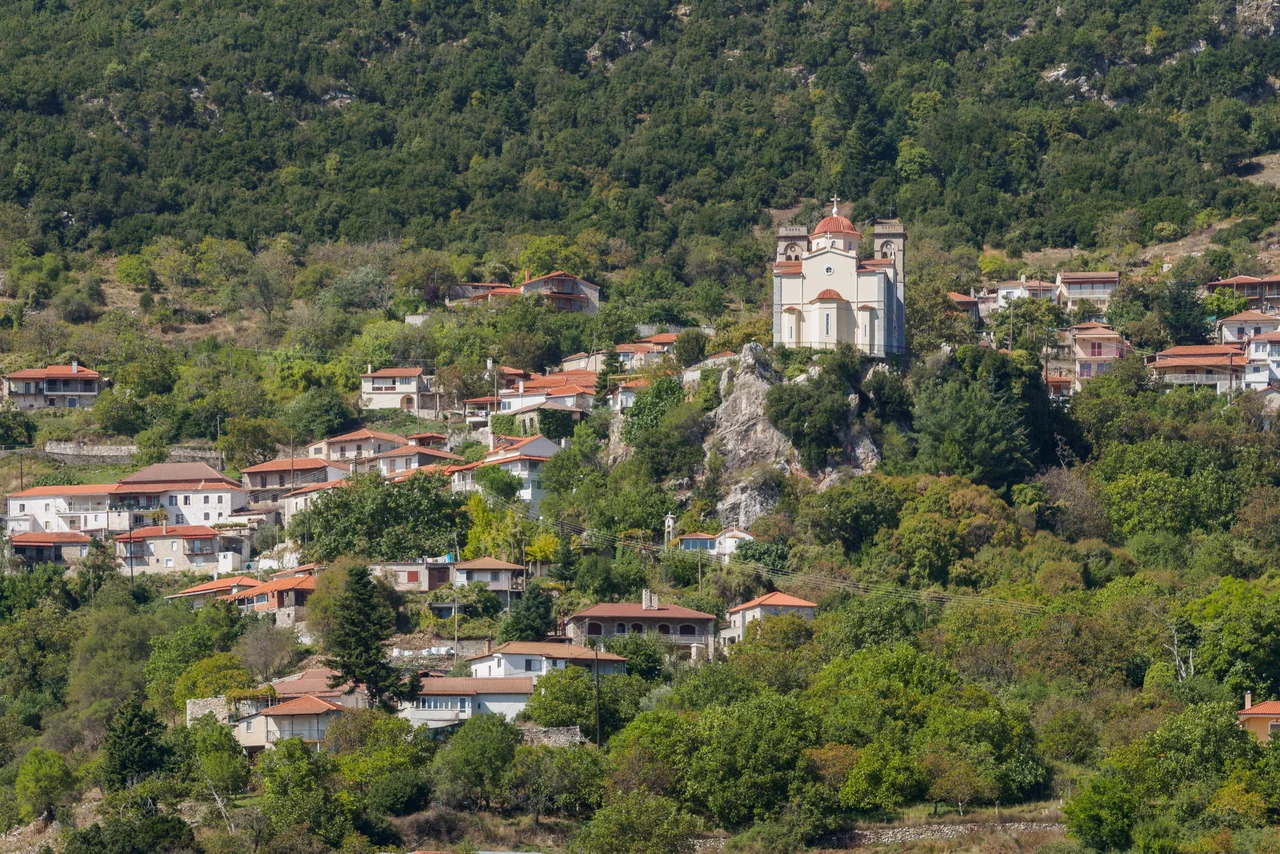

Piana, Arcadia
In 1821, the Greek revolution ran on bread baked in Piana. The armies of Theodoros Kolokotronis, gathering in the mountain villages above the Arcadian plain before their assault on the Ottoman capital of Tripolitsa, needed feeding. The church of Panagitsa Polykammeni — the church the Ottomans had reportedly tried to burn several times, hence its name, 'the much-burned' — still held a wood-burning oven in its courtyard. From those ovens, Piana kept the camps supplied. The revolution is full of generals and battles; it is less often remembered that someone had to bake the bread.
A Village Built for Concealment
Piana sits on the slopes of the Mainalo mountain, above the plain of Arcadia, near the ruins of the ancient city of Dipaia. The terrain is steep and forested — exactly the kind of ground that the armed irregular fighters known as the Armatoloi and Kleftes had exploited for generations before 1821. During the Ottoman period these fighters, outlaws and resisters depending on one's point of view, used the mountains as refuges and staging grounds. When the revolution came, the inaccessibility that had always defined Piana became a military asset. Kolokotronis established command posts in the surrounding villages — Piana, Dimitsana, Stemnitsa, Zarachova — and the local population fed and sheltered the fighters preparing to take Tripolitsa. The village's population today is just 57 people (2021 census). The mountains haven't changed.
The Family That Made History Nearby
Seven kilometers west of Piana lies Limpovisi, the ancestral home of the Kolokotronis family. Theodoros Kolokotronis — called *Geros tou Moria*, the Old Man of the Morea — grew up here and in these mountains. A Venetian census of 1711 recorded 500 residents at Limpovisi; today it is a hamlet, but the Kolokotronis family house has been restored and functions as a museum. The church of Ai-Yannis stands in the courtyard. Nearby, the depopulated settlement of Arkoudorevma — abandoned as an official settlement in 1928 — occupies a gorge where ruins of old houses survive alongside a stone spring tap and the 1719 church of the Virgin Mary. The territory was mountainous enough that it too served as a reorganization point for revolutionary forces before the battles of 1821. The waters of the Arkoudorevma gorge eventually join the Elissonas river, which crosses the plain of Piana below.
The River That Disappears
The Elissonas river — sometimes written Elisson — rises at the foot of the Pianovouni mountain and crosses the plain of Piana. Watermills once lined its length: at one point, twelve stone mills ground the region's cereals, and six stone washing facilities cleaned the heavy wool clothing of the mountain villages. Some of those stone structures survive. The Elissonas supplies water to the residents of Tripoli, the prefecture capital, further into the plain. Then, midway across the Piana plain, the river does something strange: it sinks. The water disappears underground, believed to resurface near Megalopolis to the west. Rivers with this behavior — called katavoths in Greek — were common enough in limestone Arcadia that the ancients incorporated them into mythology. The Elissonas vanishes and, somewhere, reappears.
The Cave on the Mountain and the God Who Lives There
On Pianovouni, the mountain above the Elissonas springs, local tradition places a cave belonging to Pan. The goat-footed god of wild places and shepherds was one of the most deeply rooted of the Arcadian deities — this was his terrain, the high meadows and rocky gorges where flocks grazed. The name Piana itself may derive from Panas, an alternative form of the god's name. Whether the etymology holds or not, the association fits: this is exactly the kind of landscape Pan was said to haunt, where unexpected sounds in the trees could be attributed to the god's presence, where the word *panic* — named for him — came from the inexplicable terror that can take hold in lonely places.
The Folklore Museum of Piana preserves what daily life in this landscape looked like for the generations before the modern era: tools, vessels, religious heirlooms, and objects from the revolutionary period.
Fir Honey and Forgotten Apples
Piana grows potatoes, walnuts, tomatoes, courgettes, cauliflowers, and beans. For generations it was also famous for apple production — particularly the Delicious Pilafa variety, prized in the regional markets of Tripoli. That cultivation has largely stopped, the apple trees abandoned because of high labor requirements, variable yields, and susceptibility to disease and weather. The firs that cover much of the mountain, however, produce something the region has come to be known for: fir honey. The Honey of Fir Mainalou Vanilla is a protected product, dense and dark with a resinous sweetness that comes from the fir forests. The mountains that kept armies hidden and gave Pan a cave to inhabit also give the bees something to work with.
From the Air
Piana lies at approximately 37.57°N, 22.24°E on the western slopes of the Mainalo mountain range, above the Arcadian plain. From altitude the Mainalo massif is immediately identifiable — a heavily forested ridge running north-south west of the Tripoli plain. The village of Piana sits near the 900-meter contour. Nearest major airport: LGKL (Kalamata International), approximately 80 km to the southwest. Flying northeast from Kalamata over the Taygetos range and across the Arcadian plateau, the Mainalo forests appear on the left. Low passes at 3,000–5,000 feet above the foothills allow views of the gorges and stone villages.
Nearby Stories
- Araklovon Castle 4.8 km away
- Pellana 6.6 km away
- Arkadiko Bridge 10 km away
- Siege of Corinth (1463) 11 km away
- Leonidio 11 km away
- Kyparissia 11 km away
- Pheneus 14 km away
- Santameri Castle 29 km away