Pieterpad
The trick is in the name. The walk begins at Pieterburen, a village on the salt-marsh coast where the North Sea meets the Wadden, and ends 492 kilometers south at Sint-Pietersberg, a chalk hill outside Maastricht where the Netherlands runs out of country. Pieter to Pieter. Saint Peter to Saint Peter. Two women dreamed up the route in the early 1980s - Toos Goorhuis-Tjalsma and Bertje Jens, hiking enthusiasts who wanted a long-distance trail that crossed the country end to end. Officially opened in 1983 as LAW 9, the Pieterpad is now the most famous long-distance walking route in the Netherlands. Twenty-six stages. Twenty-six small daily decisions about how far you can go before dinner.
North End: A Village Beside the Wadden
Pieterburen is the kind of village you reach by ending the bus line. Hourly service from Winsum station (twice an hour by train from Groningen city), once every two hours on Sundays, drops you at the Pietersplein stop. The official starting point is Hotel Waddenweelde, where you stand on a flat coastal road with the dike to the north and the rest of the Netherlands to the south. The first stage is short - through the Hogeland region, past Eenrum and Mensingeweer, to Winsum. The second stage walks you through farmland speckled with wierden, the artificial dwelling mounds that have organized Groningen settlement for a thousand years, and ends in the city of Groningen at the railway station - the largest urban node the entire trail will see.
The Country in Twenty-Six Stages
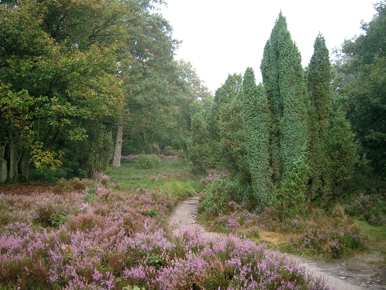
The stages range from 11 to 24 kilometers, a deliberate spread that lets walkers tune the trip to fitness and time. Most end in towns with trains or buses back to civilization, so the Pieterpad rewards weekenders as easily as it rewards through-hikers - many Dutch walkers do it one stage at a time, year after year, treating the whole 492 kilometers as a long-running personal project. From Groningen the route bends south into Drenthe past dolmen sites at Midlaren, then through the Drentsche Aa National Park, the heathland of Balloërveld, and the peatlands beyond. Overijssel follows along the Vecht river. In Gelderland it crosses the Rhine by ferry at Pannerden-Millingen. Each crossing changes the soundtrack - water birds at Pieterburen, beech leaves above Drenthe's heath, river traffic on the Maas.
The Only Hill That Counts
Most of the Netherlands is, famously, not hilly. The Pieterpad pretends otherwise for one glorious stretch in the Sallandse Heuvelrug National Park, where the Archemerberg rises to 78 meters - the highest point on the entire trail. Dutch hikers laugh at it; foreign hikers laugh at the Dutch for laughing at it. The real elevation, such as it is, comes in the final stages: South Limburg actually has hills, real ones with names and views and steeper gradients than the rest of the country can summon. The walking gets harder in the last week and most walkers, mercifully, are by then strong enough to enjoy it. The path ends at Sint-Pietersberg, a chalk hill about a kilometer from the Belgian border, where the Pieterpad meets two larger European trails - the GR 5 from Hook of Holland to Nice, and the E2 European long-distance path that begins in Northern Ireland.
How the Dutch Walk a Country
There are no permits. There is no entry fee. The path is marked in both directions with the standard white-and-red rectangles used across European long-distance routes - white above red means you are on course, a directional arrow means turn, a crossed-out symbol means you missed something. The official guidebooks (north and south) are in Dutch only, but the markers are universal and most walkers download the GPS tracks as backup. Accommodation runs from hotels to B&Bs to Vrienden op de Fiets - a network of private hosts who welcome cyclists and hikers for a small fee. Wild camping is forbidden in the Netherlands, so campers stick to designated sites. Tap water is drinkable everywhere. You will pass a village with a supermarket or a bakery every few hours. The Pieterpad is, in many ways, the gentlest long-distance hike in Europe - which is exactly why so many people finish it.
From the Air
The Pieterpad's northern end at Pieterburen sits at roughly 53.40°N, 6.45°E on the Wadden Sea coast; the southern end at Sint-Pietersberg outside Maastricht is at about 50.84°N, 5.69°E. The route runs nearly the full north-south length of the Netherlands, about 492 km on the ground. From cruise altitude the trail is invisible but the landscapes it traverses are not: the geometric polders of Groningen, the heathland of Drenthe, the river crossings of the Rhine and Maas, and the chalk hills of South Limburg. Nearest airports along the route include Groningen Airport Eelde (EHGG) at the north and Maastricht Aachen Airport (EHBK) at the south.
Nearby Stories
- Spinnenkop Wedderveer 2.5 km away
- Miedenmolen, Holwerd 3.9 km away
- Tynaarlo 6.4 km away
- Groothusen 9.7 km away
- Prinses Margriet Canal 10 km away
- Norderney 13 km away
- Schule am Meer 31 km away
- Gemini Wind Farm 47 km away