Groothusen
Before there were dikes there were warfs — artificial mounds of clay and dung and rubble, raised by hand over generations, on which Frisians built their houses to stay dry when the North Sea came across the fields. Groothusen sits on one of the longest of these mounds anywhere on the coast: a ridge five hundred meters long and about a hundred and thirty meters wide, formed slowly between the eighth and twelfth centuries by people who had decided that staying put was preferable to running uphill. Four hundred and seventy-four people lived here in 2006. They share the warf with a church that holds a 1454 cast-bronze baptismal font, an organ built between 1798 and 1801 whose flute stops produce a tone unmatched in any other instrument, and the surviving fragment of a medieval manor house once attacked by an army from Hamburg.
A Trading Post by a Vanished Bay
When Werden Abbey's land register first recorded the village around the year 1000, it was listed as Husum and was already several centuries old. Archaeologists working on the warf in 1959 found evidence of a Wikdorf — a trading settlement — established probably in the eighth century. At that point Groothusen sat only about five hundred meters from open water, on a tidal creek that ran out into the Bay of Sielmönken, a North Sea inlet that has since silted up entirely. Frisian merchants on the trade route between Dorestad in the Rhine delta and Haithabu in southern Denmark stacked their cargo here and lodged in the village while waiting for tides or weather. Then in the thirteenth century the locals built dikes, the tidal creek closed off, and Groothusen's three-hundred-year career as a port came quietly to an end.
What's in the Church
The northwestern end of the warf is dominated by St. Peter's Church, one of six provost churches that served the medieval Emsgau diocese. Its tower is disproportionately large for a village of this size — a reminder that this was once the seat of a Münster provost responsible for parishes across the region. Inside, the 1454 bronze baptismal font is the work of Ghert Klinghe, an itinerant German bell-founder whose fonts can be found in churches from Denmark to Lower Saxony. The blue-stone gravestone of Adda von Meckenaborg, lady of Groothusen, dates from 1590 and carries portrait carvings of unusual sophistication for a rural village memorial. The bell in the tower was cast in 1526. And then there is the organ.
Wenthin's Flutes
Between 1798 and 1801 the East Frisian organ-builder Johann Friedrich Wenthin installed an instrument in St. Peter's Church that organists still travel to play. Wenthin worked at the tail end of the great northern German organ tradition that produced Arp Schnitger a century earlier, and his Groothusen organ is one of the more important late examples of that lineage. The flute stops — small wooden pipes that produce a quiet, breath-like tone — have a particular sweetness and resonance that organists describe as unmatched anywhere else. The salt air and the wood of the church preserve old organs well in East Frisia, which is why this small coast has a denser concentration of historic instruments than almost any region in Europe. Recitals fill the church on summer evenings.
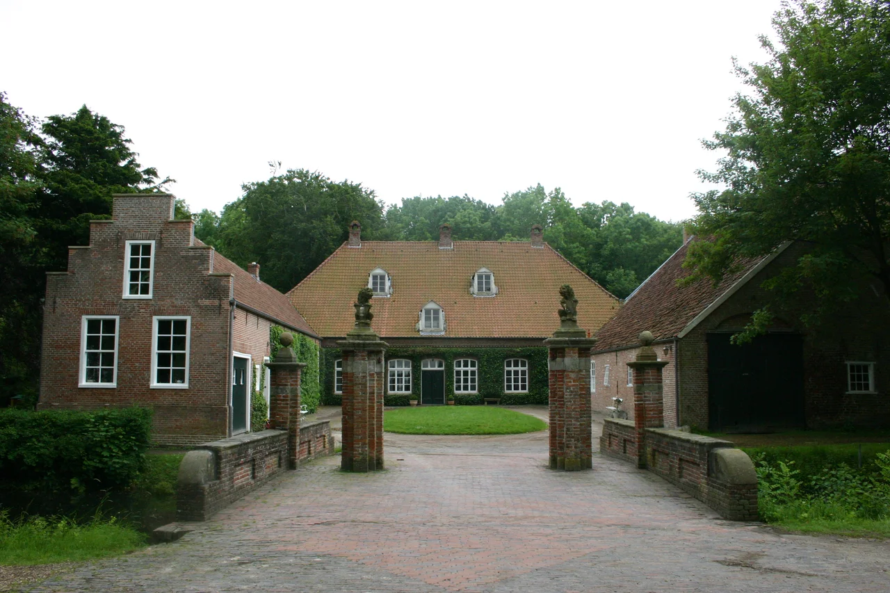
Three Manor Houses, One Survivor
Groothusen once had three manor houses — substantial fortified residences belonging to local landowning families. The Middelburg and the Westerburg were destroyed in feuds in 1400 and 1432, both attacks reportedly mounted by citizens of Hamburg as part of the long Hanseatic effort to suppress East Frisian piracy. The Osterburg, rebuilt in 1490, has survived. It sits on the eastern side of the village beyond a protected nature area, approached by a long avenue of lime trees. Today the house holds a private collection of historical memorabilia — paintings, household objects, documents — accumulated over centuries. The avenue is more dramatic than the building. Climb the warf and look down it on a winter afternoon and you can see why East Frisians once measured wealth in trees.
Living on a Mound
Walk around Groothusen for an hour and the geography of the place starts to make sense. The houses are not arranged on a flat grid. They run in a long single street along the spine of the warf, with the church at one end and the open polder beginning where the slope drops away. The Wikdorf settlements of early medieval Frisia all followed this pattern — buildings packed onto the highest available ground, gardens running down the sides, cattle grazed below in the wet months and on the mound itself when the floods came. Modern dikes mean the warf no longer functions as flood protection. The North Sea has not reached the village in living memory. But the ridge remains, half a kilometer of human-made earth raised by people who could not have imagined that anyone in the future would write about them — and who are nevertheless the reason their village is still here.
From the Air
Located at 53.43°N, 7.07°E in the Krummhörn district of western East Frisia, about 15 km northwest of Emden on the flat coastal plain. The village appears from altitude as a long, narrow linear settlement raised slightly above the surrounding polders — the warf is most visible in low-angle morning or evening light, when shadows reveal the elevation. St. Peter's Church and its outsize tower are the clearest landmarks. The Krummhörn polder geometry, with its grid of drainage ditches and scattered single farms, surrounds the village. The North Sea coast lies about 8 km west. Nearest airports: Emden-Erstrum (EDWE, ~15 km southeast), Groningen Eelde (EHGG, ~75 km southwest), Bremen (EDDW, ~125 km east). Recommended viewing altitude: 1,500–3,000 ft AGL.
Nearby Stories
- Tynaarlo 5.3 km away
- Organ in the Jacobikerk at Uithuizen 6.4 km away
- Bourtange 8.9 km away
- Norderney Airport 11 km away
- Razing of Friesoythe 11 km away
- Harle (gat) 19 km away
- Lordship of Gödens 22 km away
- Alpha Ventus Offshore Wind Farm 45 km away