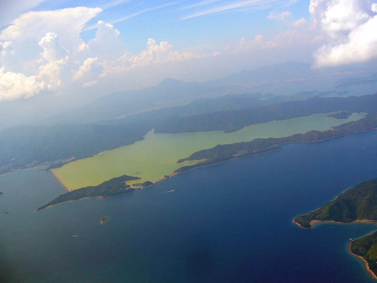

Plover Cove Reservoir
In 1958, Hong Kong had a problem that no city had ever solved in quite this way before. The territory lacked natural freshwater lakes of any size, water rationing was a recurring hardship, and a population growing faster than infrastructure could keep pace with needed a supply that no existing reservoir could provide. The solution the government's engineers proposed was audacious: find a sea inlet, seal it off from the ocean with dams, drain the saltwater, and fill the resulting basin with rain. Nobody had done it before. Plover Cove was the inlet they chose. What followed was eight years of construction and the creation of the world's first freshwater coastal lake.
The Problem and the Plan
Hong Kong's relationship with water has always been complicated. The territory sits in a subtropical zone that receives around 2,400 millimetres of rain annually — plenty of water, in theory — but the steep, fast-draining terrain means most of it runs quickly to sea. Natural inland water bodies large enough to serve a major city simply do not exist here. By the late 1950s, providing adequate water supply had become one of the government's most pressing engineering challenges. On 24 July 1958, an official spokesman confirmed that engineers were studying the conversion of sea inlets into freshwater lakes. Plover Cove, a sheltered arm of Tolo Harbour in the northeastern New Territories, was identified as the leading candidate. The cove was enclosed on three sides by land, and the sections of Tolo Harbour connecting it to open water were unusually shallow — conditions that made damming feasible. The government engaged the engineering consultancy Binnie, Deacon and Gourley to investigate. By mid-1959 they had confirmed the plan was workable and estimated construction costs at approximately HK$348 million, with a further HK$60 million for the water distribution network.
Sealing the Sea
Construction began in 1960. One main dam and three smaller service dams were built to seal Plover Cove from the tidal waters of Tolo Harbour. Once the dams were in place, the saltwater inside was pumped out and the empty basin — the bed of what had been a marine inlet — was left to fill with rainfall and freshwater runoff from the surrounding catchments. It was completed in 1968, giving a storage capacity of 170 million cubic metres. The main dam stands 28 metres tall. What had been seawater was now drinking water. Work to raise the dam heights began almost immediately after completion; by 1973 the raised dams had increased the reservoir's capacity to 230 million cubic metres. In terms of area, Plover Cove Reservoir remains the largest in Hong Kong. In terms of volume it ranks second. At the time of its construction, the main dam was one of the largest in the world.
A Lake Where the Sea Had Been
The reservoir's surface today is calm and blue-green, surrounded by the hills of Plover Cove Country Park. From the ridgeline of Pat Sin Leng to the north, the water is visible for kilometers in clear weather, a broad inland sea that did not exist before 1968. The transformation is complete enough that it is easy to forget the basin was once tidal — that fishing boats once worked these waters, and that marine life once lived here that no longer does. Freshwater fish now inhabit the reservoir, and the surrounding country park supports a range of wildlife adapted to the quieter, forested catchment slopes. Tai Mei Tuk, at the northwestern end of the main dam, has become a popular weekend destination for Hong Kong families — a barbecue area and cycle paths stretching along the dam road. On weekends it fills with cyclists, and the air carries the smell of charcoal.
A City's Thirst, an Engineer's Answer
What Plover Cove represents, stripped of technical language, is a city deciding it would not be defeated by geography. Hong Kong in the 1950s and 1960s was growing at a pace that outran almost every kind of planning. Water rationing — sometimes four hours every four days — was a lived experience for millions of people. The coastal reservoir concept, pioneered here and later adopted in Singapore and elsewhere, addressed that crisis through sheer ingenuity: if there are no natural lakes, make one. If the sea is in the way, remove it. The engineering is impressive; the necessity behind it even more so. Standing on the main dam today, with the water stretching out toward the hills and the skyline of Shenzhen just visible on clear days to the north, the scale of what was built here is quiet and enormous. It looks like a natural lake. It is nothing of the sort.
From the Air
Plover Cove Reservoir lies at approximately 22.47°N, 114.25°E in the northeastern New Territories of Hong Kong. The reservoir is visually distinctive from altitude — a large blue-green body of water enclosed by the hills of Plover Cove Country Park, unmistakable from the Pat Sin Leng ridge to the northwest. Hong Kong International Airport (VHHH) is approximately 55 km to the southwest on Lantau Island. The reservoir basin runs roughly north-south; Tolo Harbour connects to the south. At 3,000–5,000 feet the main dam structure at the northern end is visible, as is the Tai Mei Tuk recreation area at the dam's northwestern end. Sha Tin and Tai Po lie to the southwest.
Nearby Stories
- Chapel of St. Francis Xavier 3.5 km away
- Cuiheng 4.1 km away
- 2015 Shenzhen Landslide 16 km away
- Shunde 31 km away
- Wanshan Archipelago 37 km away
- Nanxiong Formation 96 km away
- Heyuan 149 km away
- Checheng Fu'an Temple 629 km away