Pom Pom Island
Seven green turtles per hour. That is the average count on a typical dive around Pom Pom Island, a speck of coral sand in the Celebes Sea measuring just 2.3 kilometers around at high tide. The turtles are not the main attraction, exactly, because on Pom Pom everything competes for attention: flamboyant cuttlefish pulsing with color, blue-ringed octopuses tucked into crevices, frogfish disguised as sponges. This island sits within the Coral Triangle, the zone of highest marine biodiversity on the planet, and the waters around it contain life in a concentration that borders on the absurd.
A Sandbar at the Edge of the Shelf
Pom Pom Island rises less than two meters above the high-tide line, a flat disc of sand and pandanus trees surrounded by a fringing reef four kilometers long. The reef flat is narrow on the western side, just 50 to 75 meters wide, but expands to several hundred meters around most of the island. Beyond the reef edge, the seabed drops sharply. The island sits on the edge of the continental shelf, and the surrounding waters plunge to depths of 100 to 130 meters. Deep, nearly vertical walls begin at 27 to 30 meters at the northern tip, the eastern plateau, and a site divers call the lobster wall. When the tide runs strong, these walls become corridors for drift dives past seafans and pelagic fish.
The Coral Triangle's Bounty
A study by UMS, WWF, Sabah Parks, and the Naturalis Biodiversity Center in the Netherlands found a record 43 species of mushroom corals in the nearby Tun Sakaran Marine Park and suggested the region may hold the world's highest marine biodiversity. The fish team encountered 844 species in the broader Semporna area. On Pom Pom itself, ongoing surveys by the Tropical Research and Conservation Centre have catalogued over 220 fish species and more than 250 coral species. The macro life is extraordinary. Mimic octopuses, wonderpus, bobtail squids, spike-fin gobies, metallic shrimp gobies, and frogfish of every variety, giant, painted, and clown, populate the shallows in front of the resorts. The water temperature stays between 25 and 29 degrees Celsius year-round, and the island sits below the monsoon belt, giving it reliable weather with only occasional short squalls.
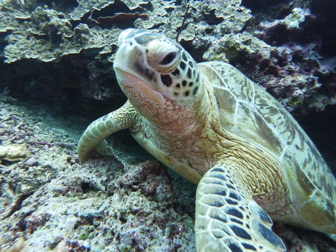
Turtles and the Work of Protection
Both green and hawksbill turtles nest on Pom Pom's beaches, making the island one of six nesting sites among the northeast Semporna islands. Green turtles nest year-round, with peak activity from May to September. Hawksbills nest in smaller numbers but are regularly seen on the reef, territorial creatures with favored spots at the lobster wall, the north tip, and a site called Magic Rocks. Conservation on the island is practical rather than bureaucratic. The two dive resorts and the Tropical Research and Conservation Centre work to reduce fishing pressure, and TRACC's volunteers replant damaged reef sections, coral fragment by coral fragment. The northeast side of the island is eroding, and Pom Pom Island Resort has constructed a sea wall at the high-tide line to stabilize the shoreline. It is the kind of small-scale intervention that reveals how precarious a two-meter-high island's existence really is.
Paradise and Its Shadows
Pom Pom's remoteness is part of its appeal and part of its vulnerability. There is no public transport to the island; resorts ferry their own guests, and the boat ride from Semporna takes 35 to 60 minutes. Both Pom Pom and nearby Mataking were featured in the 1998 season of Expedition Robinson, the Swedish reality show known internationally as Survivor. But the island made darker headlines in November 2013, when Abu Sayyaf militants raided a resort, killing a Taiwanese tourist and kidnapping his wife. She was taken to the Sulu Archipelago in the southern Philippines before being rescued. The attack was a stark reminder that these beautiful, remote waters sit at the intersection of multiple national boundaries and long-standing regional tensions. Security has since increased across eastern Sabah, but the geography remains what it has always been: a scattering of islands in contested seas.
From the Air
Located at approximately 4.60N, 118.86E in the Celebes Sea, roughly 30 km northeast of Semporna, Sabah. The island is visible from altitude as a small, densely vegetated sand island with a clearly defined reef ring. Nearby islands include Mataking and Kalapuan. Nearest airport is Tawau Airport (WBKW), approximately 90 km to the south. The Tun Sakaran Marine Park islands are visible to the west. Best viewed at 3,000-5,000 feet to see the reef structure and surrounding deep water.
Nearby Stories
- 1985 Lahad Datu Ambush 19 km away
- 2013 Lahad Datu Standoff 29 km away
- Madai Cave 36 km away
- Kapalai 41 km away
- Malaysia Airlines Flight 2133 43 km away
- Sheikh Karimul Makhdum Mosque 44 km away
- Tawi-Tawi 69 km away
- Cutting the Orchid in Half: The Proposed Sulawesi Canal 509 km away