
Porthcurno
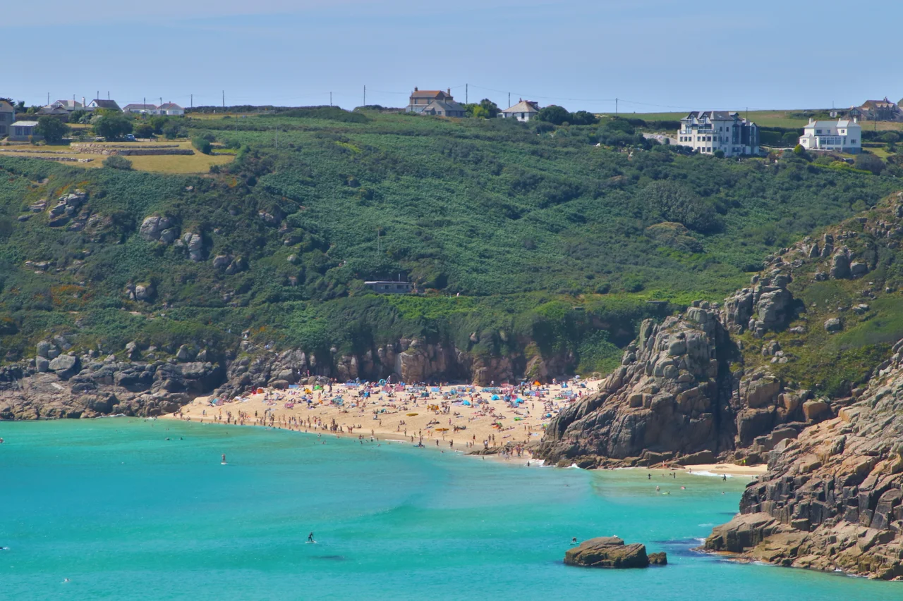
Walk down the lane from the car park at Porthcurno and you arrive at a beach the colour of milk. The sand here is not really sand. It is ground sea-shell, finer than anything most coasts can produce, and underneath the translucent green water it shines white. To either side rise the granite cliffs that gave the cove its name: porth kornow in Cornish, the landing place of horns or pinnacles. Until 1870 this was simply one of the prettier coves on the south coast of the Penwith peninsula. In 1870 a steamship called the Hibernia came in close to shore and laid the British end of a telegraph cable that ran to Carcavelos near Lisbon, and from there onward to Bombay. The Empire had a new front door.
Why Here
Falmouth was the obvious choice. Falmouth had a deep-water port, an established cable yard, a workforce, and a railway line. Porthcurno had a footpath. What Porthcurno had that Falmouth did not was emptiness. A working harbour meant anchors, and anchors meant cables severed by accident. The remote cove offered clean sand, a sheltered approach for cable-laying ships, and absolutely no ship traffic to drag iron flukes through fragile gutta-percha insulation. So in June 1870 John Pender's Falmouth, Gibraltar and Malta Telegraph Company landed the final section of the Britain-to-India cable here, and Porthcurno became the western terminus of what the Empire was already calling the all-red line. By the inter-war years the station handled fourteen cables and roughly two million words a day. For a time it was the largest submarine cable office in the world.
Tunnels and Camouflage
When Hitler's invasion plans were drawn up, German staff officers marked Porthcurno on their maps. They understood what we did, that severing this nerve centre would deafen half the Empire overnight. The British understood it too. Porthcurno was classified a Vulnerable Point. A platoon of soldiers camped on the village bowling green. Pillboxes appeared in the dunes. A petroleum warfare beach barrage was rigged: pipes that could be opened to flood the beach with burning fuel oil, all operated remotely from inside the cliff. Beginning in June 1940, Cornish tin miners drove a network of granite tunnels into the valley's eastern wall and moved the cable equipment underground behind bomb-proof and gas-proof doors. A local artist painted the concrete defences to look, from the air, like a belt of trees with rabbits and birds in it. The cables kept transmitting. The bombs never came.
The White Pyramid
Halfway along the coast path to Logan Rock, on the cliffs above Pedn Vounder, there is a small white pyramid built of granite blocks about ten feet tall. It looks like a folly. It is a navigation marker, and it replaced a coloured hut that once stood there. The hut housed the termination of a second submarine cable, owned by La Compagnie Francaise de Telegraphe de Paris a New York, laid to Porthcurno in 1880. The French cable did not stop here. From Porthcurno it ran across to Brest, and from Brest under the Atlantic to the islands of Saint-Pierre and Miquelon off Newfoundland, and from there another five hundred kilometres to Cape Cod. The first wire across an ocean that ended in America, in other words, came ashore at this Cornish beach. The pyramid is what remains of that infrastructure above ground. Some of the stone ducting that protected the cable down the cliff is still visible.
Logan Rock and a Lieutenant's Bad Idea
Half an hour east along the coast path sits the Logan Rock, an eighty-ton granite rocking stone perched on the headland that Iron Age people fortified as Treryn Dinas around two thousand years ago. Erosion had balanced it so finely that, before 1824, one person could rock the entire mass with a hand. In April 1824 Lieutenant Hugh Goldsmith of the Royal Navy, nephew of the poet Oliver Goldsmith, climbed up with a drunken crew of sailors and crowbars and shoved it off. The stone fell. Cornish disgust was thorough and noisy. The Admiralty ordered Goldsmith to put it back at his own expense. It took him seven months, sixty labourers, and 130 pounds 8 shillings and 6 pence to restore. The original invoice still hangs framed on the wall of the Logan Rock public house in Treen. The stone rocks again, but not so easily. Some lessons do not need to be repeated.
From the Air
Village and beach at 50.043 N, 5.654 W on the south coast of the Penwith peninsula. Nearest airfield is Land's End Airport (EGHC), about three nautical miles northwest, with Newquay Cornwall Airport (EGHQ) twenty-five miles northeast. Best viewed from 1,500 to 2,500 feet on a southbound run, which presents the white-sand beach, the Logan Rock headland, and the Minack Theatre carved into the western cliff in a single dramatic sweep. Watch for ridge turbulence in any wind above 15 knots and the persistent local microclimate of clear village under sea fog on the cliffs.
Nearby Stories
- Mullion Cove 1.3 km away
- Great Wheal Charlotte 3.7 km away
- Castle Down 5.3 km away
- SS Georgia (1890) 30 km away
- Wheal Coates 41 km away
- 1979 Fastnet Race 55 km away
- HMS Affray 126 km away
- Routes of Santiago de Compostela: Camino Frances and Routes of Northern Spain 713 km away